
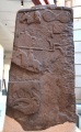

<< Our Photo Pages >> Peira Hicada - Standing Stone (Menhir) in Spain in Cataluña
Submitted by TheCaptain on Sunday, 05 September 2010 Page Views: 2955
Neolithic and Bronze AgeSite Name: Peira HicadaCountry: Spain
NOTE: This site is 11.674 km away from the location you searched for.
Region: Cataluña Type: Standing Stone (Menhir)
Nearest Town: Vielha Nearest Village: Vaqueira
Latitude: 42.729400N Longitude: 0.964400E
Condition:
| 5 | Perfect |
| 4 | Almost Perfect |
| 3 | Reasonable but with some damage |
| 2 | Ruined but still recognisable as an ancient site |
| 1 | Pretty much destroyed, possibly visible as crop marks |
| 0 | No data. |
| -1 | Completely destroyed |
| 5 | Superb |
| 4 | Good |
| 3 | Ordinary |
| 2 | Not Good |
| 1 | Awful |
| 0 | No data. |
| 5 | Can be driven to, probably with disabled access |
| 4 | Short walk on a footpath |
| 3 | Requiring a bit more of a walk |
| 2 | A long walk |
| 1 | In the middle of nowhere, a nightmare to find |
| 0 | No data. |
| 5 | co-ordinates taken by GPS or official recorded co-ordinates |
| 4 | co-ordinates scaled from a detailed map |
| 3 | co-ordinates scaled from a bad map |
| 2 | co-ordinates of the nearest village |
| 1 | co-ordinates of the nearest town |
| 0 | no data |
Internal Links:
External Links:
")
You may be viewing yesterday's version of this page. To see the most up to date information please register for a free account.
")
")
Do not use the above information on other web sites or publications without permission of the contributor.
Nearby Images from Flickr
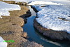
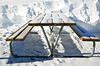
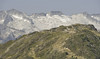

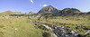
The above images may not be of the site on this page, but were taken nearby. They are loaded from Flickr so please click on them for image credits.
Click here to see more info for this site
Nearby sites
Click here to view sites on an interactive map of the areaKey: Red: member's photo, Blue: 3rd party photo, Yellow: other image, Green: no photo - please go there and take one, Grey: site destroyed
Download sites to:
KML (Google Earth)
GPX (GPS waypoints)
CSV (Garmin/Navman)
CSV (Excel)
To unlock full downloads you need to sign up as a Contributory Member. Otherwise downloads are limited to 50 sites.
Turn off the page maps and other distractions
Nearby sites listing. In the following links * = Image available
831m S 188° Pla de Beret 3 tumulus* Chambered Cairn
889m SSW 211° Peira Roja* Standing Stone (Menhir)
1.2km SSW 195° Pla de Beret 12 tumulus* Ring Cairn
2.0km SSW 207° Dolmen de Ulh deth Garona Burial Chamber or Dolmen
2.1km SSW 209° Pla de Beret 2 circulo* Ring Cairn
2.4km SSW 214° Peira deth Uelh* Standing Stone (Menhir)
12.0km NNW 337° Grotte Cigalere Cave or Rock Shelter
15.4km NNE 19° Ayer Dolmen* Burial Chamber or Dolmen
17.6km NNE 13° Vallée du Riberot* Ancient Village or Settlement
18.7km NNE 28° Peyre Quillade* Standing Stone (Menhir)
22.4km NNW 331° Piéjau cromlech Stone Circle
29.6km W 260° Forau de la Llana* Stone Circle
29.7km W 260° Remuñe Tumulus* Round Barrow(s)
29.9km W 260° Remuñe Cromlech* Chambered Cairn
32.6km N 9° Grotte de Mongautin Cave or Rock Shelter
34.6km WNW 285° Peyra dé Peyrahita Standing Stone (Menhir)
34.6km WNW 285° Cailhaou d'Arriba Pardin Standing Stone (Menhir)
34.8km ENE 58° Grotte du Ker de Massat* Cave or Rock Shelter
35.0km NE 45° Abères ancient lead mine Ancient Mine, Quarry or other Industry
35.6km WNW 285° Mail de Soupène Cromlechs* Stone Circle
35.6km WNW 285° Carnac Pyrénéen* Stone Circle
35.7km WNW 286° L'alignement d'Espiaub* Stone Row / Alignment
36.0km WNW 285° Sarrat de Cousseillot Cromlechs* Stone Circle
36.2km WNW 285° Cailhaou des Pourrics* Rock Art
36.2km WNW 285° Alignement de Peyralade* Stone Row / Alignment
View more nearby sites and additional images


 We would like to know more about this location. Please feel free to add a brief description and any relevant information in your own language.
 Wir möchten mehr über diese Stätte erfahren. Bitte zögern Sie nicht, eine kurze Beschreibung und relevante Informationen in Deutsch hinzuzufügen.
 Nous aimerions en savoir encore un peu sur les lieux. S'il vous plaît n'hesitez pas à ajouter une courte description et tous les renseignements pertinents dans votre propre langue.
 Quisieramos informarnos un poco más de las lugares. No dude en añadir una breve descripción y otros datos relevantes en su propio idioma.