


<< Other Photo Pages >> Diss Museum - Museum in England in Norfolk
Submitted by vicky on Saturday, 30 November 2002 Page Views: 6028
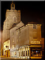
MuseumsSite Name: Diss MuseumCountry: England
NOTE: This site is 6.954 km away from the location you searched for.
County: Norfolk Type: Museum
Nearest Town: Diss
Map Ref: TM1171179980 Landranger Map Number: 144
Latitude: 52.376923N Longitude: 1.108954E
Condition:
| 5 | Perfect |
| 4 | Almost Perfect |
| 3 | Reasonable but with some damage |
| 2 | Ruined but still recognisable as an ancient site |
| 1 | Pretty much destroyed, possibly visible as crop marks |
| 0 | No data. |
| -1 | Completely destroyed |
| 5 | Superb |
| 4 | Good |
| 3 | Ordinary |
| 2 | Not Good |
| 1 | Awful |
| 0 | No data. |
| 5 | Can be driven to, probably with disabled access |
| 4 | Short walk on a footpath |
| 3 | Requiring a bit more of a walk |
| 2 | A long walk |
| 1 | In the middle of nowhere, a nightmare to find |
| 0 | No data. |
| 5 | co-ordinates taken by GPS or official recorded co-ordinates |
| 4 | co-ordinates scaled from a detailed map |
| 3 | co-ordinates scaled from a bad map |
| 2 | co-ordinates of the nearest village |
| 1 | co-ordinates of the nearest town |
| 0 | no data |
Internal Links:
External Links:
Museum in Norfolk
Diss from prehistory onwards
Address: 11, Market Hill, IP22 4JZ
Phone: 01379 650618
Opening Hours: Open - 2 p.m. to 4 p.m. on Weds and Thurs, 10.30 a.m. to 4.30 p.m. on Fri and Sat
Admission: Free
Website: Diss Museum
You may be viewing yesterday's version of this page. To see the most up to date information please register for a free account.
Do not use the above information on other web sites or publications without permission of the contributor.
davidmorgan has found this location on Google Street View:
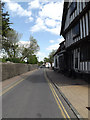
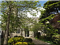
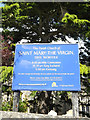
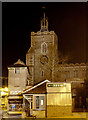
Nearby Images from Geograph Britain and Ireland:
©2015(licence)
©2015(licence)
©2015(licence)
©2014(licence)
©2014(licence)
The above images may not be of the site on this page, they are loaded from Geograph.
Please Submit an Image of this site or go out and take one for us!
Click here to see more info for this site
Nearby sites
Key: Red: member's photo, Blue: 3rd party photo, Yellow: other image, Green: no photo - please go there and take one, Grey: site destroyed
Download sites to:
KML (Google Earth)
GPX (GPS waypoints)
CSV (Garmin/Navman)
CSV (Excel)
To unlock full downloads you need to sign up as a Contributory Member. Otherwise downloads are limited to 50 sites.
Turn off the page maps and other distractions
Nearby sites listing. In the following links * = Image available
6.6km W 281° South Lopham Ox-Foot Stone* Natural Stone / Erratic / Other Natural Feature (TM05178098)
6.9km ESE 118° St. Edmund's Cross Ancient Cross (TM1877)
9.8km W 261° St. Mary's Well (Thelnetham)* Holy Well or Sacred Spring (TM0201578071)
11.6km ESE 121° Kesgrave Bowl Barrow 2 Round Barrow(s) (TM220745)
11.9km NW 313° Vikings Mound* Artificial Mound (TM02678781)
12.7km W 281° Home Covert Tumulus* Round Barrow(s) (TL99138177)
13.0km W 280° Devil's Ditch* Misc. Earthwork (TL9879281705)
13.1km WNW 288° Soldier's Hill Round Barrow(s) (TL99008346)
13.2km WNW 291° East Harling Heath Tumulus* Round Barrow(s) (TL99238425)
13.2km W 280° Riddlesworth Tumulus Round Barrow(s) (TL98648180)
14.1km WNW 293° West Harling Tumulus Round Barrow(s) (TL98438486)
14.2km S 188° Mendlesham Preaching Stone* Natural Stone / Erratic / Other Natural Feature (TM103658)
14.5km NW 317° Gallows Hill Tumulus Round Barrow(s) (TM01419019)
15.4km WNW 294° Mickelmoor Hill Settlement Ancient Village or Settlement (TL974857)
15.6km WSW 241° Artificial Mound near Wrenshall Farm Artificial Mound (TL9836071843)
15.9km WNW 284° West Harling Heath Barrows Round Barrow(s) (TL96068320)
16.2km W 273° Knettishall bowl barrow* Round Barrow(s) (TL9546280239)
17.9km WNW 303° Larling Heath Tumulus Round Barrow(s) (TL96268912)
18.1km NNE 30° Tasburgh Fort* Hillfort (TM201960)
19.6km ENE 74° Flixton Park Quarry Timber Circle (TM303863)
19.6km WNW 294° Peddars Way* Ancient Trackway (TL9341287119)
20.9km WSW 240° Pakenham Cursus Cursus (TL940688)
21.3km W 276° Seven Hills Barrow Cemetery Barrow Cemetery (TL904814)
21.5km N 359° St Thomas's Well (Wymondham)* Holy Well or Sacred Spring (TG10550146)
21.9km WNW 294° East Wretham Heath Earthwork* Misc. Earthwork (TL91278814)
View more nearby sites and additional images


 We would like to know more about this location. Please feel free to add a brief description and any relevant information in your own language.
 Wir möchten mehr über diese Stätte erfahren. Bitte zögern Sie nicht, eine kurze Beschreibung und relevante Informationen in Deutsch hinzuzufügen.
 Nous aimerions en savoir encore un peu sur les lieux. S'il vous plaît n'hesitez pas à ajouter une courte description et tous les renseignements pertinents dans votre propre langue.
 Quisieramos informarnos un poco más de las lugares. No dude en añadir una breve descripción y otros datos relevantes en su propio idioma.