

<< Text Pages >> Lady Well, Badley - Holy Well or Sacred Spring in England in Suffolk
Submitted by coldrum on Monday, 18 June 2012 Page Views: 4046
Springs and Holy WellsSite Name: Lady Well, BadleyCountry: England
NOTE: This site is 3.431 km away from the location you searched for.
County: Suffolk Type: Holy Well or Sacred Spring
Map Ref: TM06135517
Latitude: 52.156311N Longitude: 1.011941E
Condition:
| 5 | Perfect |
| 4 | Almost Perfect |
| 3 | Reasonable but with some damage |
| 2 | Ruined but still recognisable as an ancient site |
| 1 | Pretty much destroyed, possibly visible as crop marks |
| 0 | No data. |
| -1 | Completely destroyed |
| 5 | Superb |
| 4 | Good |
| 3 | Ordinary |
| 2 | Not Good |
| 1 | Awful |
| 0 | No data. |
| 5 | Can be driven to, probably with disabled access |
| 4 | Short walk on a footpath |
| 3 | Requiring a bit more of a walk |
| 2 | A long walk |
| 1 | In the middle of nowhere, a nightmare to find |
| 0 | No data. |
| 5 | co-ordinates taken by GPS or official recorded co-ordinates |
| 4 | co-ordinates scaled from a detailed map |
| 3 | co-ordinates scaled from a bad map |
| 2 | co-ordinates of the nearest village |
| 1 | co-ordinates of the nearest town |
| 0 | no data |
Be the first person to rate this site - see the 'Contribute!' box in the right hand menu.
Internal Links:
External Links:
Holy Well or Sacred Spring in Suffolk
Natural spring.
Read More at Pastscape.
You may be viewing yesterday's version of this page. To see the most up to date information please register for a free account.
Do not use the above information on other web sites or publications without permission of the contributor.
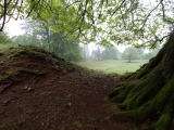
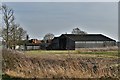
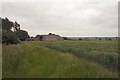
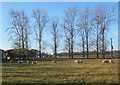
Nearby Images from Geograph Britain and Ireland:
©2019(licence)
©2007(licence)
©2007(licence)
©2019(licence)
©2007(licence)
The above images may not be of the site on this page, they are loaded from Geograph.
Please Submit an Image of this site or go out and take one for us!
Click here to see more info for this site
Nearby sites
Key: Red: member's photo, Blue: 3rd party photo, Yellow: other image, Green: no photo - please go there and take one, Grey: site destroyed
Download sites to:
KML (Google Earth)
GPX (GPS waypoints)
CSV (Garmin/Navman)
CSV (Excel)
To unlock full downloads you need to sign up as a Contributory Member. Otherwise downloads are limited to 50 sites.
Turn off the page maps and other distractions
Nearby sites listing. In the following links * = Image available
7.1km WSW 238° Wattisham Stone* Natural Stone / Erratic / Other Natural Feature (TM0027151103)
7.5km WSW 254° Cross Green Puddingstone Natural Stone / Erratic / Other Natural Feature (TL990528)
9.0km SW 233° Bildeston Puddingstone Natural Stone / Erratic / Other Natural Feature (TL992494)
10.9km SW 225° Chelsworth Puddingstone Natural Stone / Erratic / Other Natural Feature (TL987471)
11.3km NW 314° Lady Well, Woolpit* Holy Well or Sacred Spring (TL9763362676)
11.4km NW 312° Woolpit Cross* Ancient Cross (TL974625)
11.4km NNE 24° Mendlesham Preaching Stone* Natural Stone / Erratic / Other Natural Feature (TM103658)
11.9km SW 216° Drakestone Green Puddingstone Natural Stone / Erratic / Other Natural Feature (TL995453)
12.6km SSW 211° Kersey Puddingstone* Natural Stone / Erratic / Other Natural Feature (TM000441)
16.5km ESE 102° Burgh Enclosure Ancient Village or Settlement (TM224523)
17.8km SSW 211° Whitestreet Green* Natural Stone / Erratic / Other Natural Feature (TL9754839514)
18.2km NW 321° Pakenham Cursus Cursus (TL940688)
18.3km ESE 122° Kesgrave Bowl Barrow 1* Round Barrow(s) (TM22074616)
18.4km NNW 337° Artificial Mound near Wrenshall Farm Artificial Mound (TL9836071843)
18.4km ESE 123° Kesgrave Barrow* Round Barrow(s) (TM22074591)
19.5km ESE 118° Martlesham Heath* Round Barrow(s) (TM238468)
19.9km ESE 120° Martlesham Bowl Barrow 2* Round Barrow(s) (TM23874598)
20.0km ESE 120° Martlesham Bowl Barrow 1* Round Barrow(s) (TM23864587)
20.1km S 191° Stoke by Nayland Cursus (TM031353)
20.2km ESE 119° Martlesham Airfield Round Barrow(s) (TM24224616)
20.2km ESE 122° Brightwell Heath* Barrow Cemetery (TM23634505)
20.7km S 187° Stratford St. Mary A Cursus Cursus (TM046345)
20.8km NW 307° St. John's Well (Suffolk)* Holy Well or Sacred Spring (TL889669)
20.9km SE 134° Purdis Farm Cursus Cursus (TM218413)
20.9km S 186° Stratford St. Mary A Cursus Cursus (TM049343)
View more nearby sites and additional images


 We would like to know more about this location. Please feel free to add a brief description and any relevant information in your own language.
 Wir möchten mehr über diese Stätte erfahren. Bitte zögern Sie nicht, eine kurze Beschreibung und relevante Informationen in Deutsch hinzuzufügen.
 Nous aimerions en savoir encore un peu sur les lieux. S'il vous plaît n'hesitez pas à ajouter une courte description et tous les renseignements pertinents dans votre propre langue.
 Quisieramos informarnos un poco más de las lugares. No dude en añadir una breve descripción y otros datos relevantes en su propio idioma.