


<< Text Pages >> St. Osyth's Well (St. Osyth) - Holy Well or Sacred Spring in England in Essex
Submitted by DavidCWoods on Monday, 07 February 2005 Page Views: 10515
Springs and Holy WellsSite Name: St. Osyth's Well (St. Osyth) Alternative Name: St. Ositha's WellCountry: England
NOTE: This site is 2.894 km away from the location you searched for.
County: Essex Type: Holy Well or Sacred Spring
Nearest Town: Clacton Nearest Village: St. Osyth
Map Ref: TM11651670
Latitude: 51.808851N Longitude: 1.068798E
Condition:
| 5 | Perfect |
| 4 | Almost Perfect |
| 3 | Reasonable but with some damage |
| 2 | Ruined but still recognisable as an ancient site |
| 1 | Pretty much destroyed, possibly visible as crop marks |
| 0 | No data. |
| -1 | Completely destroyed |
| 5 | Superb |
| 4 | Good |
| 3 | Ordinary |
| 2 | Not Good |
| 1 | Awful |
| 0 | No data. |
| 5 | Can be driven to, probably with disabled access |
| 4 | Short walk on a footpath |
| 3 | Requiring a bit more of a walk |
| 2 | A long walk |
| 1 | In the middle of nowhere, a nightmare to find |
| 0 | No data. |
| 5 | co-ordinates taken by GPS or official recorded co-ordinates |
| 4 | co-ordinates scaled from a detailed map |
| 3 | co-ordinates scaled from a bad map |
| 2 | co-ordinates of the nearest village |
| 1 | co-ordinates of the nearest town |
| 0 | no data |
Internal Links:
External Links:
Holy Well or Sacred Spring in Essex. This well is situated on private land within the estate of St. Osyth Priory. St. Osyth was a Mercian princess (although others say there was more than one St. Osyth) who founded the church of St. Peter and Paul, and instituted a nunnery, supposed to be the most ancient monastic establishment in England in the village that now bears her name.
She was beheaded by the Danes, and the legend runs that "at the place of her martyrdom a fountain sprang up, which continues to this day as a sovereign remedy for many diseases; her head was cut off; the body rose, and taking the head in her hand walked – guided by angels – to the church. Here it knocked at the door, and then fell to the ground". The stream was afterwards collected by monks in a long pipe.<
Having written to the local Vicar, I received a reply from the History Recorder for the church. The well site is apparently still extant in Nun’s Wood, about a mile and a half from the Priory House. It is a spring with a brick culvert feeding a pond (named on the 1880 OS map as Dolphin Pond) close to what may be the ruin of the original nunnery.
The Northern Antiquarian (TNA) features a page for this site - see their entry for St. Osyth’s Well, St. Osyth, Essex, which gives the same description as above plus local folklore.
Pastscape Monument No. 387739 records a nun's conduit house at TM 1165 1670, which describes one wall left of the south gable of this structure, which are probably the remains of the small stone building which covered the well.
You may be viewing yesterday's version of this page. To see the most up to date information please register for a free account.
Do not use the above information on other web sites or publications without permission of the contributor.
Nearby Images from Geograph Britain and Ireland:
©2008(licence)
©2008(licence)
©2023(licence)
©2010(licence)
©2023(licence)
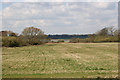
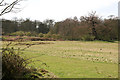
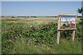
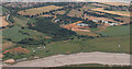
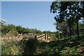
The above images may not be of the site on this page, they are loaded from Geograph.
Please Submit an Image of this site or go out and take one for us!
Click here to see more info for this site
Nearby sites
Key: Red: member's photo, Blue: 3rd party photo, Yellow: other image, Green: no photo - please go there and take one, Grey: site destroyed
Download sites to:
KML (Google Earth)
GPX (GPS waypoints)
CSV (Garmin/Navman)
CSV (Excel)
To unlock full downloads you need to sign up as a Contributory Member. Otherwise downloads are limited to 50 sites.
Turn off the page maps and other distractions
Nearby sites listing. In the following links * = Image available
1.1km N 9° Flag Inn (St Osyth) Cairn (TM11771777)
5.8km N 350° Great Bentley Henge (TM104224)
6.2km ESE 123° Clacton Cursus Cursus (TM170135)
6.4km NW 306° Alresford Hill Cairn (TM06282022)
7.5km NNE 13° Little Bentley Henge (TM130241)
9.1km ENE 78° Great Holland Cursus Cursus (TM205189)
9.3km ENE 79° Great Holland Cursus (TM207189)
9.3km ENE 78° Frinton and Walton Cursus Cursus (TM20731898)
9.7km W 262° West Mersea* Artificial Mound (TM021149)
10.9km NNW 348° Little Bromley Henge (TM089273)
11.8km WSW 251° St Peter's Well (West Mersea)* Holy Well or Sacred Spring (TM006124)
12.1km NW 311° Annan Road Bronze Age Barrow Cemetery* Barrow Cemetery (TM0215024164)
12.1km SW 227° Othona Roman Fort* Early Christian Sculptured Stone (TM031081)
12.3km WNW 299° Tamworth Mound Misc. Earthwork (TM0065922209)
12.5km NW 313° Greenstead Stones* Natural Stone / Erratic / Other Natural Feature (TM021248)
13.0km WNW 296° Berechurch Dyke Misc. Earthwork
13.6km N 352° Lawford Cursus (TM093301)
13.7km N 353° Lawford 2 Long Barrow (TM095302)
13.7km N 354° Lawford Cursus (TM097303)
13.8km N 353° Lawford C Cursus Cursus (TM095303)
14.4km N 351° Lawford Timber Circle (TM088308)
14.4km NW 306° St John's Green (Colchester) Cairn (TL99642468)
14.6km NW 308° Colchester Castle Museum* Museum (TL998253)
14.9km NNW 346° Lawford B Cursus Cursus (TM075310)
15.0km NNW 346° Lawford 1 Long Barrow (TM074311)
View more nearby sites and additional images


 We would like to know more about this location. Please feel free to add a brief description and any relevant information in your own language.
 Wir möchten mehr über diese Stätte erfahren. Bitte zögern Sie nicht, eine kurze Beschreibung und relevante Informationen in Deutsch hinzuzufügen.
 Nous aimerions en savoir encore un peu sur les lieux. S'il vous plaît n'hesitez pas à ajouter une courte description et tous les renseignements pertinents dans votre propre langue.
 Quisieramos informarnos un poco más de las lugares. No dude en añadir una breve descripción y otros datos relevantes en su propio idioma.