

<< Our Photo Pages >> Shrub's Wood Long Barrow - Long Barrow in England in Kent
Submitted by coldrum on Wednesday, 23 July 2008 Page Views: 8019
Neolithic and Bronze AgeSite Name: Shrub's Wood Long BarrowCountry: England County: Kent Type: Long Barrow
Nearest Village: Hastingleigh
Map Ref: TR09914587
Latitude: 51.173527N Longitude: 1.001505E
Condition:
| 5 | Perfect |
| 4 | Almost Perfect |
| 3 | Reasonable but with some damage |
| 2 | Ruined but still recognisable as an ancient site |
| 1 | Pretty much destroyed, possibly visible as crop marks |
| 0 | No data. |
| -1 | Completely destroyed |
| 5 | Superb |
| 4 | Good |
| 3 | Ordinary |
| 2 | Not Good |
| 1 | Awful |
| 0 | No data. |
| 5 | Can be driven to, probably with disabled access |
| 4 | Short walk on a footpath |
| 3 | Requiring a bit more of a walk |
| 2 | A long walk |
| 1 | In the middle of nowhere, a nightmare to find |
| 0 | No data. |
| 5 | co-ordinates taken by GPS or official recorded co-ordinates |
| 4 | co-ordinates scaled from a detailed map |
| 3 | co-ordinates scaled from a bad map |
| 2 | co-ordinates of the nearest village |
| 1 | co-ordinates of the nearest town |
| 0 | no data |
Internal Links:
External Links:
I have visited· I would like to visit
SolarMegalith Brian_Eyes would like to visit
")
Information from Pastscape: "A long barrow at TR 09914587 is 40.0m long, 17.0 to 20.0m in bradth, and 2.0m in height at the E end, slightly less at the W end. Side ditches are 7.0m wide, and up to 0.5m deep." http://www.pastscape.org.uk/hob.aspx?hob_id=463075 The barrow is situated on level ground within chestnut woodland and is in excellent condition, and apparently undisturbed.
http://morganbd.blogspot.com/2008/05/couplea-weeks-ago-i-was-re-visiting.html
http://hotlandscapes.blogspot.com/2008/05/shrubs-wood-barrow-shrubs-woodis.html
From Exploring Kent's Past: "The remains of a Neolithic long barrow are located in Shrubs Wood near Elmstead. The barrow is 40m long, between 17 to 20m in breadth, and survives to 2m in height at its east end. The ditches are 7m wide, and up to half a metre deep. The barrow is situated on level ground within chestnut woodland and is in excellent condition, and apparently undisturbed. One of a group of three long barrows in the Stour Valley." http://extranet7.kent.gov.uk/ExploringKentsPast/SingleResult.aspx?uid=MKE3881
You may be viewing yesterday's version of this page. To see the most up to date information please register for a free account.
")
Do not use the above information on other web sites or publications without permission of the contributor.
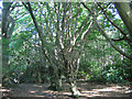
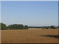
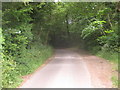
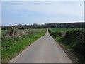
Nearby Images from Geograph Britain and Ireland:
©2006(licence)
©2006(licence)
©2010(licence)
©2009(licence)
©2013(licence)
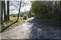
The above images may not be of the site on this page, they are loaded from Geograph.
Please Submit an Image of this site or go out and take one for us!
Click here to see more info for this site
Nearby sites
Key: Red: member's photo, Blue: 3rd party photo, Yellow: other image, Green: no photo - please go there and take one, Grey: site destroyed
Download sites to:
KML (Google Earth)
GPX (GPS waypoints)
CSV (Garmin/Navman)
CSV (Excel)
To unlock full downloads you need to sign up as a Contributory Member. Otherwise downloads are limited to 50 sites.
Turn off the page maps and other distractions
Nearby sites listing. In the following links * = Image available
2.0km WSW 253° Broad Downs Bowl Barrow* Round Barrow(s) (TR08004520)
3.2km WNW 293° The Junipers Tumulus* Round Barrow(s) (TR069470)
3.6km NW 319° Warren Wood Saucer Barrow Round Barrow(s) (TR07444852)
3.7km W 273° St. Eustace's Well* Holy Well or Sacred Spring (TR0617045889)
3.9km N 5° Buckholt Farm Barrows Round Barrow(s) (TR10114972)
3.9km N 359° Eggringe Wood Bowl Barrow Round Barrow(s) (TR09664979)
4.4km SE 142° Swinyard's Hill Tumulus Round Barrow(s) (TR12784255)
4.5km N 359° Pennypot Lane Bowl Barrow* Round Barrow(s) (TR09675035)
4.5km N 359° Eggringe Wood Western Bowl Barrow* Round Barrow(s) (TR09655041)
4.6km N 11° Mounts Wood Barrow Round Barrow(s) (TR10615043)
4.7km SE 130° West Wood Barrows Barrow Cemetery (TR136430)
4.7km ESE 120° Mockbegger Farm Barrow Round Barrow(s) (TR14074372)
4.7km SSE 157° Stowting Court Barrow Round Barrow(s) (TR11904161)
4.8km SE 137° Stone Street Barrow Round Barrow(s) (TR13354250)
4.8km N 360° Eggringe Wood Barrow Cemetery* Barrow Cemetery (TR097507)
4.9km N 5° Eggringe Wood Round Barrow* Round Barrow(s) (TR10155079)
5.0km N 5° Eggringe Wood East Bowl Barrow* Round Barrow(s) (TR10115083)
5.0km SE 137° Tumulus farm Barrow* Round Barrow(s) (TR1348742346)
5.4km W 280° Pilgrims Way 8 Ancient Trackway (TR045466)
5.6km NNE 18° Mounts Wood Barrow* Round Barrow(s) (TR11455126)
6.2km N 357° Denge Wood Tumulus Round Barrow(s) (TR0933852069)
6.2km E 95° Elhampark Wood Barrows* Round Barrow(s) (TR16154558)
6.6km N 359° Denge Wood Earthworks Misc. Earthwork (TR095525)
6.7km ESE 119° Tumulus, Boyke Lane* Round Barrow(s) (TR15944290)
7.6km NW 311° Kings Wood Barrow* Round Barrow(s) (TR04005060)
View more nearby sites and additional images


 We would like to know more about this location. Please feel free to add a brief description and any relevant information in your own language.
 Wir möchten mehr über diese Stätte erfahren. Bitte zögern Sie nicht, eine kurze Beschreibung und relevante Informationen in Deutsch hinzuzufügen.
 Nous aimerions en savoir encore un peu sur les lieux. S'il vous plaît n'hesitez pas à ajouter une courte description et tous les renseignements pertinents dans votre propre langue.
 Quisieramos informarnos un poco más de las lugares. No dude en añadir una breve descripción y otros datos relevantes en su propio idioma.