


<< Our Photo Pages >> Menhir de La Rue - Natural Stone / Erratic / Other Natural Feature in France in Aquitaine:Dordogne (24)
Submitted by LaDragonne on Sunday, 21 August 2022 Page Views: 349
Natural PlacesSite Name: Menhir de La Rue Alternative Name: Menhir du CombaletCountry: France
NOTE: This site is 1.941 km away from the location you searched for.
Département: Aquitaine:Dordogne (24) Type: Natural Stone / Erratic / Other Natural Feature
Nearest Town: Périgueux Nearest Village: Rouffignac
Latitude: 45.024425N Longitude: 0.978763E
Condition:
| 5 | Perfect |
| 4 | Almost Perfect |
| 3 | Reasonable but with some damage |
| 2 | Ruined but still recognisable as an ancient site |
| 1 | Pretty much destroyed, possibly visible as crop marks |
| 0 | No data. |
| -1 | Completely destroyed |
| 5 | Superb |
| 4 | Good |
| 3 | Ordinary |
| 2 | Not Good |
| 1 | Awful |
| 0 | No data. |
| 5 | Can be driven to, probably with disabled access |
| 4 | Short walk on a footpath |
| 3 | Requiring a bit more of a walk |
| 2 | A long walk |
| 1 | In the middle of nowhere, a nightmare to find |
| 0 | No data. |
| 5 | co-ordinates taken by GPS or official recorded co-ordinates |
| 4 | co-ordinates scaled from a detailed map |
| 3 | co-ordinates scaled from a bad map |
| 2 | co-ordinates of the nearest village |
| 1 | co-ordinates of the nearest town |
| 0 | no data |
Internal Links:
External Links:
")
Pierre ressemblant joliment à un menhir, implantée non loin du creusement du lac collinaire. À l'intersection de la RD 32 et de la route communale menant au Combalet.
You may be viewing yesterday's version of this page. To see the most up to date information please register for a free account.
Do not use the above information on other web sites or publications without permission of the contributor.
Nearby Images from Flickr
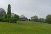

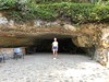
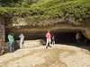
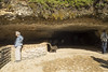
The above images may not be of the site on this page, but were taken nearby. They are loaded from Flickr so please click on them for image credits.
Click here to see more info for this site
Nearby sites
Click here to view sites on an interactive map of the areaKey: Red: member's photo, Blue: 3rd party photo, Yellow: other image, Green: no photo - please go there and take one, Grey: site destroyed
Download sites to:
KML (Google Earth)
GPX (GPS waypoints)
CSV (Garmin/Navman)
CSV (Excel)
To unlock full downloads you need to sign up as a Contributory Member. Otherwise downloads are limited to 50 sites.
Turn off the page maps and other distractions
Nearby sites listing. In the following links * = Image available
1.9km SSE 158° Grotte de Rouffignac* Cave or Rock Shelter
3.3km NNW 335° Dolmen de la Faille* Burial Chamber or Dolmen
4.6km SW 220° Pierre des Justices Polissoir
5.5km SSE 164° Peyrelevade de Fleurac* Burial Chamber or Dolmen
6.9km ESE 123° Abri de Ruth* Cave or Rock Shelter
7.2km ESE 118° Abri du Moustier* Cave or Rock Shelter
7.4km SSE 148° Abri de la Madeleine* Cave or Rock Shelter
7.4km SSE 147° Source de la Madeleine* Holy Well or Sacred Spring
7.5km SE 146° Village de la Madeleine* Ancient Village or Settlement
7.7km SSE 164° Gisement de la Micoque* Cave or Rock Shelter
7.9km ESE 120° La Roque-Saint-Christophe* Ancient Village or Settlement
8.1km SE 131° Grotte de La Forêt Cave or Rock Shelter
8.2km SSE 166° Abri de Laugerie-Haute* Cave or Rock Shelter
8.4km S 170° Abri de Laugerie-Basse* Cave or Rock Shelter
8.5km S 170° Grotte de Grand Roc* Cave or Rock Shelter
8.7km SSW 202° Abri de la Ferrassie* Cave or Rock Shelter
9.1km S 170° Abri du Poisson* Cave or Rock Shelter
9.1km S 171° Abri de Lartet* Cave or Rock Shelter
9.3km S 170° Grotte de l'Oreille d'Enfer* Cave or Rock Shelter
9.4km NNW 330° Chaos de Marbois* Standing Stones
9.6km SSE 165° Abri de Cro-Magnon* Cave or Rock Shelter
10.0km SSE 165° Gisement du Pataud* Cave or Rock Shelter
10.0km ESE 106° Abri Reverdit Cave or Rock Shelter
10.0km ESE 106° Abri Castanet Cave or Rock Shelter
10.2km SSE 164° Musée National de Préhistoire* Museum
View more nearby sites and additional images


 We would like to know more about this location. Please feel free to add a brief description and any relevant information in your own language.
 Wir möchten mehr über diese Stätte erfahren. Bitte zögern Sie nicht, eine kurze Beschreibung und relevante Informationen in Deutsch hinzuzufügen.
 Nous aimerions en savoir encore un peu sur les lieux. S'il vous plaît n'hesitez pas à ajouter une courte description et tous les renseignements pertinents dans votre propre langue.
 Quisieramos informarnos un poco más de las lugares. No dude en añadir una breve descripción y otros datos relevantes en su propio idioma.