


<< Our Photo Pages >> Cayra Levada - Burial Chamber or Dolmen in France in Aquitaine:Dordogne (24)
Submitted by TheCaptain on Sunday, 16 January 2011 Page Views: 4328
Neolithic and Bronze AgeSite Name: Cayra Levada Alternative Name: Cayre Leva, Dolmen de CayrelevaCountry: France Département: Aquitaine:Dordogne (24) Type: Burial Chamber or Dolmen
Nearest Town: Sarlat-la-Canéda Nearest Village: Soirac
Latitude: 44.803500N Longitude: 0.975400E
Condition:
| 5 | Perfect |
| 4 | Almost Perfect |
| 3 | Reasonable but with some damage |
| 2 | Ruined but still recognisable as an ancient site |
| 1 | Pretty much destroyed, possibly visible as crop marks |
| 0 | No data. |
| -1 | Completely destroyed |
| 5 | Superb |
| 4 | Good |
| 3 | Ordinary |
| 2 | Not Good |
| 1 | Awful |
| 0 | No data. |
| 5 | Can be driven to, probably with disabled access |
| 4 | Short walk on a footpath |
| 3 | Requiring a bit more of a walk |
| 2 | A long walk |
| 1 | In the middle of nowhere, a nightmare to find |
| 0 | No data. |
| 5 | co-ordinates taken by GPS or official recorded co-ordinates |
| 4 | co-ordinates scaled from a detailed map |
| 3 | co-ordinates scaled from a bad map |
| 2 | co-ordinates of the nearest village |
| 1 | co-ordinates of the nearest town |
| 0 | no data |
Internal Links:
External Links:
I have visited· I would like to visit
johnstone visited on 22nd Jun 2015 - their rating: Cond: 3 Amb: 2 Access: 4
TheCaptain visited on 21st May 2005 - their rating: Cond: 3 Amb: 3 Access: 4 Just beside a little road northwest of Belvès but fenced in a garden and becoming overgrown this 1.5 metre high dolmen had several polished axes found within it. There’s a raised capstone on a couple of supports but its difficult to make out much more.
While sitting making notes here I got overrun and attacked by a lot of vicious little ants and am still paying the price for sitting down carelessly 12 hours later. Bastards !
regina have visited here
Average ratings for this site from all visit loggers: Condition: 3 Ambience: 2.5 Access: 4
")
While sitting making notes here I got overrun and attacked by a lot of vicious little ants and am still paying the price for sitting down carelessly 12 hours later. Bastards !
You may be viewing yesterday's version of this page. To see the most up to date information please register for a free account.
")
")
Do not use the above information on other web sites or publications without permission of the contributor.
Nearby Images from Flickr
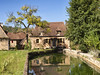


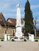
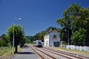
The above images may not be of the site on this page, but were taken nearby. They are loaded from Flickr so please click on them for image credits.
Click here to see more info for this site
Nearby sites
Click here to view sites on an interactive map of the areaKey: Red: member's photo, Blue: 3rd party photo, Yellow: other image, Green: no photo - please go there and take one, Grey: site destroyed
Download sites to:
KML (Google Earth)
GPX (GPS waypoints)
CSV (Garmin/Navman)
CSV (Excel)
To unlock full downloads you need to sign up as a Contributory Member. Otherwise downloads are limited to 50 sites.
Turn off the page maps and other distractions
Nearby sites listing. In the following links * = Image available
889m SSW 193° Bonarme Dolmen* Burial Chamber or Dolmen
1.5km SSW 197° Bonarme polissoirs* Polissoir
4.1km SE 143° Dolmen Pelevade de Belvès* Burial Chamber or Dolmen
5.3km WNW 301° Dolmen Le Cayre* Burial Chamber or Dolmen
6.5km SSW 208° Dolmen de Peyrelevade (Bouillac)* Burial Chamber or Dolmen
6.9km SSW 206° Peyrelevade de Bouillac* Burial Chamber or Dolmen
6.9km ESE 122° Cayre Levat* Burial Chamber or Dolmen
7.7km NW 325° Saint-Chamassy Dolmen* Burial Chamber or Dolmen
8.4km SE 135° Langlade Dolmen* Burial Chamber or Dolmen
9.1km NNE 18° Polissoirs du Bousquet* Polissoir
9.5km SSW 195° Peyro Negro de Fongalop* Marker Stone
10.0km WNW 292° Grotte de Cussac* Cave or Rock Shelter
11.1km NW 323° Gisement de Limeuil Cave or Rock Shelter
11.5km N 359° Campagne menhir* Standing Stone (Menhir)
11.5km WSW 241° Abris-sous-roche de Combe-Capelle* Cave or Rock Shelter
11.6km SSW 195° Menhir de Peyrecourt* Standing Stone (Menhir)
11.8km N 358° Grotte du Roc de Marsal* Cave or Rock Shelter
11.9km SE 129° Menhir de Peyre longue* Standing Stone (Menhir)
12.2km ESE 115° Dolmen de Pomarède* Burial Chamber or Dolmen
12.2km SSW 194° Motte du Maréchal* Artificial Mound
12.3km SW 220° Roc de Nanty* Standing Stone (Menhir)
12.4km SSW 207° Maison du Loup dolmen 2* Passage Grave
12.4km SSW 208° Maison du Loup dolmen 1* Passage Grave
12.5km SSW 193° Menhir de Pechegut* Standing Stone (Menhir)
12.7km SSW 193° Source de Pechegut* Holy Well or Sacred Spring
View more nearby sites and additional images


 We would like to know more about this location. Please feel free to add a brief description and any relevant information in your own language.
 Wir möchten mehr über diese Stätte erfahren. Bitte zögern Sie nicht, eine kurze Beschreibung und relevante Informationen in Deutsch hinzuzufügen.
 Nous aimerions en savoir encore un peu sur les lieux. S'il vous plaît n'hesitez pas à ajouter une courte description et tous les renseignements pertinents dans votre propre langue.
 Quisieramos informarnos un poco más de las lugares. No dude en añadir una breve descripción y otros datos relevantes en su propio idioma.