


<< Other Photo Pages >> Menhirs de Mancioux - Standing Stone (Menhir) in France in Midi:Haute-Garonne (31)
Submitted by TheCaptain on Monday, 26 October 2020 Page Views: 420
Neolithic and Bronze AgeSite Name: Menhirs de ManciouxCountry: France
NOTE: This site is 1.839 km away from the location you searched for.
Département: Midi:Haute-Garonne (31) Type: Standing Stone (Menhir)
Nearest Town: Saint-Gaudens Nearest Village: Mancioux
Latitude: 43.160300N Longitude: 0.953100E
Condition:
| 5 | Perfect |
| 4 | Almost Perfect |
| 3 | Reasonable but with some damage |
| 2 | Ruined but still recognisable as an ancient site |
| 1 | Pretty much destroyed, possibly visible as crop marks |
| 0 | No data. |
| -1 | Completely destroyed |
| 5 | Superb |
| 4 | Good |
| 3 | Ordinary |
| 2 | Not Good |
| 1 | Awful |
| 0 | No data. |
| 5 | Can be driven to, probably with disabled access |
| 4 | Short walk on a footpath |
| 3 | Requiring a bit more of a walk |
| 2 | A long walk |
| 1 | In the middle of nowhere, a nightmare to find |
| 0 | No data. |
| 5 | co-ordinates taken by GPS or official recorded co-ordinates |
| 4 | co-ordinates scaled from a detailed map |
| 3 | co-ordinates scaled from a bad map |
| 2 | co-ordinates of the nearest village |
| 1 | co-ordinates of the nearest town |
| 0 | no data |
Be the first person to rate this site - see the 'Contribute!' box in the right hand menu.
Internal Links:
External Links:
Two large 3.5 metre tall menhirs standing near the Cap du Pont just outside the village of Mancioux
The menhirs were uncovered from old walls and restood in 1962.
See more on T4t35.
You may be viewing yesterday's version of this page. To see the most up to date information please register for a free account.
Do not use the above information on other web sites or publications without permission of the contributor.
Nearby Images from Flickr

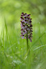
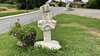
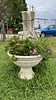
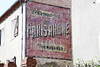
The above images may not be of the site on this page, but were taken nearby. They are loaded from Flickr so please click on them for image credits.
Click here to see more info for this site
Nearby sites
Click here to view sites on an interactive map of the areaKey: Red: member's photo, Blue: 3rd party photo, Yellow: other image, Green: no photo - please go there and take one, Grey: site destroyed
Download sites to:
KML (Google Earth)
GPX (GPS waypoints)
CSV (Garmin/Navman)
CSV (Excel)
To unlock full downloads you need to sign up as a Contributory Member. Otherwise downloads are limited to 50 sites.
Turn off the page maps and other distractions
Nearby sites listing. In the following links * = Image available
2.3km SW 218° Grotte de Montconfort Cave or Rock Shelter
2.5km SW 222° Peyro-Hitto* Standing Stone (Menhir)
3.4km ESE 117° Menhir de Balesta Standing Stone (Menhir)
6.3km SSE 158° Grotte de Marsoulas* Cave or Rock Shelter
6.5km ESE 110° Carrières Souterraines du Pédégas* Ancient Mine, Quarry or other Industry
8.5km ESE 101° Dolmen dit Très Peyros Burial Chamber or Dolmen
8.6km NW 317° Musée de Préhistoire (Aurignac)* Museum
9.9km NW 314° Grotte d'Aurignac* Cave or Rock Shelter
10.8km ESE 107° Dolmen de Couteret 1 Burial Chamber or Dolmen
10.8km ESE 106° Dolmen de Couteret 3 Burial Chamber or Dolmen
10.9km ESE 106° Dolmen de Couteret 2 Burial Chamber or Dolmen
12.9km SW 221° Souterrain de Houantaou Cave or Rock Shelter
16.9km SSE 159° Grotte de Mongautin Cave or Rock Shelter
22.6km WSW 252° Valentine Roman Villa Ancient Village or Settlement
24.5km WNW 289° Musée de Lespugue* Museum
24.7km SE 125° Grotte de Tuc-d'Audobert* Cave or Rock Shelter
24.8km WNW 291° Grotte des Harpons* Cave or Rock Shelter
24.9km WNW 289° Grotte des Rideaux* Cave or Rock Shelter
25.2km WNW 289° Grottes et abris préhistoriques de la vallée de la Save* Cave or Rock Shelter
25.7km ESE 124° Grotte des Trois-Frères* Cave or Rock Shelter
25.7km WNW 284° Tourenne Gallo-Roman Villa Ancient Village or Settlement
27.1km WNW 287° Grotte de Montmaurin Cave or Rock Shelter
28.2km ESE 105° Dolmen de Couminge* Burial Chamber or Dolmen
30.1km SSW 199° Piéjau cromlech Stone Circle
31.1km S 171° Vallée du Riberot* Ancient Village or Settlement
View more nearby sites and additional images


 We would like to know more about this location. Please feel free to add a brief description and any relevant information in your own language.
 Wir möchten mehr über diese Stätte erfahren. Bitte zögern Sie nicht, eine kurze Beschreibung und relevante Informationen in Deutsch hinzuzufügen.
 Nous aimerions en savoir encore un peu sur les lieux. S'il vous plaît n'hesitez pas à ajouter une courte description et tous les renseignements pertinents dans votre propre langue.
 Quisieramos informarnos un poco más de las lugares. No dude en añadir una breve descripción y otros datos relevantes en su propio idioma.