


<< Our Photo Pages >> Little Walsingham Holy Well - Holy Well or Sacred Spring in England in Norfolk
Submitted by vicky on Wednesday, 29 September 2004 Page Views: 14890
Springs and Holy WellsSite Name: Little Walsingham Holy WellCountry: England County: Norfolk Type: Holy Well or Sacred Spring
Nearest Village: Little Walsingham
Map Ref: TF93603678 Landranger Map Number: 132
Latitude: 52.893597N Longitude: 0.876529E
Condition:
| 5 | Perfect |
| 4 | Almost Perfect |
| 3 | Reasonable but with some damage |
| 2 | Ruined but still recognisable as an ancient site |
| 1 | Pretty much destroyed, possibly visible as crop marks |
| 0 | No data. |
| -1 | Completely destroyed |
| 5 | Superb |
| 4 | Good |
| 3 | Ordinary |
| 2 | Not Good |
| 1 | Awful |
| 0 | No data. |
| 5 | Can be driven to, probably with disabled access |
| 4 | Short walk on a footpath |
| 3 | Requiring a bit more of a walk |
| 2 | A long walk |
| 1 | In the middle of nowhere, a nightmare to find |
| 0 | No data. |
| 5 | co-ordinates taken by GPS or official recorded co-ordinates |
| 4 | co-ordinates scaled from a detailed map |
| 3 | co-ordinates scaled from a bad map |
| 2 | co-ordinates of the nearest village |
| 1 | co-ordinates of the nearest town |
| 0 | no data |
Be the first person to rate this site - see the 'Contribute!' box in the right hand menu.
Internal Links:
External Links:
I have visited· I would like to visit
PAB has visited here
")
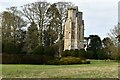
There are two medieval healing wells, now described as wishing wells and a medicinal bath at Walsingham Priory, recorded as Pastscape Monument No. 359067, the most recent entry being from 1971, reading: "Both the bath and the wells are now in excellent condition, indicating that the former has certainly been restored and the others probably have. They are set in a small ornamental garden access to which is gained through a re-erected Norman doorway at TF93413680."
The Journal of Antiquities also features a page for this Abbey and shrines - see their entry for Walsingham, Norfolk, which includes a brief history, directions for finding the shrines and information about how this site became a place of pilgrimage - "For many twentieth-century [and 21st!] pilgrims the annual pilgrimage to Walsingham is a highlight of the Christian year". The Journal includes a list of reference sources for more information.
Whilst there is no specific entry for these wells on Historic England, see Historic England List ID 1004055, Ruins and site of Walsingham Priory for the scheduling information; the location of the wells are marked on their map (use the grid reference below in their 'map search' feature). Also see The History of Pilgrimage.
You may be viewing yesterday's version of this page. To see the most up to date information please register for a free account.
")
Do not use the above information on other web sites or publications without permission of the contributor.
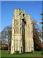
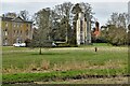
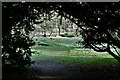
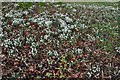
Nearby Images from Geograph Britain and Ireland:
©2011(licence)
©2022(licence)
©2022(licence)
©2018(licence)
©2022(licence)
The above images may not be of the site on this page, they are loaded from Geograph.
Please Submit an Image of this site or go out and take one for us!
Click here to see more info for this site
Nearby sites
Key: Red: member's photo, Blue: 3rd party photo, Yellow: other image, Green: no photo - please go there and take one, Grey: site destroyed
Download sites to:
KML (Google Earth)
GPX (GPS waypoints)
CSV (Garmin/Navman)
CSV (Excel)
To unlock full downloads you need to sign up as a Contributory Member. Otherwise downloads are limited to 50 sites.
Turn off the page maps and other distractions
Nearby sites listing. In the following links * = Image available
124m NNW 339° Our Lady of Walsingham Holy Well* Holy Well or Sacred Spring (TF9355136894)
4.2km NNE 13° Warham Camp* Hillfort (TF94374089)
5.0km NNE 33° Fiddler's Hill (Norfolk)* Round Barrow(s) (TF96134105)
8.9km W 262° South Creake* Hillfort (TF848352)
9.7km NW 323° Holkham Camp* Hillfort (TF875443)
10.3km NW 308° Leath House Roman Barrow* Barrow Cemetery (TF852427)
10.7km NE 52° Blakeney Downs Barrows Round Barrow(s) (TG01864365)
11.3km WSW 240° Wicken Covert Barrow Round Barrow(s) (TF83973081)
11.8km WSW 241° Coxford Heath Barrow Round Barrow(s) (TF83493070)
12.2km WNW 298° Burnham Market* Round Barrow(s) (TF826421)
13.5km S 189° Whissonsett wheel-head cross* Ancient Cross (TF91922334)
14.0km ENE 67° The Hangs* Round Barrow(s) (TG06304270)
15.2km WNW 302° Burnham Deepdale* Early Christian Sculptured Stone (TF804443)
15.4km ENE 71° Salthouse Heath* Barrow Cemetery (TG07974241)
16.0km SSE 163° North Elmham Chapel* Ancient Temple (TF9888121640)
16.3km SW 233° West Rudham North* Long Barrow (TF810264)
16.3km SW 232° West Rudham South* Long Barrow (TF810263)
16.8km SW 228° West Rudham* Round Barrow(s) (TF81652495)
16.9km SW 230° West Rudham Cursus Cursus (TF810254)
17.0km WNW 298° Branodunum Stone Fort or Dun (TF78214402)
17.2km WSW 251° Bircham Common Barrows* Barrow Cemetery (TF775306)
18.1km SSW 206° Litcham Heath* Round Barrow(s) (TF863202)
18.9km SSW 208° Weasenham Plantation* Barrow Cemetery (TF853198)
19.8km WSW 248° Harpley Common Barrow Cemetery* Barrow Cemetery (TF755287)
20.2km E 80° Howe’s Hill Oval Barrow* Round Barrow(s) (TG1340941007)
View more nearby sites and additional images


 We would like to know more about this location. Please feel free to add a brief description and any relevant information in your own language.
 Wir möchten mehr über diese Stätte erfahren. Bitte zögern Sie nicht, eine kurze Beschreibung und relevante Informationen in Deutsch hinzuzufügen.
 Nous aimerions en savoir encore un peu sur les lieux. S'il vous plaît n'hesitez pas à ajouter une courte description et tous les renseignements pertinents dans votre propre langue.
 Quisieramos informarnos un poco más de las lugares. No dude en añadir una breve descripción y otros datos relevantes en su propio idioma.