


<< Text Pages >> Stoke by Nayland A Cursus - Cursus in England in Suffolk
Submitted by EssexMan on Wednesday, 07 April 2010 Page Views: 3337
Neolithic and Bronze AgeSite Name: Stoke by Nayland A CursusCountry: England
NOTE: This site is 2.505 km away from the location you searched for.
County: Suffolk Type: Cursus
Nearest Town: Colchester Nearest Village: Stoke by Nayland
Map Ref: TL987348 Landranger Map Number: 155
Latitude: 51.976128N Longitude: 0.891631E
Condition:
| 5 | Perfect |
| 4 | Almost Perfect |
| 3 | Reasonable but with some damage |
| 2 | Ruined but still recognisable as an ancient site |
| 1 | Pretty much destroyed, possibly visible as crop marks |
| 0 | No data. |
| -1 | Completely destroyed |
| 5 | Superb |
| 4 | Good |
| 3 | Ordinary |
| 2 | Not Good |
| 1 | Awful |
| 0 | No data. |
| 5 | Can be driven to, probably with disabled access |
| 4 | Short walk on a footpath |
| 3 | Requiring a bit more of a walk |
| 2 | A long walk |
| 1 | In the middle of nowhere, a nightmare to find |
| 0 | No data. |
| 5 | co-ordinates taken by GPS or official recorded co-ordinates |
| 4 | co-ordinates scaled from a detailed map |
| 3 | co-ordinates scaled from a bad map |
| 2 | co-ordinates of the nearest village |
| 1 | co-ordinates of the nearest town |
| 0 | no data |
Internal Links:
External Links:
Long Enclosure in Suffolk
Status: Characteristic
Extent: 50mx20m
Terminal type: Round
You may be viewing yesterday's version of this page. To see the most up to date information please register for a free account.
Do not use the above information on other web sites or publications without permission of the contributor.
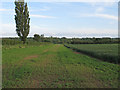
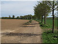
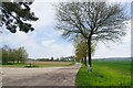
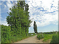
Nearby Images from Geograph Britain and Ireland:
©2015(licence)
©2015(licence)
©2023(licence)
©2015(licence)
©2023(licence)
The above images may not be of the site on this page, they are loaded from Geograph.
Please Submit an Image of this site or go out and take one for us!
Click here to see more info for this site
Nearby sites
Key: Red: member's photo, Blue: 3rd party photo, Yellow: other image, Green: no photo - please go there and take one, Grey: site destroyed
Download sites to:
KML (Google Earth)
GPX (GPS waypoints)
CSV (Garmin/Navman)
CSV (Excel)
To unlock full downloads you need to sign up as a Contributory Member. Otherwise downloads are limited to 50 sites.
Turn off the page maps and other distractions
Nearby sites listing. In the following links * = Image available
2.1km WSW 238° Great Horkesley Cursus Cursus (TL97003364)
2.1km WSW 237° Great Horkesley Cursus (TL970336)
3.0km SE 136° Boxted Henge (TM009327)
3.8km WSW 241° Little Horkesley Cursus (TL954328)
4.4km E 86° Stoke by Nayland Cursus (TM031353)
4.8km NNW 349° Whitestreet Green* Natural Stone / Erratic / Other Natural Feature (TL9754839514)
5.9km E 95° Stratford St. Mary A Cursus Cursus (TM046345)
6.2km SSW 202° Pitchbury Ramparts Hillfort (TL966290)
6.2km E 97° Stratford St. Mary A Cursus Cursus (TM049343)
6.6km E 97° Stratford St. Mary B Cursus Cursus (TM05253425)
6.7km WSW 252° Little Horkesley Cursus Cursus (TL924325)
6.8km WSW 255° Wormingford Cursus Cursus (TL92243274)
6.8km WSW 255° Little Horkesley Cursus Cursus (TL922328)
6.8km WSW 254° Wormingford Cursus (TL922327)
7.0km W 259° Bures St. Mary Cursus Cursus (TL91883325)
7.6km W 259° Mount Bures Cursus Cursus (TL913331)
7.6km WSW 259° Mount Bures Long Barrow (TL913330)
7.7km W 260° Bures Cursus (TL911332)
7.7km W 260° Mount Bures Cursus Cursus (TL911332)
7.8km S 189° Lexden Dyke* Ancient Village or Settlement (TL978270)
7.9km SW 224° Fordham Puddingstone* Marker Stone (TL9348028891)
8.0km ESE 108° Dedham Cursus (TM064326)
8.3km WSW 256° Mount Bures Puddingstone* Natural Stone / Erratic / Other Natural Feature (TL907325)
9.2km W 276° Lamarsh* Natural Stone / Erratic / Other Natural Feature (TL89473543)
9.3km S 182° Sheepden Dyke Ancient Village or Settlement (TL987255)
View more nearby sites and additional images


 We would like to know more about this location. Please feel free to add a brief description and any relevant information in your own language.
 Wir möchten mehr über diese Stätte erfahren. Bitte zögern Sie nicht, eine kurze Beschreibung und relevante Informationen in Deutsch hinzuzufügen.
 Nous aimerions en savoir encore un peu sur les lieux. S'il vous plaît n'hesitez pas à ajouter une courte description et tous les renseignements pertinents dans votre propre langue.
 Quisieramos informarnos un poco más de las lugares. No dude en añadir una breve descripción y otros datos relevantes en su propio idioma.