


<< Text Pages >> Lady well (Hothfield) - Holy Well or Sacred Spring in England in Kent
Submitted by HOLYWELL on Tuesday, 29 August 2006 Page Views: 4683
Springs and Holy WellsSite Name: Lady well (Hothfield)Country: England
NOTE: This site is 3.634 km away from the location you searched for.
County: Kent Type: Holy Well or Sacred Spring
Nearest Town: Ashford Nearest Village: Hothfield
Map Ref: TQ98054452
Latitude: 51.165630N Longitude: 0.831326E
Condition:
| 5 | Perfect |
| 4 | Almost Perfect |
| 3 | Reasonable but with some damage |
| 2 | Ruined but still recognisable as an ancient site |
| 1 | Pretty much destroyed, possibly visible as crop marks |
| 0 | No data. |
| -1 | Completely destroyed |
| 5 | Superb |
| 4 | Good |
| 3 | Ordinary |
| 2 | Not Good |
| 1 | Awful |
| 0 | No data. |
| 5 | Can be driven to, probably with disabled access |
| 4 | Short walk on a footpath |
| 3 | Requiring a bit more of a walk |
| 2 | A long walk |
| 1 | In the middle of nowhere, a nightmare to find |
| 0 | No data. |
| 5 | co-ordinates taken by GPS or official recorded co-ordinates |
| 4 | co-ordinates scaled from a detailed map |
| 3 | co-ordinates scaled from a bad map |
| 2 | co-ordinates of the nearest village |
| 1 | co-ordinates of the nearest town |
| 0 | no data |
Internal Links:
External Links:
Not much is known of this bar its name. However the presence of a nearby wood called Chapel Wood may be significant.
The well is a circular four foot red brick domed well house lying in a small copse. Clear spring water emerges through a large opening to the left side of this well house. Its brickwork is in good order, and the supply clear of visible rubbish or pollution. Some of the well's brickwork, may possibly be of a 17th century origin, but it has certainly been repaired this century using concrete.
Confusing correspondence with Mr. Simmons of nearby Godington Place did not reveal any knowledge of this site, but did highlight another possible ancient well. He noted that close to the grid reference is a mediaeval well, now a traditional cottage winch well enclosed in the garden of the North Lodge. He believed that this was possible a holy well with a chapel associated with it.
To find the Lady’s Well, take the A20 (T) to Ashford, taking the minor road to the right which enters Hothfield, pass out of the village, taking the southerly minor road that passes the waterfall. The well lies close to this besides the wood, on the left. Follow the edge of the lake until one reaches the well in a wooded glade below (NB There is no evidence for a public right of way, but parts of the route appear to be well traversed.)
You may be viewing yesterday's version of this page. To see the most up to date information please register for a free account.
Do not use the above information on other web sites or publications without permission of the contributor.
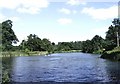
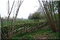
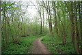
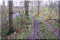
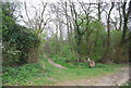
Nearby Images from Geograph Britain and Ireland:
©2006(licence)
©2011(licence)
©2011(licence)
©2009(licence)
©2011(licence)
The above images may not be of the site on this page, they are loaded from Geograph.
Please Submit an Image of this site or go out and take one for us!
Click here to see more info for this site
Nearby sites
Key: Red: member's photo, Blue: 3rd party photo, Yellow: other image, Green: no photo - please go there and take one, Grey: site destroyed
Download sites to:
KML (Google Earth)
GPX (GPS waypoints)
CSV (Garmin/Navman)
CSV (Excel)
To unlock full downloads you need to sign up as a Contributory Member. Otherwise downloads are limited to 50 sites.
Turn off the page maps and other distractions
Nearby sites listing. In the following links * = Image available
2.3km SSW 212° Gold well* Holy Well or Sacred Spring (TQ96904250)
3.6km NNE 26° Pilgrims Way 6 Ancient Trackway (TQ995478)
3.8km NE 44° Lady Well ( East well ) Holy Well or Sacred Spring (TR006474)
4.0km ENE 61° Duke's Spring* Holy Well or Sacred Spring (TR015466)
4.4km NE 50° Pilgrims Way 7 Ancient Trackway (TR013475)
4.7km ENE 56° Plantagenet's Well* Holy Well or Sacred Spring (TR019473)
6.1km NNE 24° The Lees Denehole Ancient Mine, Quarry or other Industry (TR003502)
6.8km ENE 74° Pilgrims Way 8 Ancient Trackway (TR045466)
7.3km NE 48° Jackets Field Long Barrow* Long Barrow (TR03304961)
7.8km NE 45° Kings Wood Mound* Misc. Earthwork (TR034502)
8.2km E 83° St. Eustace's Well* Holy Well or Sacred Spring (TR0617045889)
8.5km NE 47° Kings Wood Barrow* Round Barrow(s) (TR04005060)
9.2km ENE 77° The Junipers Tumulus* Round Barrow(s) (TR069470)
9.9km E 88° Broad Downs Bowl Barrow* Round Barrow(s) (TR08004520)
10.2km ENE 69° Warren Wood Saucer Barrow Round Barrow(s) (TR07444852)
10.9km SSE 147° Bilsington Priory Holy Well Holy Well or Sacred Spring (TR04433565)
11.9km E 86° Shrub's Wood Long Barrow* Long Barrow (TR09914587)
12.7km ENE 68° Eggringe Wood Bowl Barrow Round Barrow(s) (TR09664979)
12.9km SE 138° Aldington Knoll Barrow* Round Barrow(s) (TR07083525)
13.0km NE 50° Julliberrie's Grave* Long Barrow (TR077532)
13.0km ENE 66° Pennypot Lane Bowl Barrow* Round Barrow(s) (TR09675035)
13.0km ENE 65° Eggringe Wood Western Bowl Barrow* Round Barrow(s) (TR09655041)
13.1km ENE 69° Buckholt Farm Barrows Round Barrow(s) (TR10114972)
13.2km ENE 64° Eggringe Wood Barrow Cemetery* Barrow Cemetery (TR097507)
13.5km ENE 58° Denge Wood Tumulus Round Barrow(s) (TR0933852069)
View more nearby sites and additional images


 We would like to know more about this location. Please feel free to add a brief description and any relevant information in your own language.
 Wir möchten mehr über diese Stätte erfahren. Bitte zögern Sie nicht, eine kurze Beschreibung und relevante Informationen in Deutsch hinzuzufügen.
 Nous aimerions en savoir encore un peu sur les lieux. S'il vous plaît n'hesitez pas à ajouter une courte description et tous les renseignements pertinents dans votre propre langue.
 Quisieramos informarnos un poco más de las lugares. No dude en añadir una breve descripción y otros datos relevantes en su propio idioma.