


<< Our Photo Pages >> Whitestreet Green - Natural Stone / Erratic / Other Natural Feature in England in Suffolk
Submitted by ermine on Monday, 26 October 2015 Page Views: 1632
Natural PlacesSite Name: Whitestreet GreenCountry: England
NOTE: This site is 2.949 km away from the location you searched for.
County: Suffolk Type: Natural Stone / Erratic / Other Natural Feature
Map Ref: TL9754839514
Latitude: 52.018867N Longitude: 0.877595E
Condition:
| 5 | Perfect |
| 4 | Almost Perfect |
| 3 | Reasonable but with some damage |
| 2 | Ruined but still recognisable as an ancient site |
| 1 | Pretty much destroyed, possibly visible as crop marks |
| 0 | No data. |
| -1 | Completely destroyed |
| 5 | Superb |
| 4 | Good |
| 3 | Ordinary |
| 2 | Not Good |
| 1 | Awful |
| 0 | No data. |
| 5 | Can be driven to, probably with disabled access |
| 4 | Short walk on a footpath |
| 3 | Requiring a bit more of a walk |
| 2 | A long walk |
| 1 | In the middle of nowhere, a nightmare to find |
| 0 | No data. |
| 5 | co-ordinates taken by GPS or official recorded co-ordinates |
| 4 | co-ordinates scaled from a detailed map |
| 3 | co-ordinates scaled from a bad map |
| 2 | co-ordinates of the nearest village |
| 1 | co-ordinates of the nearest town |
| 0 | no data |
Internal Links:
External Links:
I have visited· I would like to visit
ermine has visited here
")
This stone is listed in the puddingstone trail article "The Lost Trackway" posted on the MP forum by Thorgrim many years ago on p13 - after the author passed Kersey and searched further.
You may be viewing yesterday's version of this page. To see the most up to date information please register for a free account.
Do not use the above information on other web sites or publications without permission of the contributor.
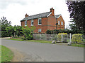
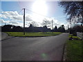
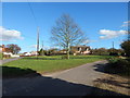
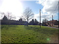
Nearby Images from Geograph Britain and Ireland:
©2015(licence)
©2014(licence)
©2014(licence)
©2014(licence)
©2015(licence)
The above images may not be of the site on this page, they are loaded from Geograph.
Please Submit an Image of this site or go out and take one for us!
Click here to see more info for this site
Nearby sites
Key: Red: member's photo, Blue: 3rd party photo, Yellow: other image, Green: no photo - please go there and take one, Grey: site destroyed
Download sites to:
KML (Google Earth)
GPX (GPS waypoints)
CSV (Garmin/Navman)
CSV (Excel)
To unlock full downloads you need to sign up as a Contributory Member. Otherwise downloads are limited to 50 sites.
Turn off the page maps and other distractions
Nearby sites listing. In the following links * = Image available
4.8km SSE 169° Stoke by Nayland A Cursus Cursus (TL987348)
5.2km NNE 30° Kersey Puddingstone* Natural Stone / Erratic / Other Natural Feature (TM000441)
5.9km S 188° Great Horkesley Cursus Cursus (TL97003364)
5.9km S 188° Great Horkesley Cursus (TL970336)
6.1km NNE 21° Drakestone Green Puddingstone Natural Stone / Erratic / Other Natural Feature (TL995453)
7.0km SE 130° Stoke by Nayland Cursus (TM031353)
7.0km SSW 200° Little Horkesley Cursus (TL954328)
7.6km SSE 156° Boxted Henge (TM009327)
7.7km N 11° Chelsworth Puddingstone Natural Stone / Erratic / Other Natural Feature (TL987471)
8.4km SW 224° Bures St. Mary Cursus Cursus (TL91883325)
8.6km SW 221° Little Horkesley Cursus Cursus (TL922328)
8.6km SW 220° Wormingford Cursus Cursus (TL92243274)
8.6km SE 128° Stratford St. Mary A Cursus Cursus (TM046345)
8.6km SW 220° Wormingford Cursus (TL922327)
8.7km SW 218° Little Horkesley Cursus Cursus (TL924325)
8.9km W 274° The Mead, Great Cornard Round Barrow(s) (TL8859239779)
8.9km SW 226° Mount Bures Cursus Cursus (TL913331)
9.0km SE 128° Stratford St. Mary A Cursus Cursus (TM049343)
9.0km SW 228° Bures Cursus (TL911332)
9.0km SW 228° Mount Bures Cursus Cursus (TL911332)
9.0km SW 226° Mount Bures Long Barrow (TL913330)
9.0km WSW 245° Lamarsh* Natural Stone / Erratic / Other Natural Feature (TL89473543)
9.3km SE 127° Stratford St. Mary B Cursus Cursus (TM05253425)
9.8km SW 227° Mount Bures Puddingstone* Natural Stone / Erratic / Other Natural Feature (TL907325)
9.8km W 276° Middleton Cursus Cursus (TL877402)
View more nearby sites and additional images


 We would like to know more about this location. Please feel free to add a brief description and any relevant information in your own language.
 Wir möchten mehr über diese Stätte erfahren. Bitte zögern Sie nicht, eine kurze Beschreibung und relevante Informationen in Deutsch hinzuzufügen.
 Nous aimerions en savoir encore un peu sur les lieux. S'il vous plaît n'hesitez pas à ajouter une courte description et tous les renseignements pertinents dans votre propre langue.
 Quisieramos informarnos un poco más de las lugares. No dude en añadir una breve descripción y otros datos relevantes en su propio idioma.