


<< Text Pages >> Holywell (Ospringe) - Holy Well or Sacred Spring in England in Kent
Submitted by HOLYWELL on Tuesday, 01 March 2011 Page Views: 4288
Springs and Holy WellsSite Name: Holywell (Ospringe)Country: England
NOTE: This site is 1.271 km away from the location you searched for.
County: Kent Type: Holy Well or Sacred Spring
Nearest Town: Faversham
Map Ref: TR002608
Latitude: 51.311087N Longitude: 0.871130E
Condition:
| 5 | Perfect |
| 4 | Almost Perfect |
| 3 | Reasonable but with some damage |
| 2 | Ruined but still recognisable as an ancient site |
| 1 | Pretty much destroyed, possibly visible as crop marks |
| 0 | No data. |
| -1 | Completely destroyed |
| 5 | Superb |
| 4 | Good |
| 3 | Ordinary |
| 2 | Not Good |
| 1 | Awful |
| 0 | No data. |
| 5 | Can be driven to, probably with disabled access |
| 4 | Short walk on a footpath |
| 3 | Requiring a bit more of a walk |
| 2 | A long walk |
| 1 | In the middle of nowhere, a nightmare to find |
| 0 | No data. |
| 5 | co-ordinates taken by GPS or official recorded co-ordinates |
| 4 | co-ordinates scaled from a detailed map |
| 3 | co-ordinates scaled from a bad map |
| 2 | co-ordinates of the nearest village |
| 1 | co-ordinates of the nearest town |
| 0 | no data |
Internal Links:
External Links:
Holy Well or Sacred Spring in Kent
The name, Ospringe, according to placename expert Glover (1976) suggests that an ancient venerated spring existed here, having derived from ‘God's Spring.’ It is worth also considering the presence of a Woe Water hereabouts, and furthermore it is noteworthy that a Well Lane lies within the Parish.
Despite the circumstantial evidence, Mr. Percival of the Favisham Society, did not know of any holy well existing in this area. Excavation of the site of St. Mary's Hospital did reveal the top of a stone well shaft in 1977. This was not excavated in itself, and so we cannot say for sure whether this is the said Holy Well. Sadly, the site was lost in the construction of a housing estate.
The origin may have arisen from a note in Whittaker (1908): “There are springs up the valley south of Ospringe, one just east of the churchyard and the other close by, near the vicarage: these ought to be Holy Wells.”
You may be viewing yesterday's version of this page. To see the most up to date information please register for a free account.
Do not use the above information on other web sites or publications without permission of the contributor.
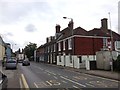
Nearby Images from Geograph Britain and Ireland:
![TR0060 : Ospringe houses [18] by Michael Dibb](https://s1.geograph.org.uk/geophotos/07/05/77/7057725_29c3ff40_120x120.jpg)
©2022(licence)
![TR0060 : Ospringe houses [17] by Michael Dibb](https://s0.geograph.org.uk/geophotos/07/05/77/7057724_a8bc7810_120x120.jpg)
©2022(licence)
![TR0060 : Ospringe houses [19] by Michael Dibb](https://s2.geograph.org.uk/geophotos/07/05/77/7057726_8885b849_120x120.jpg)
©2022(licence)
![TR0060 : Ospringe houses [1] by Michael Dibb](https://s1.geograph.org.uk/geophotos/07/05/66/7056677_7f4c8b76_120x120.jpg)
©2021(licence)
©2016(licence)
The above images may not be of the site on this page, they are loaded from Geograph.
Please Submit an Image of this site or go out and take one for us!
Click here to see more info for this site
Nearby sites
Key: Red: member's photo, Blue: 3rd party photo, Yellow: other image, Green: no photo - please go there and take one, Grey: site destroyed
Download sites to:
KML (Google Earth)
GPX (GPS waypoints)
CSV (Garmin/Navman)
CSV (Excel)
To unlock full downloads you need to sign up as a Contributory Member. Otherwise downloads are limited to 50 sites.
Turn off the page maps and other distractions
Nearby sites listing. In the following links * = Image available
1.5km ENE 73° Cross Well (Faversham)* Holy Well or Sacred Spring (TR016613)
7.5km WNW 290° St. Thomas a Becket's Spring (Bapchild)* Holy Well or Sacred Spring (TQ930631)
9.5km W 278° Highsted Gravel Pit Not Known (by us) (TQ907617)
9.8km NW 304° Castle Rough (Kent) Ancient Village or Settlement (TQ9183265969)
10.0km NW 319° Elmley Barrow Misc. Earthwork (TQ93306801)
10.2km W 273° Highsted Settlement Ancient Village or Settlement (TQ900610)
10.4km SE 125° Pilgrims Way 9 Ancient Trackway (TR090552)
10.6km S 182° The Lees Denehole Ancient Mine, Quarry or other Industry (TR003502)
10.7km SE 138° Julliberrie's Grave* Long Barrow (TR077532)
10.9km SSE 162° Kings Wood Barrow* Round Barrow(s) (TR04005060)
11.1km SSE 165° Kings Wood Mound* Misc. Earthwork (TR034502)
11.6km SSE 167° Jackets Field Long Barrow* Long Barrow (TR03304961)
11.8km N 349° Kingsborough 1 Causewayed Enclosure (TQ975723)
11.8km ESE 108° Bigbury Camp* Hillfort (TR116576)
12.0km WSW 252° Oorlair Round Barrow Round Barrow(s) (TQ88885661)
12.4km SE 134° Denge Wood Earthworks Misc. Earthwork (TR095525)
12.5km WSW 253° Park Farm Deneholes Ancient Mine, Quarry or other Industry (TQ883567)
12.6km SE 136° Denge Wood Tumulus Round Barrow(s) (TR0933852069)
12.8km E 79° Clowes Wood Barrows* Round Barrow(s) (TR12746378)
12.9km NNW 342° Birth Bracelet Well* Holy Well or Sacred Spring (TQ95667292)
12.9km ESE 104° Black Prince's Well* Holy Well or Sacred Spring (TR129581)
13.0km S 185° Pilgrims Way 6 Ancient Trackway (TQ995478)
13.0km NNW 342° The Abbess's Well* Holy Well or Sacred Spring (TQ9569673029)
13.0km NNW 342° Well of the Triple Goddess* Holy Well or Sacred Spring (TQ95577300)
13.0km NNW 341° Minster Gatehouse Museum* Museum (TQ95567300)
View more nearby sites and additional images


 We would like to know more about this location. Please feel free to add a brief description and any relevant information in your own language.
 Wir möchten mehr über diese Stätte erfahren. Bitte zögern Sie nicht, eine kurze Beschreibung und relevante Informationen in Deutsch hinzuzufügen.
 Nous aimerions en savoir encore un peu sur les lieux. S'il vous plaît n'hesitez pas à ajouter une courte description et tous les renseignements pertinents dans votre propre langue.
 Quisieramos informarnos un poco más de las lugares. No dude en añadir una breve descripción y otros datos relevantes en su propio idioma.