


<< Our Photo Pages >> Grotte de Cussac - Cave or Rock Shelter in France in Aquitaine:Dordogne (24)
Submitted by TheCaptain on Saturday, 12 July 2008 Page Views: 12618
Natural PlacesSite Name: Grotte de CussacCountry: France
NOTE: This site is 1.599 km away from the location you searched for.
Département: Aquitaine:Dordogne (24) Type: Cave or Rock Shelter
Nearest Town: Bergerac Nearest Village: Le Buisson-de-Cadoui
Latitude: 44.837000N Longitude: 0.858000E
Condition:
| 5 | Perfect |
| 4 | Almost Perfect |
| 3 | Reasonable but with some damage |
| 2 | Ruined but still recognisable as an ancient site |
| 1 | Pretty much destroyed, possibly visible as crop marks |
| 0 | No data. |
| -1 | Completely destroyed |
| 5 | Superb |
| 4 | Good |
| 3 | Ordinary |
| 2 | Not Good |
| 1 | Awful |
| 0 | No data. |
| 5 | Can be driven to, probably with disabled access |
| 4 | Short walk on a footpath |
| 3 | Requiring a bit more of a walk |
| 2 | A long walk |
| 1 | In the middle of nowhere, a nightmare to find |
| 0 | No data. |
| 5 | co-ordinates taken by GPS or official recorded co-ordinates |
| 4 | co-ordinates scaled from a detailed map |
| 3 | co-ordinates scaled from a bad map |
| 2 | co-ordinates of the nearest village |
| 1 | co-ordinates of the nearest town |
| 0 | no data |
Internal Links:
External Links:
I have visited· I would like to visit
DrewParsons would like to visit
")
The find, at Cussac, in the valley of the Dordogne, is regarded as almost as important as the celebrated Lascaux cave paintings in the same area. This latest discovery was made by Marc Delluc, an amateur archaeologist in September, but the richness of his finds were not known until yesterday. French anthropologists said the site was important because it contained "monumental" drawings of animals in friezes of up to 25 yards long. These are sketches rather than paintings more primitive, almost certainly older than the Lascaux pictures and perhaps up to 37,000 years old.
The caves also contain erotic drawings of women, which have been found previously only in the caverns discovered in 1994 in the Ardèche region.
The caverns, which extend for a total of more than half a mile, are thought to contain up to 200 separate drawings.
Read more in THe Independent. IMPORTANT NOTE: Site believed to be near this position.
Note: Erotic cave paintings could be 37,000 years old
You may be viewing yesterday's version of this page. To see the most up to date information please register for a free account.
")
Do not use the above information on other web sites or publications without permission of the contributor.
Nearby Images from Flickr
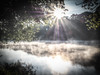
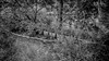

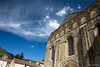
The above images may not be of the site on this page, but were taken nearby. They are loaded from Flickr so please click on them for image credits.
Click here to see more info for this site
Nearby sites
Click here to view sites on an interactive map of the areaKey: Red: member's photo, Blue: 3rd party photo, Yellow: other image, Green: no photo - please go there and take one, Grey: site destroyed
Download sites to:
KML (Google Earth)
GPX (GPS waypoints)
CSV (Garmin/Navman)
CSV (Excel)
To unlock full downloads you need to sign up as a Contributory Member. Otherwise downloads are limited to 50 sites.
Turn off the page maps and other distractions
Nearby sites listing. In the following links * = Image available
4.4km WSW 248° Sigoniac Ancient Village or Settlement
4.8km ESE 102° Dolmen Le Cayre* Burial Chamber or Dolmen
5.5km ENE 61° Saint-Chamassy Dolmen* Burial Chamber or Dolmen
5.7km NNE 26° Gisement de Limeuil Cave or Rock Shelter
7.2km WNW 282° Dolmen de Laumède* Burial Chamber or Dolmen
7.3km N 9° Dolmen des Fontenelles* Burial Chamber or Dolmen
7.8km NNE 18° Limeuil Jardin Musée Cave or Rock Shelter
8.5km NNE 21° Dolmen Queyre-Levat* Burial Chamber or Dolmen
9.1km WNW 284° Dolmen Sud-est de Le Maux Burial Chamber or Dolmen
9.4km S 185° Abris-sous-roche de Combe-Capelle* Cave or Rock Shelter
9.7km WNW 286° Dolmen Le Mos* Burial Chamber or Dolmen
10.0km ESE 112° Cayra Levada* Burial Chamber or Dolmen
10.2km ESE 117° Bonarme Dolmen* Burial Chamber or Dolmen
10.2km ESE 120° Bonarme polissoirs* Polissoir
10.6km WSW 250° Gisement de la Gravette Cave or Rock Shelter
10.9km NNE 27° Grotte de Bara-Bahau* Cave or Rock Shelter
11.2km SSW 210° Allée couverte de La Bouquerie* Passage Grave
11.4km SSE 147° Dolmen de Peyrelevade (Bouillac)* Burial Chamber or Dolmen
11.7km WSW 237° Menhir du Peyroux 1* Standing Stone (Menhir)
11.7km SSE 148° Peyrelevade de Bouillac* Burial Chamber or Dolmen
11.8km WSW 238° Menhir de Peyroux 2* Standing Stone (Menhir)
11.9km NNE 24° Menhir de Ladouch* Natural Stone / Erratic / Other Natural Feature
11.9km NE 50° Campagne menhir* Standing Stone (Menhir)
12.0km NE 47° Grotte du Roc de Marsal* Cave or Rock Shelter
12.8km W 272° Menhir Tranche de Saumon Standing Stone (Menhir)
View more nearby sites and additional images


 We would like to know more about this location. Please feel free to add a brief description and any relevant information in your own language.
 Wir möchten mehr über diese Stätte erfahren. Bitte zögern Sie nicht, eine kurze Beschreibung und relevante Informationen in Deutsch hinzuzufügen.
 Nous aimerions en savoir encore un peu sur les lieux. S'il vous plaît n'hesitez pas à ajouter une courte description et tous les renseignements pertinents dans votre propre langue.
 Quisieramos informarnos un poco más de las lugares. No dude en añadir una breve descripción y otros datos relevantes en su propio idioma.