


<< Other Photo Pages >> East Wretham Heath Earthwork - Misc. Earthwork in England in Norfolk
Submitted by coldrum on Tuesday, 11 August 2009 Page Views: 3943
Multi-periodSite Name: East Wretham Heath EarthworkCountry: England
NOTE: This site is 1.427 km away from the location you searched for.
County: Norfolk Type: Misc. Earthwork
Map Ref: TL91278814
Latitude: 52.457707N Longitude: 0.813718E
Condition:
| 5 | Perfect |
| 4 | Almost Perfect |
| 3 | Reasonable but with some damage |
| 2 | Ruined but still recognisable as an ancient site |
| 1 | Pretty much destroyed, possibly visible as crop marks |
| 0 | No data. |
| -1 | Completely destroyed |
| 5 | Superb |
| 4 | Good |
| 3 | Ordinary |
| 2 | Not Good |
| 1 | Awful |
| 0 | No data. |
| 5 | Can be driven to, probably with disabled access |
| 4 | Short walk on a footpath |
| 3 | Requiring a bit more of a walk |
| 2 | A long walk |
| 1 | In the middle of nowhere, a nightmare to find |
| 0 | No data. |
| 5 | co-ordinates taken by GPS or official recorded co-ordinates |
| 4 | co-ordinates scaled from a detailed map |
| 3 | co-ordinates scaled from a bad map |
| 2 | co-ordinates of the nearest village |
| 1 | co-ordinates of the nearest town |
| 0 | no data |
Be the first person to rate this site - see the 'Contribute!' box in the right hand menu.
Internal Links:
External Links:
Misc. Earthwork in Norfolk
"The monument comprises double parallel banks, both with outer accompanying ditches; there is a suggestion of a causeway across the outer ditch." - Pastscape monument no. 385587.
You may be viewing yesterday's version of this page. To see the most up to date information please register for a free account.
Do not use the above information on other web sites or publications without permission of the contributor.
coldrum has found this location on Google Street View:
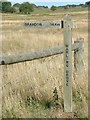
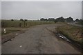
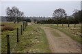
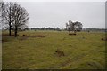
Nearby Images from Geograph Britain and Ireland:
©2008(licence)
©2008(licence)
©2008(licence)
©2008(licence)
©2007(licence)
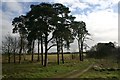
The above images may not be of the site on this page, they are loaded from Geograph.
Please Submit an Image of this site or go out and take one for us!
Click here to see more info for this site
Nearby sites
Key: Red: member's photo, Blue: 3rd party photo, Yellow: other image, Green: no photo - please go there and take one, Grey: site destroyed
Download sites to:
KML (Google Earth)
GPX (GPS waypoints)
CSV (Garmin/Navman)
CSV (Excel)
To unlock full downloads you need to sign up as a Contributory Member. Otherwise downloads are limited to 50 sites.
Turn off the page maps and other distractions
Nearby sites listing. In the following links * = Image available
2.4km ESE 118° Peddars Way* Ancient Trackway (TL9341287119)
4.0km WNW 282° Mickle Hill Tumulus* Round Barrow(s) (TL873888)
5.1km E 81° Larling Heath Tumulus Round Barrow(s) (TL96268912)
6.5km SW 217° Thetford Castle* Hillfort (TL875828)
6.6km ESE 114° Mickelmoor Hill Settlement Ancient Village or Settlement (TL974857)
6.6km SW 224° Thetford Puddingstones* Marker Stone (TL8684583181)
6.8km S 190° Seven Hills Barrow Cemetery Barrow Cemetery (TL904814)
6.9km SE 138° West Harling Heath Barrows Round Barrow(s) (TL96068320)
7.2km W 268° Blood Hill* Round Barrow(s) (TL84078765)
7.4km SW 224° Thetford Barrow Round Barrow(s) (TL86358256)
7.9km ESE 117° West Harling Tumulus Round Barrow(s) (TL98438486)
8.8km SSW 199° Barnham Heath Pit Natural Stone / Erratic / Other Natural Feature (TL887797)
8.8km ESE 118° East Harling Heath Tumulus* Round Barrow(s) (TL99238425)
8.9km SSE 154° Knettishall bowl barrow* Round Barrow(s) (TL9546280239)
9.0km ESE 123° Soldier's Hill Round Barrow(s) (TL99008346)
9.7km WNW 282° Grime's Graves Flint Mines* Ancient Mine, Quarry or other Industry (TL817898)
9.7km SE 133° Riddlesworth Tumulus Round Barrow(s) (TL98648180)
9.7km W 280° Grimes Puddingstone Marker Stone (TL816895)
9.8km SSW 211° Barnham Puddingstone Marker Stone (TL865796)
9.9km SE 133° Devil's Ditch* Misc. Earthwork (TL9879281705)
10.1km SE 131° Home Covert Tumulus* Round Barrow(s) (TL99138177)
10.2km SSW 209° Mill House Barrow Round Barrow(s) (TL867790)
10.2km SSW 209° Millfield Barn Round Barrow(s) (TL86717898)
10.3km E 81° Gallows Hill Tumulus Round Barrow(s) (TM01419019)
11.0km WNW 282° Grimes Graves Barrows* Round Barrow(s) (TL804901)
View more nearby sites and additional images


 We would like to know more about this location. Please feel free to add a brief description and any relevant information in your own language.
 Wir möchten mehr über diese Stätte erfahren. Bitte zögern Sie nicht, eine kurze Beschreibung und relevante Informationen in Deutsch hinzuzufügen.
 Nous aimerions en savoir encore un peu sur les lieux. S'il vous plaît n'hesitez pas à ajouter une courte description et tous les renseignements pertinents dans votre propre langue.
 Quisieramos informarnos un poco más de las lugares. No dude en añadir una breve descripción y otros datos relevantes en su propio idioma.