


<< Text Pages >> Dolmen de Reignac - Burial Chamber or Dolmen in France in Centre:Indre-et-Loire (37)
Submitted by TheCaptain on Wednesday, 08 September 2010 Page Views: 2053
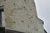
Neolithic and Bronze AgeSite Name: Dolmen de Reignac Alternative Name: Dolmen de la GuignardièreCountry: France
NOTE: This site is 12.033 km away from the location you searched for.
Département: Centre:Indre-et-Loire (37) Type: Burial Chamber or Dolmen
Nearest Town: Tours Nearest Village: Reignac Sur Indre
Latitude: 47.234702N Longitude: 0.902388E
Condition:
| 5 | Perfect |
| 4 | Almost Perfect |
| 3 | Reasonable but with some damage |
| 2 | Ruined but still recognisable as an ancient site |
| 1 | Pretty much destroyed, possibly visible as crop marks |
| 0 | No data. |
| -1 | Completely destroyed |
| 5 | Superb |
| 4 | Good |
| 3 | Ordinary |
| 2 | Not Good |
| 1 | Awful |
| 0 | No data. |
| 5 | Can be driven to, probably with disabled access |
| 4 | Short walk on a footpath |
| 3 | Requiring a bit more of a walk |
| 2 | A long walk |
| 1 | In the middle of nowhere, a nightmare to find |
| 0 | No data. |
| 5 | co-ordinates taken by GPS or official recorded co-ordinates |
| 4 | co-ordinates scaled from a detailed map |
| 3 | co-ordinates scaled from a bad map |
| 2 | co-ordinates of the nearest village |
| 1 | co-ordinates of the nearest town |
| 0 | no data |
Be the first person to rate this site - see the 'Contribute!' box in the right hand menu.
Internal Links:
External Links:
Dolmen in Centre:Indre-et-Loire (37)
Dolmen de Reignac is a Dolmen in the community of Reignac Sur Indre, Departement of Indre-et-Loire, Region of Centre
Info:
clicforum
You may be viewing yesterday's version of this page. To see the most up to date information please register for a free account.
Do not use the above information on other web sites or publications without permission of the contributor.
Nearby Images from Flickr

The above images may not be of the site on this page, but were taken nearby. They are loaded from Flickr so please click on them for image credits.
Click here to see more info for this site
Nearby sites
Click here to view sites on an interactive map of the areaKey: Red: member's photo, Blue: 3rd party photo, Yellow: other image, Green: no photo - please go there and take one, Grey: site destroyed
Download sites to:
KML (Google Earth)
GPX (GPS waypoints)
CSV (Garmin/Navman)
CSV (Excel)
To unlock full downloads you need to sign up as a Contributory Member. Otherwise downloads are limited to 50 sites.
Turn off the page maps and other distractions
Nearby sites listing. In the following links * = Image available
6.1km ENE 77° Menhir dit Pierre Bachelière Standing Stone (Menhir)
8.4km NE 51° Pierre du pas de Saint-Martin* Polissoir
8.6km NE 54° Dolmen de Villaine Burial Chamber or Dolmen
9.2km WNW 295° Dolmen du Moulin Sauquet Burial Chamber or Dolmen
11.3km ENE 78° La Pierre Saint Martin Polissoir
12.0km SSE 167° Menhir dit la Grande Borne (Chanceaux-près-Loches)* Standing Stone (Menhir)
12.1km ESE 103° Dolmen dit la Pierre Levée (Mallée) Burial Chamber or Dolmen
12.3km ENE 76° Menhir de La Grange Standing Stone (Menhir)
13.8km E 96° Dolmen de la Pierre Levée (Hys)* Burial Chamber or Dolmen
15.5km SE 140° Cromlech de la Croix-Bonnin Stone Circle
21.0km NNE 18° Oppidum des Châteliers* Ancient Village or Settlement
21.1km NNE 19° Le Rempart* Misc. Earthwork
21.9km NW 304° Le Menhir de l’Alouette Standing Stone (Menhir)
22.4km W 272° La Pierre Levée (Thilouze) Standing Stone (Menhir)
22.4km NNW 332° Oppidum de Château-Chevrier Ancient Village or Settlement
23.3km W 280° Dolmen du bois des plantes Burial Chamber or Dolmen
23.6km NW 317° Musée Archéologique (Tours) Museum
25.5km WSW 237° Deux Manses Oppidum Hillfort
25.6km NW 316° Polissoir de Bois Livière Polissoir
27.7km W 267° La Pierre à Vinaigre Standing Stone (Menhir)
28.4km SW 234° La Pierre Fondue* Burial Chamber or Dolmen
28.4km NNE 25° La Pierre David* Standing Stone (Menhir)
28.6km S 190° Polissoir de La Chauvelière Polissoir
28.7km SW 231° Pierre Percée (Draché)* Standing Stone (Menhir)
29.4km SSW 195° Pierre Chaude* Burial Chamber or Dolmen
View more nearby sites and additional images


 We would like to know more about this location. Please feel free to add a brief description and any relevant information in your own language.
 Wir möchten mehr über diese Stätte erfahren. Bitte zögern Sie nicht, eine kurze Beschreibung und relevante Informationen in Deutsch hinzuzufügen.
 Nous aimerions en savoir encore un peu sur les lieux. S'il vous plaît n'hesitez pas à ajouter une courte description et tous les renseignements pertinents dans votre propre langue.
 Quisieramos informarnos un poco más de las lugares. No dude en añadir una breve descripción y otros datos relevantes en su propio idioma.