


<< Our Photo Pages >> La Chapoulie - Standing Stones in France in Aquitaine:Dordogne (24)
Submitted by Andy B on Friday, 26 September 2014 Page Views: 2630
Neolithic and Bronze AgeSite Name: La ChapoulieCountry: France
NOTE: This site is 7.943 km away from the location you searched for.
Département: Aquitaine:Dordogne (24) Type: Standing Stones
Nearest Town: Périgueux Nearest Village: Nontron
Latitude: 45.564724N Longitude: 0.660208E
Condition:
| 5 | Perfect |
| 4 | Almost Perfect |
| 3 | Reasonable but with some damage |
| 2 | Ruined but still recognisable as an ancient site |
| 1 | Pretty much destroyed, possibly visible as crop marks |
| 0 | No data. |
| -1 | Completely destroyed |
| 5 | Superb |
| 4 | Good |
| 3 | Ordinary |
| 2 | Not Good |
| 1 | Awful |
| 0 | No data. |
| 5 | Can be driven to, probably with disabled access |
| 4 | Short walk on a footpath |
| 3 | Requiring a bit more of a walk |
| 2 | A long walk |
| 1 | In the middle of nowhere, a nightmare to find |
| 0 | No data. |
| 5 | co-ordinates taken by GPS or official recorded co-ordinates |
| 4 | co-ordinates scaled from a detailed map |
| 3 | co-ordinates scaled from a bad map |
| 2 | co-ordinates of the nearest village |
| 1 | co-ordinates of the nearest town |
| 0 | no data |
Internal Links:
External Links:
I have visited· I would like to visit
LaDragonne visited on 7th Mar 2024 - their rating: Cond: 5 Amb: 3 Access: 5 Après examen des deux "pierres levées" granitiques qui sont maintenant complètement couvertes de végétation, il ne s'agit pas de stèles mégalithiques . Leur mise en place semble relativement récente.
")
The book I have on the archaeology of the area (written in 1952) by C Barriere (Les Etapes du Peuplement entre Dronne et Tardoire) mentions a lot of megaliths you won't have picked up from the maps (I'm still trying to find some of them myself) but states categorically that Fixard has the only menhirs in the region
The examples we have found are at La Chapoulie: UTM: 31T 317410E 5048350N
They are about 15m apart and not visible on GoogleEarth
Here I am with them - I'm about 5'6"
Rosey
You may be viewing yesterday's version of this page. To see the most up to date information please register for a free account.
")
")
Do not use the above information on other web sites or publications without permission of the contributor.
Nearby Images from Flickr
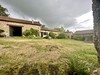
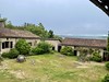
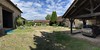

The above images may not be of the site on this page, but were taken nearby. They are loaded from Flickr so please click on them for image credits.
Click here to see more info for this site
Nearby sites
Click here to view sites on an interactive map of the areaKey: Red: member's photo, Blue: 3rd party photo, Yellow: other image, Green: no photo - please go there and take one, Grey: site destroyed
Download sites to:
KML (Google Earth)
GPX (GPS waypoints)
CSV (Garmin/Navman)
CSV (Excel)
To unlock full downloads you need to sign up as a Contributory Member. Otherwise downloads are limited to 50 sites.
Turn off the page maps and other distractions
Nearby sites listing. In the following links * = Image available
6.3km N 356° Menhir de Fixard* Standing Stone (Menhir)
7.1km WNW 290° Grotte de la Mairie* Cave or Rock Shelter
7.5km WNW 303° La Pierre Plate (Teyjat)* Burial Chamber or Dolmen
11.8km SSW 202° Grotte de la Font-Bargeix Cave or Rock Shelter
11.9km SW 217° Bernardieres* Stone Row / Alignment
14.5km SW 226° La Roderie* Standing Stone (Menhir)
15.1km S 187° Menhir de Champredon* Standing Stone (Menhir)
15.7km SW 229° Saint Sulpice de Mareuil Dolmen* Not Known (by us)
16.4km WNW 291° Dolmens du Bancheraud Burial Chamber or Dolmen
16.5km E 94° Dolmen de Vaure (St Saud)* Burial Chamber or Dolmen
16.7km SE 144° Grotte de Villars* Cave or Rock Shelter
17.3km E 96° Dolmen de Vaure (Mialet) Burial Chamber or Dolmen
18.6km SSE 156° Dolmen de Puyruffet Burial Chamber or Dolmen
18.7km NW 308° Grotte de Montgaudier* Cave or Rock Shelter
18.9km NW 312° Grotte de Fontechevade Cave or Rock Shelter
19.1km SW 226° Grotte de Fronsac Cave or Rock Shelter
19.7km SE 133° Grotte des Fraux Cave or Rock Shelter
19.9km W 267° Dolmen de Charras Burial Chamber or Dolmen
20.0km ESE 104° Dolmen dit Peyre Jazen* Burial Chamber or Dolmen
20.3km ESE 104° La Pierre Levée (St Jory)* Burial Chamber or Dolmen
20.3km NW 305° Grotte de la Chaise* Cave or Rock Shelter
21.5km S 171° Menhir de Fouret* Standing Stone (Menhir)
21.9km S 172° Peyre Levade (Condat)* Burial Chamber or Dolmen
22.6km S 179° La Pierre Levée (Brantôme)* Burial Chamber or Dolmen
22.8km NW 306° Grotte de Vilhonneur Cave or Rock Shelter
View more nearby sites and additional images


 We would like to know more about this location. Please feel free to add a brief description and any relevant information in your own language.
 Wir möchten mehr über diese Stätte erfahren. Bitte zögern Sie nicht, eine kurze Beschreibung und relevante Informationen in Deutsch hinzuzufügen.
 Nous aimerions en savoir encore un peu sur les lieux. S'il vous plaît n'hesitez pas à ajouter une courte description et tous les renseignements pertinents dans votre propre langue.
 Quisieramos informarnos un poco más de las lugares. No dude en añadir una breve descripción y otros datos relevantes en su propio idioma.