


<< Our Photo Pages >> Pierre de Nautours - Standing Stone (Menhir) in France in Aquitaine:Dordogne (24)
Submitted by thecaptain on Tuesday, 05 July 2005 Page Views: 3756
Neolithic and Bronze AgeSite Name: Pierre de Nautours Alternative Name: Combe du Puy GauthierCountry: France Département: Aquitaine:Dordogne (24) Type: Standing Stone (Menhir)
Nearest Town: Marsac-sur-L’Isle Nearest Village: Périgueux
Latitude: 45.184800N Longitude: 0.661600E
Condition:
| 5 | Perfect |
| 4 | Almost Perfect |
| 3 | Reasonable but with some damage |
| 2 | Ruined but still recognisable as an ancient site |
| 1 | Pretty much destroyed, possibly visible as crop marks |
| 0 | No data. |
| -1 | Completely destroyed |
| 5 | Superb |
| 4 | Good |
| 3 | Ordinary |
| 2 | Not Good |
| 1 | Awful |
| 0 | No data. |
| 5 | Can be driven to, probably with disabled access |
| 4 | Short walk on a footpath |
| 3 | Requiring a bit more of a walk |
| 2 | A long walk |
| 1 | In the middle of nowhere, a nightmare to find |
| 0 | No data. |
| 5 | co-ordinates taken by GPS or official recorded co-ordinates |
| 4 | co-ordinates scaled from a detailed map |
| 3 | co-ordinates scaled from a bad map |
| 2 | co-ordinates of the nearest village |
| 1 | co-ordinates of the nearest town |
| 0 | no data |
Internal Links:
External Links:
I have visited· I would like to visit
TheCaptain visited on 17th May 2005 - their rating: Cond: 3 Amb: 2 Access: 5 I wasn’t expecting this. I was just getting caught up in rush hour traffic on the outskirts of Périgueux when I saw this large brownish black megalith standing beside a busy roundabout. There was a bus stop conveniently right by it at which I was able to stop and have a decent look although I didn’t spend long here.
I assume its been moved here from Combe du Puy Gauthier wherever that may be and it was dedicated as a monument to somebody whose name I didn’t remember.
alchemille have visited here
")
I wasn’t expecting this. I was just getting caught up in rush hour traffic on the outskirts of Périgueux when I saw this large brownish black megalith standing beside a busy roundabout. There was a bus stop conveniently right by it at which I was able to stop and have a decent look, although I didn’t spend long here.
I assume its been moved here from Combe du Puy Gauthier, wherever that may be, and it was dedicated as a monument to somebody, whose name I didn’t remember.
You may be viewing yesterday's version of this page. To see the most up to date information please register for a free account.
")
Do not use the above information on other web sites or publications without permission of the contributor.
TheCaptain has found this location on Google Street View:
Nearby Images from Flickr
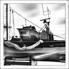
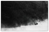
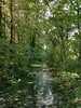
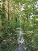
The above images may not be of the site on this page, but were taken nearby. They are loaded from Flickr so please click on them for image credits.
Click here to see more info for this site
Nearby sites
Click here to view sites on an interactive map of the areaKey: Red: member's photo, Blue: 3rd party photo, Yellow: other image, Green: no photo - please go there and take one, Grey: site destroyed
Download sites to:
KML (Google Earth)
GPX (GPS waypoints)
CSV (Garmin/Navman)
CSV (Excel)
To unlock full downloads you need to sign up as a Contributory Member. Otherwise downloads are limited to 50 sites.
Turn off the page maps and other distractions
Nearby sites listing. In the following links * = Image available
2.6km NNE 21° Raymonden* Cave or Rock Shelter
3.3km ESE 104° Grotte de Campniac Cave or Rock Shelter
4.9km E 89° Musée de Périgord* Museum
9.2km SSE 146° Pierre Bouine* Natural Stone / Erratic / Other Natural Feature
11.0km S 171° Dolmen des Planches n°2* Burial Chamber or Dolmen
11.1km S 171° Dolmen des Planches n°1* Burial Chamber or Dolmen
11.1km SSE 166° Allée couverte de Rossignol Passage Grave
13.1km WSW 243° Dolmen de La Redondie* Burial Chamber or Dolmen
13.3km S 174° Dolmen Peyrelevade de Creyssensac* Burial Chamber or Dolmen
13.5km W 273° La Vigerie tumulus* Chambered Tomb
14.4km NW 320° Pierre Plantée (Lisle)* Standing Stone (Menhir)
14.8km N 356° Beauroulet Dolmen* Burial Chamber or Dolmen
15.2km N 360° Dolmen des Coutoux* Burial Chamber or Dolmen
16.0km W 274° Peyrebrune (Seyssac)* Burial Chamber or Dolmen
16.2km WNW 290° Dolmen de la Vaurelie* Burial Chamber or Dolmen
16.5km WNW 282° Dolmen de Palus* Burial Chamber or Dolmen
16.6km NNW 340° Grotte du Trou de la Chèvre Cave or Rock Shelter
16.8km NNW 348° Mégalithe (Valeuil) Standing Stone (Menhir)
17.1km NNW 341° Grotte des Bernoux Cave or Rock Shelter
17.4km NNW 342° Fourneau du Diable* Rock Outcrop
17.7km ENE 70° Grotte de Combe Saunière Cave or Rock Shelter
18.4km NNW 330° La Monerie menhir* Standing Stone (Menhir)
18.5km SSW 200° Pierre philosophale de Peyrelevade* Natural Stone / Erratic / Other Natural Feature
18.5km SSW 201° Dolmen de Peyrelevade (Villamblard)* Burial Chamber or Dolmen
19.0km NNE 13° Peyrelevade 2 (Condat)* Burial Chamber or Dolmen
View more nearby sites and additional images


 We would like to know more about this location. Please feel free to add a brief description and any relevant information in your own language.
 Wir möchten mehr über diese Stätte erfahren. Bitte zögern Sie nicht, eine kurze Beschreibung und relevante Informationen in Deutsch hinzuzufügen.
 Nous aimerions en savoir encore un peu sur les lieux. S'il vous plaît n'hesitez pas à ajouter une courte description et tous les renseignements pertinents dans votre propre langue.
 Quisieramos informarnos un poco más de las lugares. No dude en añadir una breve descripción y otros datos relevantes en su propio idioma.