

<< Text Pages >> Holy well at Holywell Farm - Holy Well or Sacred Spring in England in Kent
Submitted by coldrum on Tuesday, 08 November 2011 Page Views: 3336
Springs and Holy WellsSite Name: Holy well at Holywell FarmCountry: England County: Kent Type: Holy Well or Sacred Spring
Map Ref: TQ85106695
Latitude: 51.371434N Longitude: 0.657926E
Condition:
| 5 | Perfect |
| 4 | Almost Perfect |
| 3 | Reasonable but with some damage |
| 2 | Ruined but still recognisable as an ancient site |
| 1 | Pretty much destroyed, possibly visible as crop marks |
| 0 | No data. |
| -1 | Completely destroyed |
| 5 | Superb |
| 4 | Good |
| 3 | Ordinary |
| 2 | Not Good |
| 1 | Awful |
| 0 | No data. |
| 5 | Can be driven to, probably with disabled access |
| 4 | Short walk on a footpath |
| 3 | Requiring a bit more of a walk |
| 2 | A long walk |
| 1 | In the middle of nowhere, a nightmare to find |
| 0 | No data. |
| 5 | co-ordinates taken by GPS or official recorded co-ordinates |
| 4 | co-ordinates scaled from a detailed map |
| 3 | co-ordinates scaled from a bad map |
| 2 | co-ordinates of the nearest village |
| 1 | co-ordinates of the nearest town |
| 0 | no data |
Internal Links:
External Links:
Holy Well in Kent
"A flat sarsen slab, 5ft. square and 9 inches thick, found when ploughing, appears to cover the lost holy well which gave its name to Holywell Farm. It covered a roughly circular opening which had been filled in with flint nodules. Probing showed the well to be 5.5ft. deep with the water level at 4.5ft. No masonry was observed but the filling was not removed. Situated in the valley bottom, c. 130ft. from the stream, 400ft. from the crown of Holywell Lane and 17ft. from the fence bounding the lane to Lower Halstow.
This well has been filled and the field is now an orchard; there is nothing to mark its site but an approximate siting by a farm worker closely agrees with the position given by Evans. The sarsen which covered it has been moved into a pasture field on the other (N.) side of the lane."
Source: Exploring Kent's Past
You may be viewing yesterday's version of this page. To see the most up to date information please register for a free account.
Do not use the above information on other web sites or publications without permission of the contributor.
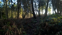
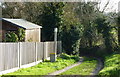
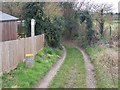
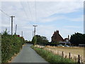
Nearby Images from Geograph Britain and Ireland:
©2009(licence)
©2008(licence)
©2009(licence)
©2017(licence)
©2009(licence)
The above images may not be of the site on this page, they are loaded from Geograph.
Please Submit an Image of this site or go out and take one for us!
Click here to see more info for this site
Nearby sites
Key: Red: member's photo, Blue: 3rd party photo, Yellow: other image, Green: no photo - please go there and take one, Grey: site destroyed
Download sites to:
KML (Google Earth)
GPX (GPS waypoints)
CSV (Garmin/Navman)
CSV (Excel)
To unlock full downloads you need to sign up as a Contributory Member. Otherwise downloads are limited to 50 sites.
Turn off the page maps and other distractions
Nearby sites listing. In the following links * = Image available
2.0km SSE 149° The Devil's stone (Kent)* Standing Stone (Menhir) (TQ8618865306)
4.3km SW 217° Queendown Warren Deneholes Ancient Mine, Quarry or other Industry (TQ826634)
4.6km SW 219° Queendown Warren Dene Holes Ancient Mine, Quarry or other Industry (TQ823633)
6.5km WSW 256° Grove Wood Deneholes Ancient Mine, Quarry or other Industry (TQ788651)
6.8km E 100° Castle Rough (Kent) Ancient Village or Settlement (TQ9183265969)
7.0km WNW 287° Gillingham Stone circle* Stone Circle (TQ7835668721)
7.7km SE 135° Highsted Gravel Pit Not Known (by us) (TQ907617)
7.7km SE 143° Highsted Settlement Ancient Village or Settlement (TQ900610)
8.1km WSW 250° Lordswood Barrow Round Barrow(s) (TQ776639)
8.2km E 85° Elmley Barrow Misc. Earthwork (TQ93306801)
8.7km WSW 240° Lordswood Sarsen Stones* Natural Stone / Erratic / Other Natural Feature (TQ7771162358)
8.8km ESE 118° St. Thomas a Becket's Spring (Bapchild)* Holy Well or Sacred Spring (TQ930631)
8.8km WSW 240° Lordswood Sarsen Stones (Buxton/Iona Close)* Natural Stone / Erratic / Other Natural Feature (TQ7762262215)
9.4km SW 226° Grange Farm Dene Hole Ancient Mine, Quarry or other Industry (TQ785602)
9.5km W 280° Dene Hole, Fort Amherst* Ancient Mine, Quarry or other Industry (TQ757683)
10.1km WSW 245° Walderslade Wood Sarsons* Natural Stone / Erratic / Other Natural Feature (TQ761623)
10.4km WSW 242° Stones off Impton Lane* Natural Stone / Erratic / Other Natural Feature (TQ7601561793)
10.5km NW 325° High Halstow Barrow Round Barrow(s) (TQ787753)
10.6km SW 222° Pilgrims Way 5 Ancient Trackway (TQ783588)
10.6km S 171° Drake Lane Plantation Deneholes Ancient Mine, Quarry or other Industry (TQ871565)
10.7km SSE 165° Park Farm Deneholes Ancient Mine, Quarry or other Industry (TQ883567)
10.8km WNW 287° Frindsbury Chalk Quarry Ancient Mine, Quarry or other Industry (TQ74596970)
10.8km S 174° Drake Lane Deneholes Ancient Mine, Quarry or other Industry (TQ866562)
10.9km S 170° West Leas Denehole Ancient Mine, Quarry or other Industry (TQ873563)
10.9km W 279° Turf Maze, Rochester (Kent)* Turf Maze (TQ74266826)
View more nearby sites and additional images


 We would like to know more about this location. Please feel free to add a brief description and any relevant information in your own language.
 Wir möchten mehr über diese Stätte erfahren. Bitte zögern Sie nicht, eine kurze Beschreibung und relevante Informationen in Deutsch hinzuzufügen.
 Nous aimerions en savoir encore un peu sur les lieux. S'il vous plaît n'hesitez pas à ajouter une courte description et tous les renseignements pertinents dans votre propre langue.
 Quisieramos informarnos un poco más de las lugares. No dude en añadir una breve descripción y otros datos relevantes en su propio idioma.