


<< Our Photo Pages >> Dolmen des Pelyverts - Burial Chamber or Dolmen in France in Poitou:Vienne (86)
Submitted by TheCaptain on Wednesday, 08 September 2010 Page Views: 1951
Neolithic and Bronze AgeSite Name: Dolmen des Pelyverts Alternative Name: Dolmen de PelivertCountry: France
NOTE: This site is 3.735 km away from the location you searched for.
Département: Poitou:Vienne (86) Type: Burial Chamber or Dolmen
Nearest Town: Limoges Nearest Village: Sénillé
Latitude: 46.780006N Longitude: 0.599642E
Condition:
| 5 | Perfect |
| 4 | Almost Perfect |
| 3 | Reasonable but with some damage |
| 2 | Ruined but still recognisable as an ancient site |
| 1 | Pretty much destroyed, possibly visible as crop marks |
| 0 | No data. |
| -1 | Completely destroyed |
| 5 | Superb |
| 4 | Good |
| 3 | Ordinary |
| 2 | Not Good |
| 1 | Awful |
| 0 | No data. |
| 5 | Can be driven to, probably with disabled access |
| 4 | Short walk on a footpath |
| 3 | Requiring a bit more of a walk |
| 2 | A long walk |
| 1 | In the middle of nowhere, a nightmare to find |
| 0 | No data. |
| 5 | co-ordinates taken by GPS or official recorded co-ordinates |
| 4 | co-ordinates scaled from a detailed map |
| 3 | co-ordinates scaled from a bad map |
| 2 | co-ordinates of the nearest village |
| 1 | co-ordinates of the nearest town |
| 0 | no data |
Internal Links:
External Links:
I have visited· I would like to visit
johnstone visited on 14th Jul 1998 - their rating: Cond: 3 Amb: 3 Access: 4
")
Dolmen des Pelyverts (Le Pelyvert) is a burial chamber in the community of Sénillé, Departement of Vienne, Region of Poitou-Charentes
You may be viewing yesterday's version of this page. To see the most up to date information please register for a free account.
")
Do not use the above information on other web sites or publications without permission of the contributor.
Nearby Images from Flickr
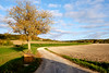
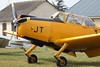
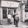

The above images may not be of the site on this page, but were taken nearby. They are loaded from Flickr so please click on them for image credits.
Click here to see more info for this site
Nearby sites
Click here to view sites on an interactive map of the areaKey: Red: member's photo, Blue: 3rd party photo, Yellow: other image, Green: no photo - please go there and take one, Grey: site destroyed
Download sites to:
KML (Google Earth)
GPX (GPS waypoints)
CSV (Garmin/Navman)
CSV (Excel)
To unlock full downloads you need to sign up as a Contributory Member. Otherwise downloads are limited to 50 sites.
Turn off the page maps and other distractions
Nearby sites listing. In the following links * = Image available
7.0km WSW 256° La Pierre Levée (Chézelles)* Standing Stone (Menhir)
7.5km W 259° Menhir-polissoir de Souhé Standing Stone (Menhir)
7.7km ESE 103° Dolmen de la Chenaillère Burial Chamber or Dolmen
12.1km WSW 238° Haute Flotte Tumulus Chambered Tomb
12.4km SSE 161° Dolmen au Trépaizan Burial Chamber or Dolmen
12.7km WSW 238° Pierre-Fitte* Standing Stone (Menhir)
18.2km E 91° Dolmen de la Pierre Levée (Confluent)* Burial Chamber or Dolmen
18.3km SW 234° Dolmen d'Aillé* Burial Chamber or Dolmen
18.3km SSE 148° Dolmen dit la Maison du Fadet Burial Chamber or Dolmen
20.0km SW 233° Dolmen dit la Roche aux Oies* Burial Chamber or Dolmen
20.3km NNE 29° Archéolab Museum
22.1km NE 44° Grand-Pressigny Musée de la Préhistoire* Museum
22.1km NE 45° Le Grand-Pressigny flint mines Ancient Mine, Quarry or other Industry
22.1km NE 44° Coeur de Birette* Polissoir
22.3km ENE 63° Menhir de La Touche Standing Stone (Menhir)
22.9km NNW 345° Dolmen de Doux Burial Chamber or Dolmen
22.9km WNW 301° Beauregard Polissoir Polissoir
23.7km N 355° Menhir de Doulx Standing Stone (Menhir)
23.8km N 355° Dolmen de Doux Burial Chamber or Dolmen
23.9km ESE 114° Roc-aux-Sorciers Museum
23.9km ESE 116° Dolmen des Liboureaux 2 Burial Chamber or Dolmen
24.1km ESE 116° Dolmen des Liboureaux 1 Burial Chamber or Dolmen
24.6km ESE 116° Grotte Angles sur l'Anglin* Cave or Rock Shelter
25.2km SE 131° Dolmen de Busserais Burial Chamber or Dolmen
26.2km NNE 34° Polissoir du Camp de Brenne Polissoir
View more nearby sites and additional images


 We would like to know more about this location. Please feel free to add a brief description and any relevant information in your own language.
 Wir möchten mehr über diese Stätte erfahren. Bitte zögern Sie nicht, eine kurze Beschreibung und relevante Informationen in Deutsch hinzuzufügen.
 Nous aimerions en savoir encore un peu sur les lieux. S'il vous plaît n'hesitez pas à ajouter une courte description et tous les renseignements pertinents dans votre propre langue.
 Quisieramos informarnos un poco más de las lugares. No dude en añadir una breve descripción y otros datos relevantes en su propio idioma.