

<< Text Pages >> Menhir dit Pierre des Druides (Eperrais) - Standing Stone (Menhir) in France in Normandie:Orne (61)
Submitted by t4t35 on Saturday, 16 April 2005 Page Views: 3784
Neolithic and Bronze AgeSite Name: Menhir dit Pierre des Druides (Eperrais)Country: France
NOTE: This site is 2.896 km away from the location you searched for.
Département: Normandie:Orne (61) Type: Standing Stone (Menhir)
Nearest Town: Mortagne-au-Perche Nearest Village: Saint-Ouen-de-la-Cou
Latitude: 48.400410N Longitude: 0.575700E
Condition:
| 5 | Perfect |
| 4 | Almost Perfect |
| 3 | Reasonable but with some damage |
| 2 | Ruined but still recognisable as an ancient site |
| 1 | Pretty much destroyed, possibly visible as crop marks |
| 0 | No data. |
| -1 | Completely destroyed |
| 5 | Superb |
| 4 | Good |
| 3 | Ordinary |
| 2 | Not Good |
| 1 | Awful |
| 0 | No data. |
| 5 | Can be driven to, probably with disabled access |
| 4 | Short walk on a footpath |
| 3 | Requiring a bit more of a walk |
| 2 | A long walk |
| 1 | In the middle of nowhere, a nightmare to find |
| 0 | No data. |
| 5 | co-ordinates taken by GPS or official recorded co-ordinates |
| 4 | co-ordinates scaled from a detailed map |
| 3 | co-ordinates scaled from a bad map |
| 2 | co-ordinates of the nearest village |
| 1 | co-ordinates of the nearest town |
| 0 | no data |
Be the first person to rate this site - see the 'Contribute!' box in the right hand menu.
Internal Links:
External Links:
Menhir in Orne
La Herse, Eperrais, Mortagne-au-Perche, Orne, Normandie
Location Source: T4T35
At locality les Sept Bras
You may be viewing yesterday's version of this page. To see the most up to date information please register for a free account.
Do not use the above information on other web sites or publications without permission of the contributor.
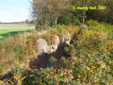
Nearby Images from Flickr


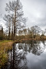
The above images may not be of the site on this page, but were taken nearby. They are loaded from Flickr so please click on them for image credits.
Click here to see more info for this site
Nearby sites
Click here to view sites on an interactive map of the areaKey: Red: member's photo, Blue: 3rd party photo, Yellow: other image, Green: no photo - please go there and take one, Grey: site destroyed
Download sites to:
KML (Google Earth)
GPX (GPS waypoints)
CSV (Garmin/Navman)
CSV (Excel)
To unlock full downloads you need to sign up as a Contributory Member. Otherwise downloads are limited to 50 sites.
Turn off the page maps and other distractions
Nearby sites listing. In the following links * = Image available
11.8km SSE 158° Dolmen de la Pierre Procureuse* Burial Chamber or Dolmen
14.9km ENE 60° La Grosse-Pierre (Boissy)* Burial Chamber or Dolmen
20.2km ESE 110° Dolmen de Margon Burial Chamber or Dolmen
21.1km SSW 199° Courtevrais Menhir* Standing Stone (Menhir)
24.6km SSW 200° Menhir de Clossay* Standing Stone (Menhir)
29.4km S 182° Menhir de Boëssé-le-Sec Standing Stone (Menhir)
30.2km S 185° Dolmen des Grandes-Bruyères Burial Chamber or Dolmen
32.7km SSW 205° Dolmen dit Palet-de-Gargantua* Burial Chamber or Dolmen
34.7km S 183° Dolmen des Roches* Burial Chamber or Dolmen
35.3km N 351° Les Gastines* Standing Stones
36.2km N 8° Dolmen du Bois de la Pierre 3 Burial Chamber or Dolmen
36.2km N 8° Dolmen du Bois de la Pierre 2 Burial Chamber or Dolmen
36.3km N 8° Dolmen du Bois de la Pierre 1 Burial Chamber or Dolmen
37.2km E 88° Dolmen dit la Grosse Pierre (Champrond-en-Gâtine) Burial Chamber or Dolmen
37.5km W 261° Fanum d´Oisseau-le-Petit* Ancient Temple
38.1km S 186° Menhir de la Pierre Fiche (Duneau)* Standing Stone (Menhir)
38.3km NNW 342° Menhirs dits Les Croûtes* Standing Stones
38.8km S 186° La Pierre Couverte (Duneau)* Burial Chamber or Dolmen
39.0km NNW 341° La Pierre Levée (Echauffour)* Burial Chamber or Dolmen
39.3km W 263° Camp de Saint-Evroult Ancient Village or Settlement
39.4km NE 34° Menhir de la Pierre Bise Standing Stone (Menhir)
41.7km N 7° Menhir dit de la Chevrolière* Standing Stone (Menhir)
41.9km N 8° Dolmen du Jarrier* Burial Chamber or Dolmen
43.6km E 99° Dolmen de Nonvilliers-Grandhoux Burial Chamber or Dolmen
45.0km WSW 255° La Croix (Saint George le Gaultier)* Ancient Cross
View more nearby sites and additional images


 We would like to know more about this location. Please feel free to add a brief description and any relevant information in your own language.
 Wir möchten mehr über diese Stätte erfahren. Bitte zögern Sie nicht, eine kurze Beschreibung und relevante Informationen in Deutsch hinzuzufügen.
 Nous aimerions en savoir encore un peu sur les lieux. S'il vous plaît n'hesitez pas à ajouter une courte description et tous les renseignements pertinents dans votre propre langue.
 Quisieramos informarnos un poco más de las lugares. No dude en añadir una breve descripción y otros datos relevantes en su propio idioma.