


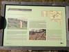
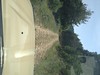
<< Our Photo Pages >> Merli Menhir - Standing Stone (Menhir) in Spain in Aragón
Submitted by irundarra on Thursday, 01 October 2009 Page Views: 3476
Neolithic and Bronze AgeSite Name: Merli Menhir Alternative Name: MahierCountry: Spain
NOTE: This site is 7.177 km away from the location you searched for.
Region: Aragón Type: Standing Stone (Menhir)
Nearest Town: Huesca Nearest Village: Merli
Latitude: 42.338205N Longitude: 0.487388E
Condition:
| 5 | Perfect |
| 4 | Almost Perfect |
| 3 | Reasonable but with some damage |
| 2 | Ruined but still recognisable as an ancient site |
| 1 | Pretty much destroyed, possibly visible as crop marks |
| 0 | No data. |
| -1 | Completely destroyed |
| 5 | Superb |
| 4 | Good |
| 3 | Ordinary |
| 2 | Not Good |
| 1 | Awful |
| 0 | No data. |
| 5 | Can be driven to, probably with disabled access |
| 4 | Short walk on a footpath |
| 3 | Requiring a bit more of a walk |
| 2 | A long walk |
| 1 | In the middle of nowhere, a nightmare to find |
| 0 | No data. |
| 5 | co-ordinates taken by GPS or official recorded co-ordinates |
| 4 | co-ordinates scaled from a detailed map |
| 3 | co-ordinates scaled from a bad map |
| 2 | co-ordinates of the nearest village |
| 1 | co-ordinates of the nearest town |
| 0 | no data |
Internal Links:
External Links:
I have visited· I would like to visit
DrTrojan visited on 1st Jul 2012 - their rating: Cond: 4 Amb: 3 Access: 5
")
UTM : X-293095 Y-4690606
You may be viewing yesterday's version of this page. To see the most up to date information please register for a free account.
")
Do not use the above information on other web sites or publications without permission of the contributor.
Nearby Images from Flickr
The above images may not be of the site on this page, but were taken nearby. They are loaded from Flickr so please click on them for image credits.
Click here to see more info for this site
Nearby sites
Click here to view sites on an interactive map of the areaKey: Red: member's photo, Blue: 3rd party photo, Yellow: other image, Green: no photo - please go there and take one, Grey: site destroyed
Download sites to:
KML (Google Earth)
GPX (GPS waypoints)
CSV (Garmin/Navman)
CSV (Excel)
To unlock full downloads you need to sign up as a Contributory Member. Otherwise downloads are limited to 50 sites.
Turn off the page maps and other distractions
Nearby sites listing. In the following links * = Image available
12.2km E 88° Sis Chromlech (6) Stone Circle
12.3km E 88° Menhir de Sis Standing Stone (Menhir)
12.5km E 87° Sis Chromlech (5) Stone Circle
12.7km E 82° Sis Chromlech (4) Stone Circle
12.8km E 84° Sis Chromlech (10) Stone Circle
13.7km ENE 77° Sis Chromlech (11) Stone Circle
13.7km ENE 77° Sis Chromlech (3) Stone Circle
13.7km E 101° Menhir Tancat de Dalt* Standing Stone (Menhir)
13.8km ENE 77° Sis Chromlech (2) Stone Circle
13.9km E 100° Cabaneta del Tancat de Dalt* Burial Chamber or Dolmen
13.9km ESE 102° Cabaneta del Fornó* Burial Chamber or Dolmen
14.0km ESE 103° Ribera Chromlech Stone Circle
14.0km WSW 245° Dolmen de Perarrúa Burial Chamber or Dolmen
14.2km ENE 75° Sis Chromlech (1) Stone Circle
15.0km ENE 72° Sis Chromlech (9) Stone Circle
15.0km ENE 72° Sis Chromlech (8) Stone Circle
15.6km NNW 338° Seira Dolmen* Burial Chamber or Dolmen
17.9km NE 39° Coll De Espina Menhir* Standing Stone (Menhir)
22.0km N 2° Espía Dolmen* Burial Chamber or Dolmen
23.3km NNW 331° Armeña Túmulo Round Barrow(s)
26.0km S 188° Mas de Abad* Burial Chamber or Dolmen
26.2km S 188° Dolmen de Mas del Abad* Burial Chamber or Dolmen
26.2km S 188° Menhir Mas d'Abad Standing Stone (Menhir)
26.6km NNW 346° La Bocona Chromlechs 1+2* Stone Circle
26.8km S 187° San Salvador Dolmen* Burial Chamber or Dolmen
View more nearby sites and additional images


 We would like to know more about this location. Please feel free to add a brief description and any relevant information in your own language.
 Wir möchten mehr über diese Stätte erfahren. Bitte zögern Sie nicht, eine kurze Beschreibung und relevante Informationen in Deutsch hinzuzufügen.
 Nous aimerions en savoir encore un peu sur les lieux. S'il vous plaît n'hesitez pas à ajouter une courte description et tous les renseignements pertinents dans votre propre langue.
 Quisieramos informarnos un poco más de las lugares. No dude en añadir una breve descripción y otros datos relevantes en su propio idioma.