

<< Text Pages >> Boughton Green Settlement - Ancient Village or Settlement in England in Kent
Submitted by coldrum on Thursday, 21 June 2007 Page Views: 6143
Multi-periodSite Name: Boughton Green Settlement Alternative Name: Quarry Wood Camp, Camp fieldCountry: England County: Kent Type: Ancient Village or Settlement
Nearest Town: Loose Nearest Village: Boughton Monchelsea
Map Ref: TQ76565158
Latitude: 51.236084N Longitude: 0.527765E
Condition:
| 5 | Perfect |
| 4 | Almost Perfect |
| 3 | Reasonable but with some damage |
| 2 | Ruined but still recognisable as an ancient site |
| 1 | Pretty much destroyed, possibly visible as crop marks |
| 0 | No data. |
| -1 | Completely destroyed |
| 5 | Superb |
| 4 | Good |
| 3 | Ordinary |
| 2 | Not Good |
| 1 | Awful |
| 0 | No data. |
| 5 | Can be driven to, probably with disabled access |
| 4 | Short walk on a footpath |
| 3 | Requiring a bit more of a walk |
| 2 | A long walk |
| 1 | In the middle of nowhere, a nightmare to find |
| 0 | No data. |
| 5 | co-ordinates taken by GPS or official recorded co-ordinates |
| 4 | co-ordinates scaled from a detailed map |
| 3 | co-ordinates scaled from a bad map |
| 2 | co-ordinates of the nearest village |
| 1 | co-ordinates of the nearest town |
| 0 | no data |
Be the first person to rate this site - see the 'Contribute!' box in the right hand menu.
Internal Links:
External Links:
Ancient Village or Settlement in Kent.
More information at Pastscape. From Exploring Kent's Past: "This site was excavated between 1963 and 1967 by the Kent Archaeological Society as part of its programme into the investigation of Iron Age earthworks. All that now remains of the original earthwork is a single western bank and a single eastern bank with traces of a ditch on its eastern side. The former is about 300 yards long and ranges from 8 ft. at the north end to 21 ft. at the south end above the present ground level. The latter extends for about 380 yards and stands 8-9 feet high. Any defences to the south were levelled by the landowner in the early 19th century and, similarly, any defences to the north were entirely destroyed by quarrying. The enclosed area would probably have been about 30 acres. No original gateways remain but there is a suggestion that there might have been one at the south-west corner. The whole earthwork was built in one period only, the second quarter of the 1st century AD., not long before the Roman invasion. This date is supported by the pottery found in 1911." http://extranet7.kent.gov.uk/ExploringKentsPast/SingleResult.aspx?uid=MKE2124
You may be viewing yesterday's version of this page. To see the most up to date information please register for a free account.
Do not use the above information on other web sites or publications without permission of the contributor.
Nearby Images from Geograph Britain and Ireland:
©2012(licence)
©2012(licence)
©2009(licence)
©2016(licence)
©2012(licence)
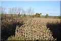
The above images may not be of the site on this page, they are loaded from Geograph.
Please Submit an Image of this site or go out and take one for us!
Click here to see more info for this site
Nearby sites
Key: Red: member's photo, Blue: 3rd party photo, Yellow: other image, Green: no photo - please go there and take one, Grey: site destroyed
Download sites to:
KML (Google Earth)
GPX (GPS waypoints)
CSV (Garmin/Navman)
CSV (Excel)
To unlock full downloads you need to sign up as a Contributory Member. Otherwise downloads are limited to 50 sites.
Turn off the page maps and other distractions
Nearby sites listing. In the following links * = Image available
1.1km S 169° Quarry Wood Oppidum Ancient Village or Settlement (TQ768505)
1.5km E 95° Park Wood Earthworks Ancient Village or Settlement (TQ781515)
1.8km SW 218° Goose Well Holy Well or Sacred Spring (TQ755501)
2.1km ESE 122° Marlpit Farm Earthworks Ancient Village or Settlement (TQ784505)
4.5km N 354° Maidstone Museum & Art Gallery* Museum (TQ7593456003)
4.7km NE 41° Lion of Kent Natural Stone / Erratic / Other Natural Feature (TQ7956855225)
7.4km E 85° St. Margaret's Well (Broomfield)* Holy Well or Sacred Spring (TQ8390252503)
7.4km NNE 15° Pilgrims Way 5 Ancient Trackway (TQ783588)
8.6km N 351° Aylesford Megalith Long Barrow (TQ750600)
8.6km NNW 348° Cossington Spring* Holy Well or Sacred Spring (TQ745599)
8.6km ENE 66° Hollingbourne Henge* Henge (TQ8434355407)
8.7km N 357° White Horse Spring* Holy Well or Sacred Spring (TQ758603)
8.8km N 353° Lower White Horse Stone* Standing Stone (Menhir) (TQ75126022)
8.8km N 353° White Horse Stone Neolithic Longhouse Ancient Village or Settlement (TQ7525060250)
8.8km N 354° White Horse Stone* Chambered Tomb (TQ75356032)
8.8km NNE 15° Grange Farm Dene Hole Ancient Mine, Quarry or other Industry (TQ785602)
9.0km NNW 347° Tottington Stone* Standing Stone (Menhir) (TQ7418660231)
9.0km WSW 258° Hob's pool Holy Well or Sacred Spring (TQ678494)
9.0km N 354° Smythe's Megalith Chambered Tomb (TQ753605)
9.1km NNW 348° Little Kit's Coty* Burial Chamber or Dolmen (TQ74426040)
9.2km NNW 345° Great Tottington Farm Natural Stone / Erratic / Other Natural Feature (TQ73956038)
9.4km NNW 346° Coffin Stone* Standing Stone (Menhir) (TQ74016059)
9.5km NNW 346° Pilgrims Way 4 Ancient Trackway (TQ739607)
9.5km N 349° Kit's Coty.* Burial Chamber or Dolmen (TQ7448660856)
9.7km NW 321° Larkfield Cairnfield (Maidstone) Cairn (TQ70155891)
View more nearby sites and additional images


 We would like to know more about this location. Please feel free to add a brief description and any relevant information in your own language.
 Wir möchten mehr über diese Stätte erfahren. Bitte zögern Sie nicht, eine kurze Beschreibung und relevante Informationen in Deutsch hinzuzufügen.
 Nous aimerions en savoir encore un peu sur les lieux. S'il vous plaît n'hesitez pas à ajouter une courte description et tous les renseignements pertinents dans votre propre langue.
 Quisieramos informarnos un poco más de las lugares. No dude en añadir una breve descripción y otros datos relevantes en su propio idioma.