 with our Megalithic Portal iPhone app")


<< Our Photo Pages >> Howe Hill Bowl Barrow - Round Barrow(s) in England in Cambridgeshire
Submitted by coldrum on Tuesday, 25 October 2011 Page Views: 3692
Neolithic and Bronze AgeSite Name: Howe Hill Bowl BarrowCountry: England
NOTE: This site is 2.085 km away from the location you searched for.
County: Cambridgeshire Type: Round Barrow(s)
Map Ref: TL69536822
Latitude: 52.285968N Longitude: 0.484032E
Condition:
| 5 | Perfect |
| 4 | Almost Perfect |
| 3 | Reasonable but with some damage |
| 2 | Ruined but still recognisable as an ancient site |
| 1 | Pretty much destroyed, possibly visible as crop marks |
| 0 | No data. |
| -1 | Completely destroyed |
| 5 | Superb |
| 4 | Good |
| 3 | Ordinary |
| 2 | Not Good |
| 1 | Awful |
| 0 | No data. |
| 5 | Can be driven to, probably with disabled access |
| 4 | Short walk on a footpath |
| 3 | Requiring a bit more of a walk |
| 2 | A long walk |
| 1 | In the middle of nowhere, a nightmare to find |
| 0 | No data. |
| 5 | co-ordinates taken by GPS or official recorded co-ordinates |
| 4 | co-ordinates scaled from a detailed map |
| 3 | co-ordinates scaled from a bad map |
| 2 | co-ordinates of the nearest village |
| 1 | co-ordinates of the nearest town |
| 0 | no data |
Be the first person to rate this site - see the 'Contribute!' box in the right hand menu.
Internal Links:
External Links:
I have visited· I would like to visit
Spiderdrone visited on 13th Dec 2021 - their rating: Cond: 3 Amb: 2 Access: 4
")
"A Bronze Age bowl barrow with a mound slightly oval in plan, measuring 31m north to south by 28m east to west. It stands 3m above the surrounding ground surface. There is no visible indication of a surrounding ditch."
Source: Pastscape.
You may be viewing yesterday's version of this page. To see the most up to date information please register for a free account.
Do not use the above information on other web sites or publications without permission of the contributor.
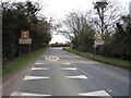
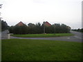
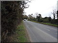
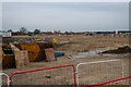
Nearby Images from Geograph Britain and Ireland:
©2016(licence)
©2005(licence)
©2016(licence)
©2024(licence)
©2014(licence)
The above images may not be of the site on this page, they are loaded from Geograph.
Please Submit an Image of this site or go out and take one for us!
Click here to see more info for this site
Nearby sites
Key: Red: member's photo, Blue: 3rd party photo, Yellow: other image, Green: no photo - please go there and take one, Grey: site destroyed
Download sites to:
KML (Google Earth)
GPX (GPS waypoints)
CSV (Garmin/Navman)
CSV (Excel)
To unlock full downloads you need to sign up as a Contributory Member. Otherwise downloads are limited to 50 sites.
Turn off the page maps and other distractions
Nearby sites listing. In the following links * = Image available
10.3km NE 41° How Hill Round Barrow(s) (TL75987626)
11.3km E 85° Flempton Cursus Cursus (TL808695)
11.6km ENE 78° West Stow* Ancient Village or Settlement (TL808710)
11.7km W 261° The Burwells* Holy Well or Sacred Spring (TL5866)
12.0km ENE 69° West Stow Field Barrow* Round Barrow(s) (TL806729)
12.0km WSW 254° Devil's Dyke, Cambridgeshire* Misc. Earthwork (TL580646)
13.3km E 89° Fornham All Saints A Cursus Cursus (TL829688)
13.4km WNW 282° Wicken Fen* Natural Stone / Erratic / Other Natural Feature (TL563705)
13.8km E 93° Fornham All Saints B Cursus Cursus (TL83346794)
14.1km E 94° Fornham All Saints C Cursus Cursus (TL83636765)
14.4km E 80° The Hill of Health* Round Barrow(s) (TL8365171319)
14.6km E 96° Fornham All Saints A Cursus Cursus (TL841672)
15.9km ENE 69° Traveller's Hill* Round Barrow(s) (TL842745)
16.1km WSW 249° Bottisham Cursus Cursus (TL547619)
16.2km ESE 106° Moyse's Hall Museum Museum (TL8530264367)
16.2km E 83° Ingham Puddingstone* Marker Stone (TL8556770828)
16.3km E 88° Timworth Puddingstone* Marker Stone (TL8580969281)
16.5km SE 131° Baal Stone* Natural Stone / Erratic / Other Natural Feature (TL82375776)
16.8km E 95° Hall Farm Puddingstone Marker Stone (TL864672)
17.6km ENE 74° Seven hills, Rymer Barrow Cemetery (TL863737)
18.4km NNE 26° White Hill, Suffolk* Round Barrow(s) (TL77168497)
19.4km E 96° St. John's Well (Suffolk)* Holy Well or Sacred Spring (TL889669)
19.9km ENE 75° Black Hill-Suffolk* Round Barrow(s) (TL886742)
20.2km ENE 60° Millfield Barn Round Barrow(s) (TL86717898)
20.2km ENE 60° Mill House Barrow Round Barrow(s) (TL867790)
View more nearby sites and additional images


 We would like to know more about this location. Please feel free to add a brief description and any relevant information in your own language.
 Wir möchten mehr über diese Stätte erfahren. Bitte zögern Sie nicht, eine kurze Beschreibung und relevante Informationen in Deutsch hinzuzufügen.
 Nous aimerions en savoir encore un peu sur les lieux. S'il vous plaît n'hesitez pas à ajouter une courte description et tous les renseignements pertinents dans votre propre langue.
 Quisieramos informarnos un poco más de las lugares. No dude en añadir una breve descripción y otros datos relevantes en su propio idioma.