


<< Text Pages >> Great Tottington Farm - Natural Stone / Erratic / Other Natural Feature in England in Kent
Submitted by coldrum on Monday, 07 November 2011 Page Views: 4955
Natural PlacesSite Name: Great Tottington FarmCountry: England County: Kent Type: Natural Stone / Erratic / Other Natural Feature
Nearest Village: Aylesford
Map Ref: TQ73956038
Latitude: 51.315938N Longitude: 0.494696E
Condition:
| 5 | Perfect |
| 4 | Almost Perfect |
| 3 | Reasonable but with some damage |
| 2 | Ruined but still recognisable as an ancient site |
| 1 | Pretty much destroyed, possibly visible as crop marks |
| 0 | No data. |
| -1 | Completely destroyed |
| 5 | Superb |
| 4 | Good |
| 3 | Ordinary |
| 2 | Not Good |
| 1 | Awful |
| 0 | No data. |
| 5 | Can be driven to, probably with disabled access |
| 4 | Short walk on a footpath |
| 3 | Requiring a bit more of a walk |
| 2 | A long walk |
| 1 | In the middle of nowhere, a nightmare to find |
| 0 | No data. |
| 5 | co-ordinates taken by GPS or official recorded co-ordinates |
| 4 | co-ordinates scaled from a detailed map |
| 3 | co-ordinates scaled from a bad map |
| 2 | co-ordinates of the nearest village |
| 1 | co-ordinates of the nearest town |
| 0 | no data |
Be the first person to rate this site - see the 'Contribute!' box in the right hand menu.
Internal Links:
External Links:
I have visited· I would like to visit
medwayexplorer visited on 26th Nov 2017 - their rating: Cond: 2 Amb: 4 Access: 4 Lots of springs, ponds and large stones here. Beautiful site with lots of footpaths.
"A group of sarsens round a springhead at Tottington, are in great disorder, some being half-buried in the stream and it is evident that the circle, if ever there was one, was a monument on its own and not set up round a barrow.
Tottington was an ancient manor. It is now a farmhouse with part of the ancient building standing detached at the west end. It is surrounded by a deep moat fed by springs. The large sarsens about the yard were undoubtedly taken up in digging the moat.
At Tottington the Aylesford Tithe Map, 1840 shows a rectangular waterfilled homestead moat with a causeway in the NW side. Within the enclosed area is a house, L shaped on plan, situated at the north end of the present cottages, with the longer wing running SW from the S end.
At Great Tottington there are the mutilated remains of a homestead moat, now dry except for a pond at the NE corner. It would appear to have been rectangular on plan, the enclosed area measuring approx. 34m NW-SE by 25 m. transversely. The NE arm has been filled in, though its outline is still discernible; the other arms remain as shallow depressions. Near the SE corner is a spring which probably fed the moat; the water is now piped away. Within the moat are two fairly modern cottages; there is no evidence of the earlier manor-house. N of and surrounding the moat and farm buildings, are large numbers of sarsens, none of which are of any archaeological significance. Antiquity Model survey carried out.
Cottages demolished, Moat now fairly overgrown."
Source: Exploring Kent's Past.
You may be viewing yesterday's version of this page. To see the most up to date information please register for a free account.
Do not use the above information on other web sites or publications without permission of the contributor.
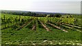
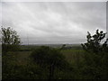
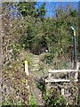
Nearby Images from Geograph Britain and Ireland:
©2020(licence)

©2020(licence)

©2020(licence)
©2013(licence)
©2008(licence)
The above images may not be of the site on this page, they are loaded from Geograph.
Please Submit an Image of this site or go out and take one for us!
Click here to see more info for this site
Nearby sites
Key: Red: member's photo, Blue: 3rd party photo, Yellow: other image, Green: no photo - please go there and take one, Grey: site destroyed
Download sites to:
KML (Google Earth)
GPX (GPS waypoints)
CSV (Garmin/Navman)
CSV (Excel)
To unlock full downloads you need to sign up as a Contributory Member. Otherwise downloads are limited to 50 sites.
Turn off the page maps and other distractions
Nearby sites listing. In the following links * = Image available
218m NNE 18° Coffin Stone* Standing Stone (Menhir) (TQ74016059)
278m SE 124° Tottington Stone* Standing Stone (Menhir) (TQ7418660231)
324m N 353° Pilgrims Way 4 Ancient Trackway (TQ739607)
469m E 90° Little Kit's Coty* Burial Chamber or Dolmen (TQ74426040)
715m NE 50° Kit's Coty.* Burial Chamber or Dolmen (TQ7448660856)
729m SE 133° Cossington Spring* Holy Well or Sacred Spring (TQ745599)
1.0km N 4° Pilgrim Spring* Holy Well or Sacred Spring (TQ73986140)
1.1km ESE 112° Aylesford Megalith Long Barrow (TQ750600)
1.2km E 100° Lower White Horse Stone* Standing Stone (Menhir) (TQ75126022)
1.3km E 98° White Horse Stone Neolithic Longhouse Ancient Village or Settlement (TQ7525060250)
1.3km NW 322° Haly Garden (Burham) Holy Well or Sacred Spring (TQ731614)
1.4km E 87° Smythe's Megalith Chambered Tomb (TQ753605)
1.4km E 94° White Horse Stone* Chambered Tomb (TQ75356032)
1.6km N 4° Blue Bell Hill Sarsons Burial Chamber or Dolmen (TQ740620)
1.8km E 94° White Horse Spring* Holy Well or Sacred Spring (TQ758603)
2.5km ENE 57° Stones off Impton Lane* Natural Stone / Erratic / Other Natural Feature (TQ7601561793)
2.9km NE 50° Walderslade Wood Sarsons* Natural Stone / Erratic / Other Natural Feature (TQ761623)
3.0km NW 313° Burham causewayed enclosure* Causewayed Enclosure (TQ71666238)
3.3km WNW 299° Battle of the Medway Stone* Modern Stone Circle etc (TQ710619)
4.1km WSW 251° Larkfield Cairnfield (Maidstone) Cairn (TQ70155891)
4.1km ENE 65° Lordswood Sarsen Stones (Buxton/Iona Close)* Natural Stone / Erratic / Other Natural Feature (TQ7762262215)
4.2km ENE 64° Lordswood Sarsen Stones* Natural Stone / Erratic / Other Natural Feature (TQ7771162358)
4.3km NNW 342° Wouldham Barrow Round Barrow(s) (TQ72456445)
4.5km E 94° Grange Farm Dene Hole Ancient Mine, Quarry or other Industry (TQ785602)
4.6km NNW 337° Pilgrims Way 3 Ancient Trackway (TQ720645)
View more nearby sites and additional images


 We would like to know more about this location. Please feel free to add a brief description and any relevant information in your own language.
 Wir möchten mehr über diese Stätte erfahren. Bitte zögern Sie nicht, eine kurze Beschreibung und relevante Informationen in Deutsch hinzuzufügen.
 Nous aimerions en savoir encore un peu sur les lieux. S'il vous plaît n'hesitez pas à ajouter une courte description et tous les renseignements pertinents dans votre propre langue.
 Quisieramos informarnos un poco más de las lugares. No dude en añadir una breve descripción y otros datos relevantes en su propio idioma.