 with our Megalithic Portal iPhone app")


<< Our Photo Pages >> Barrow Hill (Kent) - Round Barrow(s) in England in Kent
Submitted by coldrum on Monday, 10 August 2009 Page Views: 6591
Neolithic and Bronze AgeSite Name: Barrow Hill (Kent)Country: England
NOTE: This site is 0.65 km away from the location you searched for.
County: Kent Type: Round Barrow(s)
Nearest Village: Higham
Map Ref: TQ711746
Latitude: 51.444545N Longitude: 0.460684E
Condition:
| 5 | Perfect |
| 4 | Almost Perfect |
| 3 | Reasonable but with some damage |
| 2 | Ruined but still recognisable as an ancient site |
| 1 | Pretty much destroyed, possibly visible as crop marks |
| 0 | No data. |
| -1 | Completely destroyed |
| 5 | Superb |
| 4 | Good |
| 3 | Ordinary |
| 2 | Not Good |
| 1 | Awful |
| 0 | No data. |
| 5 | Can be driven to, probably with disabled access |
| 4 | Short walk on a footpath |
| 3 | Requiring a bit more of a walk |
| 2 | A long walk |
| 1 | In the middle of nowhere, a nightmare to find |
| 0 | No data. |
| 5 | co-ordinates taken by GPS or official recorded co-ordinates |
| 4 | co-ordinates scaled from a detailed map |
| 3 | co-ordinates scaled from a bad map |
| 2 | co-ordinates of the nearest village |
| 1 | co-ordinates of the nearest town |
| 0 | no data |
Be the first person to rate this site - see the 'Contribute!' box in the right hand menu.
Internal Links:
External Links:
I have visited· I would like to visit
Majick123 would like to visit
 (PID:202515)")
Possible Bronze age barrow. This could be the mound that was dug into in 1880. A cist was found with a burial and grave goods. This was thought to be of bronze age date.
Pastscape
You may be viewing yesterday's version of this page. To see the most up to date information please register for a free account.
 (PID:202517)")
 (PID:202516)")
Do not use the above information on other web sites or publications without permission of the contributor.
Nearby Images from Geograph Britain and Ireland:
©2009(licence)
©2022(licence)
©2012(licence)
©2022(licence)
©2012(licence)
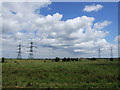
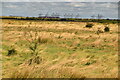
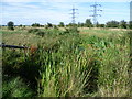
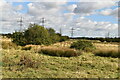
The above images may not be of the site on this page, they are loaded from Geograph.
Please Submit an Image of this site or go out and take one for us!
Click here to see more info for this site
Nearby sites
Key: Red: member's photo, Blue: 3rd party photo, Yellow: other image, Green: no photo - please go there and take one, Grey: site destroyed
Download sites to:
KML (Google Earth)
GPX (GPS waypoints)
CSV (Garmin/Navman)
CSV (Excel)
To unlock full downloads you need to sign up as a Contributory Member. Otherwise downloads are limited to 50 sites.
Turn off the page maps and other distractions
Nearby sites listing. In the following links * = Image available
2.4km E 92° Cliffe Bronze Age Settlement Ancient Village or Settlement (TQ735746)
4.0km SE 140° Frindsbury Extra Barrrow Round Barrow(s) (TQ73797166)
4.1km SSE 148° Stone House Farm Caves Cave or Rock Shelter (TQ734712)
4.2km SW 229° Shorne Barrow Round Barrow(s) (TQ68007169)
4.5km SSW 213° Randall Wood Barrow Round Barrow(s) (TQ68777069)
5.1km S 184° Sarsen Stones, Three Crutches* Natural Stone / Erratic / Other Natural Feature (TQ7092269497)
5.3km SW 221° Randall Heath Barrow Round Barrow(s) (TQ67747051)
5.7km ENE 71° Bromhey Farm Mound Ancient Mine, Quarry or other Industry (TQ76477661)
6.0km SSE 147° Frindsbury Chalk Quarry Ancient Mine, Quarry or other Industry (TQ74596970)
6.1km NE 43° Cooling Marshes Mound 1 Ancient Mine, Quarry or other Industry (TQ7511779139)
6.1km SW 219° St. Thomas's Well Holy Well or Sacred Spring (TQ67446972)
6.1km NE 45° Cooling Marshes Mound 2 Ancient Mine, Quarry or other Industry (TQ7527879124)
6.2km NE 46° Cliffe Saltings Mound Ancient Mine, Quarry or other Industry (TQ7545279075)
6.3km SSW 206° Cobham Hall Mock Stone circle* Modern Stone Circle etc (TQ685689)
6.4km NE 47° Cliffe Mound Ancient Mine, Quarry or other Industry (TQ7566379139)
6.4km SW 217° The Mount* Round Barrow(s) (TQ67386934)
6.6km SSE 154° Rochester Guildhall Museum* Museum (TQ7427068750)
6.8km SSE 157° Sarson stones, Esplanade* Natural Stone / Erratic / Other Natural Feature (TQ7401868447)
6.8km WSW 238° Single Well (Iflield) Holy Well or Sacred Spring (TQ65387081)
7.0km NW 311° Chadwell St Mary Henge (TQ657790)
7.1km SSE 155° Turf Maze, Rochester (Kent)* Turf Maze (TQ74266826)
7.4km SW 216° Cobham Megalith Burial Chamber or Dolmen (TQ669685)
7.5km SW 214° Billy Stump's stone* Natural Stone / Erratic / Other Natural Feature (TQ671683)
7.6km S 179° Pilgrims Way 2 Ancient Trackway (TQ715670)
7.6km E 87° High Halstow Barrow Round Barrow(s) (TQ787753)
View more nearby sites and additional images


 We would like to know more about this location. Please feel free to add a brief description and any relevant information in your own language.
 Wir möchten mehr über diese Stätte erfahren. Bitte zögern Sie nicht, eine kurze Beschreibung und relevante Informationen in Deutsch hinzuzufügen.
 Nous aimerions en savoir encore un peu sur les lieux. S'il vous plaît n'hesitez pas à ajouter une courte description et tous les renseignements pertinents dans votre propre langue.
 Quisieramos informarnos un poco más de las lugares. No dude en añadir una breve descripción y otros datos relevantes en su propio idioma.