


<< Our Photo Pages >> Collado de Sahún - Stone Circle in Spain in Aragón
Submitted by holger_rix on Wednesday, 30 December 2015 Page Views: 1215
Neolithic and Bronze AgeSite Name: Collado de SahúnCountry: Spain
NOTE: This site is 10.643 km away from the location you searched for.
Region: Aragón Type: Stone Circle
Latitude: 42.571447N Longitude: 0.400750E
Condition:
| 5 | Perfect |
| 4 | Almost Perfect |
| 3 | Reasonable but with some damage |
| 2 | Ruined but still recognisable as an ancient site |
| 1 | Pretty much destroyed, possibly visible as crop marks |
| 0 | No data. |
| -1 | Completely destroyed |
| 5 | Superb |
| 4 | Good |
| 3 | Ordinary |
| 2 | Not Good |
| 1 | Awful |
| 0 | No data. |
| 5 | Can be driven to, probably with disabled access |
| 4 | Short walk on a footpath |
| 3 | Requiring a bit more of a walk |
| 2 | A long walk |
| 1 | In the middle of nowhere, a nightmare to find |
| 0 | No data. |
| 5 | co-ordinates taken by GPS or official recorded co-ordinates |
| 4 | co-ordinates scaled from a detailed map |
| 3 | co-ordinates scaled from a bad map |
| 2 | co-ordinates of the nearest village |
| 1 | co-ordinates of the nearest town |
| 0 | no data |
Be the first person to rate this site - see the 'Contribute!' box in the right hand menu.
Internal Links:
External Links:
")
Source: euskal-herria.org
You may be viewing yesterday's version of this page. To see the most up to date information please register for a free account.
")
")
")
Do not use the above information on other web sites or publications without permission of the contributor.
Nearby Images from Flickr
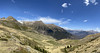
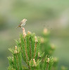
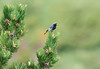
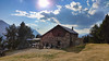
The above images may not be of the site on this page, but were taken nearby. They are loaded from Flickr so please click on them for image credits.
Click here to see more info for this site
Nearby sites
Click here to view sites on an interactive map of the areaKey: Red: member's photo, Blue: 3rd party photo, Yellow: other image, Green: no photo - please go there and take one, Grey: site destroyed
Download sites to:
KML (Google Earth)
GPX (GPS waypoints)
CSV (Garmin/Navman)
CSV (Excel)
To unlock full downloads you need to sign up as a Contributory Member. Otherwise downloads are limited to 50 sites.
Turn off the page maps and other distractions
Nearby sites listing. In the following links * = Image available
573m ESE 110° La Bocona Chromlechs 1+2* Stone Circle
6.9km SW 216° Armeña Túmulo Round Barrow(s)
7.1km WSW 257° Collata De Labasar 7* Stone Circle
7.1km WSW 256° Collata De Labasar 1-6* Stone Circle
7.2km WSW 258° Collado Del Ibón Stone Circle
8.7km ESE 117° Espía Dolmen* Burial Chamber or Dolmen
11.6km S 173° Seira Dolmen* Burial Chamber or Dolmen
18.2km W 273° Dolmen de Tella* Burial Chamber or Dolmen
18.4km W 275° Fandichuerre Dolmen* Burial Chamber or Dolmen
20.7km NE 54° Remuñe Cromlech* Chambered Cairn
20.8km NE 54° Remuñe Tumulus* Round Barrow(s)
21.0km NE 54° Forau de la Llana* Stone Circle
21.9km ESE 123° Coll De Espina Menhir* Standing Stone (Menhir)
24.1km WNW 285° Cromlech de Gurrundué* Stone Circle
26.2km NW 319° Saux burial chamber* Burial Chamber or Dolmen
26.9km SSE 165° Merli Menhir* Standing Stone (Menhir)
27.3km N 2° Armenteule Menhir* Standing Stone (Menhir)
29.1km N 2° Aneran stone* Standing Stone (Menhir)
29.3km NNE 23° Mail de Soupène Cromlechs* Stone Circle
29.3km NNE 22° Alignement de Peyralade* Stone Row / Alignment
29.3km NNE 22° Cailhaou des Pourrics* Rock Art
29.3km NNE 23° Carnac Pyrénéen* Stone Circle
29.3km NNE 23° Sarrat de Cousseillot Cromlechs* Stone Circle
29.4km NNE 25° Peyra dé Peyrahita Standing Stone (Menhir)
29.4km NNE 25° Cailhaou d'Arriba Pardin Standing Stone (Menhir)
View more nearby sites and additional images


 We would like to know more about this location. Please feel free to add a brief description and any relevant information in your own language.
 Wir möchten mehr über diese Stätte erfahren. Bitte zögern Sie nicht, eine kurze Beschreibung und relevante Informationen in Deutsch hinzuzufügen.
 Nous aimerions en savoir encore un peu sur les lieux. S'il vous plaît n'hesitez pas à ajouter une courte description et tous les renseignements pertinents dans votre propre langue.
 Quisieramos informarnos un poco más de las lugares. No dude en añadir una breve descripción y otros datos relevantes en su propio idioma.