


<< Text Pages >> Dolmens du Bancheraud - Burial Chamber or Dolmen in France in Poitou:Charente (16)
Submitted by holger_rix on Thursday, 21 January 2016 Page Views: 908
Neolithic and Bronze AgeSite Name: Dolmens du BancheraudCountry: France
NOTE: This site is 3.472 km away from the location you searched for.
Département: Poitou:Charente (16) Type: Burial Chamber or Dolmen
Nearest Town: Marthon Nearest Village: Coulée d'Oc
Latitude: 45.616260N Longitude: 0.463020E
Condition:
| 5 | Perfect |
| 4 | Almost Perfect |
| 3 | Reasonable but with some damage |
| 2 | Ruined but still recognisable as an ancient site |
| 1 | Pretty much destroyed, possibly visible as crop marks |
| 0 | No data. |
| -1 | Completely destroyed |
| 5 | Superb |
| 4 | Good |
| 3 | Ordinary |
| 2 | Not Good |
| 1 | Awful |
| 0 | No data. |
| 5 | Can be driven to, probably with disabled access |
| 4 | Short walk on a footpath |
| 3 | Requiring a bit more of a walk |
| 2 | A long walk |
| 1 | In the middle of nowhere, a nightmare to find |
| 0 | No data. |
| 5 | co-ordinates taken by GPS or official recorded co-ordinates |
| 4 | co-ordinates scaled from a detailed map |
| 3 | co-ordinates scaled from a bad map |
| 2 | co-ordinates of the nearest village |
| 1 | co-ordinates of the nearest town |
| 0 | no data |
Be the first person to rate this site - see the 'Contribute!' box in the right hand menu.
Internal Links:
External Links:
Burial Chamber (Dolmen) in Poitou:Charente (16)
Coulée d'Oc, Marthon, Angoulême, Charente, Poitou-Charentes
Source: T4T35.fr
You may be viewing yesterday's version of this page. To see the most up to date information please register for a free account.
Do not use the above information on other web sites or publications without permission of the contributor.
Nearby Images from Flickr


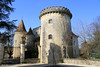
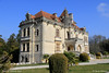
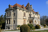
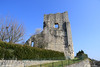
The above images may not be of the site on this page, but were taken nearby. They are loaded from Flickr so please click on them for image credits.
Click here to see more info for this site
Nearby sites
Click here to view sites on an interactive map of the areaKey: Red: member's photo, Blue: 3rd party photo, Yellow: other image, Green: no photo - please go there and take one, Grey: site destroyed
Download sites to:
KML (Google Earth)
GPX (GPS waypoints)
CSV (Garmin/Navman)
CSV (Excel)
To unlock full downloads you need to sign up as a Contributory Member. Otherwise downloads are limited to 50 sites.
Turn off the page maps and other distractions
Nearby sites listing. In the following links * = Image available
5.7km N 5° Grotte de Montgaudier* Cave or Rock Shelter
6.1km NNW 348° Grotte de la Chaise* Cave or Rock Shelter
7.0km N 10° Grotte de Fontechevade Cave or Rock Shelter
8.1km SSW 213° Dolmen de Charras Burial Chamber or Dolmen
8.2km NNW 337° Grotte de Vilhonneur Cave or Rock Shelter
8.8km NNW 338° Grotte du Placard* Cave or Rock Shelter
9.2km E 100° La Pierre Plate (Teyjat)* Burial Chamber or Dolmen
9.3km ESE 111° Grotte de la Mairie* Cave or Rock Shelter
11.4km WSW 246° Le Roc De Sers* Cave or Rock Shelter
14.8km WSW 249° Dolmen de l'Etang Burial Chamber or Dolmen
14.9km E 88° Menhir de Fixard* Standing Stone (Menhir)
15.1km SSW 213° Dolmen de Lambertie* Burial Chamber or Dolmen
15.4km SSW 210° Dolmen de la Gélie* Burial Chamber or Dolmen
15.6km SSW 210° Menhir de la Pierre Debout (Édon) Standing Stone (Menhir)
16.4km ESE 110° La Chapoulie* Standing Stones
16.4km SSE 168° Saint Sulpice de Mareuil Dolmen* Not Known (by us)
16.5km SSE 163° La Roderie* Standing Stone (Menhir)
16.6km SSW 211° Nécropole d'Edon Barrow Cemetery
16.8km W 266° Dolmen de Pierre Levade Burial Chamber or Dolmen
17.3km WSW 254° Dolmen de Brande Burial Chamber or Dolmen
17.4km SSE 152° Bernardieres* Stone Row / Alignment
17.9km SW 228° La Quina* Cave or Rock Shelter
18.3km SW 227° Le Champignon* Natural Stone / Erratic / Other Natural Feature
19.1km S 175° Grotte de Fronsac Cave or Rock Shelter
20.0km SSE 147° Grotte de la Font-Bargeix Cave or Rock Shelter
View more nearby sites and additional images


 We would like to know more about this location. Please feel free to add a brief description and any relevant information in your own language.
 Wir möchten mehr über diese Stätte erfahren. Bitte zögern Sie nicht, eine kurze Beschreibung und relevante Informationen in Deutsch hinzuzufügen.
 Nous aimerions en savoir encore un peu sur les lieux. S'il vous plaît n'hesitez pas à ajouter une courte description et tous les renseignements pertinents dans votre propre langue.
 Quisieramos informarnos un poco más de las lugares. No dude en añadir una breve descripción y otros datos relevantes en su propio idioma.