


<< Text Pages >> Fort des Carrières Grotte - Cave or Rock Shelter in France in Normandie:Seine-Maritime (76)
Submitted by TheCaptain on Saturday, 16 April 2005 Page Views: 2864
Natural PlacesSite Name: Fort des Carrières GrotteCountry: France
NOTE: This site is 13.274 km away from the location you searched for.
Département: Normandie:Seine-Maritime (76) Type: Cave or Rock Shelter
Nearest Town: Le Havre Nearest Village: Saint-Vigor-d'Ymonvi
Latitude: 49.484458N Longitude: 0.353768E
Condition:
| 5 | Perfect |
| 4 | Almost Perfect |
| 3 | Reasonable but with some damage |
| 2 | Ruined but still recognisable as an ancient site |
| 1 | Pretty much destroyed, possibly visible as crop marks |
| 0 | No data. |
| -1 | Completely destroyed |
| 5 | Superb |
| 4 | Good |
| 3 | Ordinary |
| 2 | Not Good |
| 1 | Awful |
| 0 | No data. |
| 5 | Can be driven to, probably with disabled access |
| 4 | Short walk on a footpath |
| 3 | Requiring a bit more of a walk |
| 2 | A long walk |
| 1 | In the middle of nowhere, a nightmare to find |
| 0 | No data. |
| 5 | co-ordinates taken by GPS or official recorded co-ordinates |
| 4 | co-ordinates scaled from a detailed map |
| 3 | co-ordinates scaled from a bad map |
| 2 | co-ordinates of the nearest village |
| 1 | co-ordinates of the nearest town |
| 0 | no data |
Be the first person to rate this site - see the 'Contribute!' box in the right hand menu.
Internal Links:
External Links:
Cave in Seine-Maritime
Location Source: T4T35.fr
You may be viewing yesterday's version of this page. To see the most up to date information please register for a free account.
Do not use the above information on other web sites or publications without permission of the contributor.
Nearby Images from Flickr
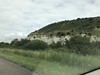
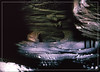
The above images may not be of the site on this page, but were taken nearby. They are loaded from Flickr so please click on them for image credits.
Click here to see more info for this site
Nearby sites
Click here to view sites on an interactive map of the areaKey: Red: member's photo, Blue: 3rd party photo, Yellow: other image, Green: no photo - please go there and take one, Grey: site destroyed
Download sites to:
KML (Google Earth)
GPX (GPS waypoints)
CSV (Garmin/Navman)
CSV (Excel)
To unlock full downloads you need to sign up as a Contributory Member. Otherwise downloads are limited to 50 sites.
Turn off the page maps and other distractions
Nearby sites listing. In the following links * = Image available
3.2km WNW 290° Camp du César (Sandouville) Ancient Village or Settlement
9.4km S 172° Monolithe de la Croix-aux-Chiens Standing Stone (Menhir)
13.7km ENE 76° Roman Theatre (Lillebonne)* Ancient Palace
17.7km W 271° Musée d'Histoire Naturelle (Le Havre)* Museum
20.1km SW 236° Grosse Pierre de la Bergerie* Standing Stone (Menhir)
20.4km ENE 61° Château tumulus* Chambered Tomb
20.6km SW 234° Menhir Couché Lieu Gobin* Standing Stone (Menhir)
20.6km ESE 107° Pierre Trouée de l'allée couverte d'Aizier* Passage Grave
27.2km E 93° Le Wuy Menhir* Standing Stone (Menhir)
29.1km N 8° Camp du Canada* Ancient Village or Settlement
39.7km ESE 115° Pierre Tournante (Bosgouet)* Burial Chamber or Dolmen
39.9km S 190° les Pierres Tremblantes Burial Chamber or Dolmen
40.0km E 89° Camp du Châtelier Ancient Village or Settlement
41.9km ESE 105° Allée Couverte de Mauny* Passage Grave
41.9km ESE 101° Bardouville burial chamber Burial Chamber or Dolmen
42.5km SSE 159° Courbépine Menhir Standing Stone (Menhir)
43.8km NNE 23° Camp du Câtelier Ancient Village or Settlement
44.5km SW 215° Chateau des Anglais Hillfort
47.7km SSE 147° Menhir du Croc* Standing Stone (Menhir)
47.8km SSE 147° Menhir du Croc 2* Standing Stone (Menhir)
50.9km ESE 102° Menhir dit la Pierre d'Etat* Standing Stone (Menhir)
53.7km SSW 194° Pierre Tournante (Livarot)* Standing Stone (Menhir)
54.0km E 94° Musée des Antiquités (Rouen)* Museum
54.7km WSW 250° Luc-sur-Mer menhir* Standing Stone (Menhir)
55.2km WSW 241° Les Pierres Branlantes* Chambered Tomb
View more nearby sites and additional images


 We would like to know more about this location. Please feel free to add a brief description and any relevant information in your own language.
 Wir möchten mehr über diese Stätte erfahren. Bitte zögern Sie nicht, eine kurze Beschreibung und relevante Informationen in Deutsch hinzuzufügen.
 Nous aimerions en savoir encore un peu sur les lieux. S'il vous plaît n'hesitez pas à ajouter une courte description et tous les renseignements pertinents dans votre propre langue.
 Quisieramos informarnos un poco más de las lugares. No dude en añadir una breve descripción y otros datos relevantes en su propio idioma.