

, Aubrey Burl")
<< Text Pages >> Chalk Well - Holy Well or Sacred Spring in England in Kent
Submitted by coldrum on Monday, 10 August 2009 Page Views: 3158
Springs and Holy WellsSite Name: Chalk WellCountry: England
NOTE: This site is 2.528 km away from the location you searched for.
County: Kent Type: Holy Well or Sacred Spring
Nearest Village: Meopham
Map Ref: TQ629685
Latitude: 51.392158N Longitude: 0.339996E
Condition:
| 5 | Perfect |
| 4 | Almost Perfect |
| 3 | Reasonable but with some damage |
| 2 | Ruined but still recognisable as an ancient site |
| 1 | Pretty much destroyed, possibly visible as crop marks |
| 0 | No data. |
| -1 | Completely destroyed |
| 5 | Superb |
| 4 | Good |
| 3 | Ordinary |
| 2 | Not Good |
| 1 | Awful |
| 0 | No data. |
| 5 | Can be driven to, probably with disabled access |
| 4 | Short walk on a footpath |
| 3 | Requiring a bit more of a walk |
| 2 | A long walk |
| 1 | In the middle of nowhere, a nightmare to find |
| 0 | No data. |
| 5 | co-ordinates taken by GPS or official recorded co-ordinates |
| 4 | co-ordinates scaled from a detailed map |
| 3 | co-ordinates scaled from a bad map |
| 2 | co-ordinates of the nearest village |
| 1 | co-ordinates of the nearest town |
| 0 | no data |
Be the first person to rate this site - see the 'Contribute!' box in the right hand menu.
Internal Links:
External Links:
I have visited· I would like to visit
Twistytwirly would like to visit
Chalk well.
Pastscape:
http://www.pastscape.org.uk/hob.aspx?hob_id=413298
You may be viewing yesterday's version of this page. To see the most up to date information please register for a free account.
Do not use the above information on other web sites or publications without permission of the contributor.
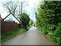
Nearby Images from Geograph Britain and Ireland:
©2009(licence)
©2015(licence)
©2015(licence)
©2012(licence)
©2010(licence)
The above images may not be of the site on this page, they are loaded from Geograph.
Please Submit an Image of this site or go out and take one for us!
Click here to see more info for this site
Nearby sites
Key: Red: member's photo, Blue: 3rd party photo, Yellow: other image, Green: no photo - please go there and take one, Grey: site destroyed
Download sites to:
KML (Google Earth)
GPX (GPS waypoints)
CSV (Garmin/Navman)
CSV (Excel)
To unlock full downloads you need to sign up as a Contributory Member. Otherwise downloads are limited to 50 sites.
Turn off the page maps and other distractions
Nearby sites listing. In the following links * = Image available
2.7km SSE 149° St John The Baptist Church Sarson Stone Natural Stone / Erratic / Other Natural Feature (TQ644662)
3.4km NE 49° Single Well (Iflield) Holy Well or Sacred Spring (TQ65387081)
4.0km E 92° Cobham Megalith Burial Chamber or Dolmen (TQ669685)
4.1km NNW 346° Spring Head Holy Well or Sacred Spring (TQ61767246)
4.2km E 95° Billy Stump's stone* Natural Stone / Erratic / Other Natural Feature (TQ671683)
4.5km E 81° The Mount* Round Barrow(s) (TQ67386934)
4.7km ENE 77° St. Thomas's Well Holy Well or Sacred Spring (TQ67446972)
5.0km NW 323° Lustrating Pool Holy Well or Sacred Spring (TQ598724)
5.1km NNW 342° Southfleet Road Ebbsfleet Elephant Butchery Site Not Known (by us) (TQ6117573260)
5.2km ENE 69° Randall Heath Barrow Round Barrow(s) (TQ67747051)
5.6km E 88° Cobham Hall Mock Stone circle* Modern Stone Circle etc (TQ685689)
5.8km NNW 343° Bakers Hole Ancient Mine, Quarry or other Industry (TQ610740)
5.9km SSE 155° Cock Adam Shaw Natural Stone / Erratic / Other Natural Feature (TQ65576323)
6.0km ENE 60° Shorne Barrow Round Barrow(s) (TQ68007169)
6.2km SE 143° Dode Church Well* Holy Well or Sacred Spring (TQ668637)
6.2km ENE 71° Randall Wood Barrow Round Barrow(s) (TQ68777069)
6.7km SSE 165° White Horse Wood Barrow Round Barrow(s) (TQ649621)
6.8km NNW 335° Swanscombe* Ancient Mine, Quarry or other Industry (TQ598746)
7.4km W 279° Sutton At Hone Enclosures Ancient Village or Settlement (TQ555694)
7.5km NNW 332° The Monks Well Holy Well or Sacred Spring (TQ5918474982)
7.7km ESE 116° Pilgrims Way 1 Ancient Trackway (TQ699653)
7.7km ESE 121° Halling Barrow Round Barrow(s) (TQ69686480)
7.7km ESE 104° Cucola's Stone Marker Stone (TQ705669)
8.1km E 85° Sarsen Stones, Three Crutches* Natural Stone / Erratic / Other Natural Feature (TQ7092269497)
8.2km SSE 164° Coldrum* Chambered Tomb (TQ65446072)
View more nearby sites and additional images


 We would like to know more about this location. Please feel free to add a brief description and any relevant information in your own language.
 Wir möchten mehr über diese Stätte erfahren. Bitte zögern Sie nicht, eine kurze Beschreibung und relevante Informationen in Deutsch hinzuzufügen.
 Nous aimerions en savoir encore un peu sur les lieux. S'il vous plaît n'hesitez pas à ajouter une courte description et tous les renseignements pertinents dans votre propre langue.
 Quisieramos informarnos un poco más de las lugares. No dude en añadir una breve descripción y otros datos relevantes en su propio idioma.