


<< Our Photo Pages >> Black Robin Bottom Tumulus - Round Barrow(s) in England in East Sussex
Submitted by coldrum on Friday, 25 July 2008 Page Views: 3127
Neolithic and Bronze AgeSite Name: Black Robin Bottom TumulusCountry: England
NOTE: This site is 0.158 km away from the location you searched for.
County: East Sussex Type: Round Barrow(s)
Nearest Town: Willingdon
Map Ref: TV592973
Latitude: 50.753471N Longitude: 0.255534E
Condition:
| 5 | Perfect |
| 4 | Almost Perfect |
| 3 | Reasonable but with some damage |
| 2 | Ruined but still recognisable as an ancient site |
| 1 | Pretty much destroyed, possibly visible as crop marks |
| 0 | No data. |
| -1 | Completely destroyed |
| 5 | Superb |
| 4 | Good |
| 3 | Ordinary |
| 2 | Not Good |
| 1 | Awful |
| 0 | No data. |
| 5 | Can be driven to, probably with disabled access |
| 4 | Short walk on a footpath |
| 3 | Requiring a bit more of a walk |
| 2 | A long walk |
| 1 | In the middle of nowhere, a nightmare to find |
| 0 | No data. |
| 5 | co-ordinates taken by GPS or official recorded co-ordinates |
| 4 | co-ordinates scaled from a detailed map |
| 3 | co-ordinates scaled from a bad map |
| 2 | co-ordinates of the nearest village |
| 1 | co-ordinates of the nearest town |
| 0 | no data |
Be the first person to rate this site - see the 'Contribute!' box in the right hand menu.
Internal Links:
External Links:
I have visited· I would like to visit
jonm visited on 1st Nov 2012 - their rating: Cond: 3 Amb: 3 Access: 4
")
Tumulus.
You may be viewing yesterday's version of this page. To see the most up to date information please register for a free account.
Do not use the above information on other web sites or publications without permission of the contributor.
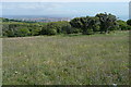
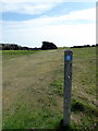
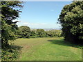
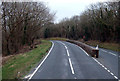
Nearby Images from Geograph Britain and Ireland:
©2010(licence)
©2017(licence)
©2017(licence)
©2012(licence)
©2010(licence)
The above images may not be of the site on this page, they are loaded from Geograph.
Please Submit an Image of this site or go out and take one for us!
Click here to see more info for this site
Nearby sites
Key: Red: member's photo, Blue: 3rd party photo, Yellow: other image, Green: no photo - please go there and take one, Grey: site destroyed
Download sites to:
KML (Google Earth)
GPX (GPS waypoints)
CSV (Garmin/Navman)
CSV (Excel)
To unlock full downloads you need to sign up as a Contributory Member. Otherwise downloads are limited to 50 sites.
Turn off the page maps and other distractions
Nearby sites listing. In the following links * = Image available
299m WNW 302° Warren Hill Low Tumulus (Black Robin Farm)* Artificial Mound (TV58949745)
363m WNW 288° Warren Hill/ Black Robin Tumuli Group* Misc. Earthwork (TV58859740)
587m NW 313° Warren Hill Upper Tumuli Group* Artificial Mound (TV58769769)
669m ESE 118° Well Combe Tumuli* Barrow Cemetery (TV598970)
922m N 349° Warren Tumuli and Cross Dyke* Barrow Cemetery (TV590982)
954m WNW 283° Warren Hill/Middle Brow Tumuli Group Artificial Mound (TV58269748)
982m ESE 116° Holy Well (Eastbourne) Holy Well or Sacred Spring (TV601969)
1000m S 182° Heathy Brow Tumulus* Round Barrow(s) (TV592963)
1.0km NNW 337° Pashley Cross-Dyke* Misc. Earthwork (TV58789823)
1.5km NNW 334° Eastbourne Downs Upper Tumuli group* Artificial Mound (TV585986)
1.5km SSW 192° Beachy Head Lower North Barrow Group* Artificial Mound (TV58939579)
1.6km S 187° Beachy Head Upper Earthwork Group* Artificial Mound (TV59069571)
1.7km NNW 337° Eastbourne Downs Tumuli* Barrow Cemetery (TV585988)
1.7km NNW 338° Eastbourne Downs Staging Tumuli Artificial Mound (TV5851698886)
1.7km SSW 213° West Brow Field System* Misc. Earthwork (TV583958)
2.0km NNW 335° Crunden's Bottom Summit* Artificial Mound (TV58329907)
2.4km WSW 253° Long Down Tumulus Round Barrow(s) (TV569965)
2.6km NNW 341° Beachy Brow Tumulus* Round Barrow(s) (TV5830099690)
2.9km NNW 342° Foxholes-Beachy Brow Tumuli* Round Barrow(s) (TQ58210003)
2.9km WSW 241° Frost Hill Tumulus* Round Barrow(s) (TV567958)
3.3km NNW 342° Foxholes-Beachy intermediate tumulus* Round Barrow(s) (TQ58090042)
3.4km NNW 343° Fox Holes Tumuli* Barrow Cemetery (TQ58100052)
3.5km WSW 244° Belle Tout Settlement* Ancient Village or Settlement (TV56109570)
3.6km WSW 245° Belle Tout Tumulus Round Barrow(s) (TV560957)
3.6km WSW 247° Belle Tout Tumuli Group* Artificial Mound (TV55949581)
View more nearby sites and additional images


 We would like to know more about this location. Please feel free to add a brief description and any relevant information in your own language.
 Wir möchten mehr über diese Stätte erfahren. Bitte zögern Sie nicht, eine kurze Beschreibung und relevante Informationen in Deutsch hinzuzufügen.
 Nous aimerions en savoir encore un peu sur les lieux. S'il vous plaît n'hesitez pas à ajouter une courte description et tous les renseignements pertinents dans votre propre langue.
 Quisieramos informarnos un poco más de las lugares. No dude en añadir una breve descripción y otros datos relevantes en su propio idioma.