


<< Our Photo Pages >> Tumulus de Malivert - Artificial Mound in France in Aquitaine:Dordogne (24)
Submitted by LaDragonne on Sunday, 10 March 2024 Page Views: 56
Multi-periodSite Name: Tumulus de Malivert Alternative Name: Tumulus du Fleix , Motte castrale du FleixCountry: France Département: Aquitaine:Dordogne (24) Type: Artificial Mound
Nearest Town: Bergerac Nearest Village: Le Fleix
Latitude: 44.868480N Longitude: 0.233960E
Condition:
| 5 | Perfect |
| 4 | Almost Perfect |
| 3 | Reasonable but with some damage |
| 2 | Ruined but still recognisable as an ancient site |
| 1 | Pretty much destroyed, possibly visible as crop marks |
| 0 | No data. |
| -1 | Completely destroyed |
| 5 | Superb |
| 4 | Good |
| 3 | Ordinary |
| 2 | Not Good |
| 1 | Awful |
| 0 | No data. |
| 5 | Can be driven to, probably with disabled access |
| 4 | Short walk on a footpath |
| 3 | Requiring a bit more of a walk |
| 2 | A long walk |
| 1 | In the middle of nowhere, a nightmare to find |
| 0 | No data. |
| 5 | co-ordinates taken by GPS or official recorded co-ordinates |
| 4 | co-ordinates scaled from a detailed map |
| 3 | co-ordinates scaled from a bad map |
| 2 | co-ordinates of the nearest village |
| 1 | co-ordinates of the nearest town |
| 0 | no data |
Internal Links:
External Links:
")
Un tumulus funéraire datant probablement de l'âge du bronze a été recouvert d'une motte défensive castrale avec une basse cour et des fortifications à quelques centaines de mètres (vues sur une étude LIDAR).
Récemment, ce tertre a été réutilisé pour abriter des sépultures modernes.
L'accès se fait par un ancien sentier abrupt longeant la falaise, à partir de la RD 20.
You may be viewing yesterday's version of this page. To see the most up to date information please register for a free account.
")
Do not use the above information on other web sites or publications without permission of the contributor.
Nearby Images from Flickr
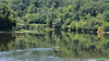


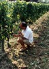

The above images may not be of the site on this page, but were taken nearby. They are loaded from Flickr so please click on them for image credits.
Click here to see more info for this site
Nearby sites
Click here to view sites on an interactive map of the areaKey: Red: member's photo, Blue: 3rd party photo, Yellow: other image, Green: no photo - please go there and take one, Grey: site destroyed
Download sites to:
KML (Google Earth)
GPX (GPS waypoints)
CSV (Garmin/Navman)
CSV (Excel)
To unlock full downloads you need to sign up as a Contributory Member. Otherwise downloads are limited to 50 sites.
Turn off the page maps and other distractions
Nearby sites listing. In the following links * = Image available
1.6km N 354° Menhir de Barbeyrolle* Standing Stone (Menhir)
1.8km N 356° Dolmen de Barbeyrolle Burial Chamber or Dolmen
6.1km WSW 256° Dolmen de Bien Assis* Burial Chamber or Dolmen
7.3km NW 316° Dolmen Pierre Plantade* Burial Chamber or Dolmen
7.7km SSW 201° Dolmen de Goulard* Burial Chamber or Dolmen
7.9km SSW 203° Menhir des Goulards* Standing Stone (Menhir)
13.4km WSW 246° Abri du Morin Cave or Rock Shelter
18.0km NE 41° Menhir de Les Leyches* Standing Stone (Menhir)
19.7km E 96° Peyre Levade Intramuros* Burial Chamber or Dolmen
19.8km E 95° La Peyre de Fonpeyre* Stone Circle
19.9km NNE 30° Dolmen de Drouillas* Burial Chamber or Dolmen
19.9km WNW 287° Pierre Levée (Salles-de-Castillon)* Standing Stone (Menhir)
20.2km WNW 285° Menhir de Clotte Standing Stone (Menhir)
20.2km WNW 284° Dolmen de Puy Landry* Burial Chamber or Dolmen
20.3km E 93° La Peyre du Pont de la Peyre* Standing Stone (Menhir)
20.6km NE 40° Dolmen de La Caze* Burial Chamber or Dolmen
20.7km WNW 286° Peyre Lebade* Standing Stone (Menhir)
21.1km W 279° Pitray Allée couverte* Passage Grave
21.5km ENE 67° Le rocher pointu* Standing Stone (Menhir)
22.0km NNE 20° Dolmen de la Joncasse* Burial Chamber or Dolmen
22.1km ESE 112° Dolmen Peyrelevade de Monbazillac* Burial Chamber or Dolmen
22.3km NNE 31° Grotte de Las Agnelas* Cave or Rock Shelter
22.3km NW 320° Menhir du Pizou* Standing Stone (Menhir)
22.5km NNE 31° Source des Pierres* Holy Well or Sacred Spring
22.6km SSE 157° Pantoufle du Diable* Rock Art
View more nearby sites and additional images


 We would like to know more about this location. Please feel free to add a brief description and any relevant information in your own language.
 Wir möchten mehr über diese Stätte erfahren. Bitte zögern Sie nicht, eine kurze Beschreibung und relevante Informationen in Deutsch hinzuzufügen.
 Nous aimerions en savoir encore un peu sur les lieux. S'il vous plaît n'hesitez pas à ajouter une courte description et tous les renseignements pertinents dans votre propre langue.
 Quisieramos informarnos un poco más de las lugares. No dude en añadir una breve descripción y otros datos relevantes en su propio idioma.