


<< Our Photo Pages >> Harlow Barrow - Round Barrow(s) in England in Essex
Submitted by Thorgrim on Friday, 26 March 2004 Page Views: 8829
Neolithic and Bronze AgeSite Name: Harlow BarrowCountry: England
NOTE: This site is 4.011 km away from the location you searched for.
County: Essex Type: Round Barrow(s)
Nearest Town: Harlow Nearest Village: Old Harlow
Map Ref: TL478112 Landranger Map Number: 167
Latitude: 51.779952N Longitude: 0.141095E
Condition:
| 5 | Perfect |
| 4 | Almost Perfect |
| 3 | Reasonable but with some damage |
| 2 | Ruined but still recognisable as an ancient site |
| 1 | Pretty much destroyed, possibly visible as crop marks |
| 0 | No data. |
| -1 | Completely destroyed |
| 5 | Superb |
| 4 | Good |
| 3 | Ordinary |
| 2 | Not Good |
| 1 | Awful |
| 0 | No data. |
| 5 | Can be driven to, probably with disabled access |
| 4 | Short walk on a footpath |
| 3 | Requiring a bit more of a walk |
| 2 | A long walk |
| 1 | In the middle of nowhere, a nightmare to find |
| 0 | No data. |
| 5 | co-ordinates taken by GPS or official recorded co-ordinates |
| 4 | co-ordinates scaled from a detailed map |
| 3 | co-ordinates scaled from a bad map |
| 2 | co-ordinates of the nearest village |
| 1 | co-ordinates of the nearest town |
| 0 | no data |
Internal Links:
External Links:
")
Bronze Age bowl barrow later used by the Anglo-Saxons as a meeting place (moot hill or mutlow) The Old English word for a mound or barrow which they reused in this way was "hlaew" This has given its name to Harlow.
A footpath off Gilden Way near Old Harlow leads to the barrow which is in a small copse TL 477781120
You may be viewing yesterday's version of this page. To see the most up to date information please register for a free account.
")
Do not use the above information on other web sites or publications without permission of the contributor.
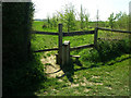
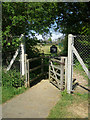
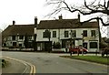
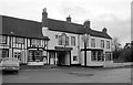
Nearby Images from Geograph Britain and Ireland:
©2007(licence)
©2007(licence)
©2006(licence)
©2012(licence)
©2012(licence)
The above images may not be of the site on this page, they are loaded from Geograph.
Please Submit an Image of this site or go out and take one for us!
Click here to see more info for this site
Nearby sites
Key: Red: member's photo, Blue: 3rd party photo, Yellow: other image, Green: no photo - please go there and take one, Grey: site destroyed
Download sites to:
KML (Google Earth)
GPX (GPS waypoints)
CSV (Garmin/Navman)
CSV (Excel)
To unlock full downloads you need to sign up as a Contributory Member. Otherwise downloads are limited to 50 sites.
Turn off the page maps and other distractions
Nearby sites listing. In the following links * = Image available
71m S 190° Matching Cursus Cursus (TL47791113)
100m W 272° Harlow Cursus Cursus (TL477112)
4.5km SE 131° Magdalen Laver Puddingstone* Marker Stone (TL513083)
4.8km S 176° Canes Puddingstone Marker Stone (TL483064)
5.4km WSW 248° Harlow Puddingstone* Natural Stone / Erratic / Other Natural Feature (TL428090)
5.5km ESE 119° High Laver Puddingstone* Natural Stone / Erratic / Other Natural Feature (TL527087)
5.5km SSW 192° Thornwood Puddingstone Marker Stone (TL468058)
6.8km NNE 14° Wallbury Camp* Hillfort (TL493178)
8.5km SSW 202° Epping Bury puddingstone* Marker Stone (TL44790322)
9.1km SW 218° Parvills Puddingstone* Marker Stone (TL424039)
10.0km N 8° Glasscock Stone* Natural Stone / Erratic / Other Natural Feature (TL4894821169)
10.1km E 100° Beauchamp Roding Puddingstone* Marker Stone (TL578098)
10.1km SE 146° St Andrew’s Church* Museum (TL538030)
10.6km NE 38° Hatfield Forest Puddingstones* Natural Stone / Erratic / Other Natural Feature (TL541198)
10.6km W 279° Emma's Well* Holy Well or Sacred Spring (TL372125)
10.7km NNE 32° Hatfield Forest* Ancient Village or Settlement (TL532204)
10.7km SW 228° Galley Hill Puddingstone Marker Stone (TL400038)
11.0km SSW 211° Upshire Stone* Natural Stone / Erratic / Other Natural Feature (TL424016)
11.5km SSW 202° Ambresbury Banks* Hillfort (TL438004)
11.7km NNW 333° Caley Wood Misc. Earthwork (TL422215)
11.8km SSE 154° Stanford Rivers Stone* Natural Stone / Erratic / Other Natural Feature (TL533008)
11.9km NNE 16° Birchanger* Early Christian Sculptured Stone (TL507228)
12.2km SW 230° Holyfield Puddingstone* Marker Stone (TL38670303)
12.5km SW 230° Monkham Puddingstone Marker Stone (TL384029)
13.0km NE 41° Stansted Airport Stone* Natural Stone / Erratic / Other Natural Feature (TL561212)
View more nearby sites and additional images


 We would like to know more about this location. Please feel free to add a brief description and any relevant information in your own language.
 Wir möchten mehr über diese Stätte erfahren. Bitte zögern Sie nicht, eine kurze Beschreibung und relevante Informationen in Deutsch hinzuzufügen.
 Nous aimerions en savoir encore un peu sur les lieux. S'il vous plaît n'hesitez pas à ajouter une courte description et tous les renseignements pertinents dans votre propre langue.
 Quisieramos informarnos un poco más de las lugares. No dude en añadir una breve descripción y otros datos relevantes en su propio idioma.