 with our Megalithic Portal iPhone app")


<< Other Photo Pages >> Musée d'Histoire Naturelle (Le Havre) - Museum in France in Normandie:Seine-Maritime (76)
Submitted by TheCaptain on Saturday, 16 April 2005 Page Views: 3711
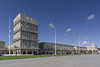
MuseumsSite Name: Musée d'Histoire Naturelle (Le Havre)Country: France Département: Normandie:Seine-Maritime (76) Type: Museum
Nearest Town: Le Havre Nearest Village: Le Havre
Latitude: 49.487651N Longitude: 0.109128E
Condition:
| 5 | Perfect |
| 4 | Almost Perfect |
| 3 | Reasonable but with some damage |
| 2 | Ruined but still recognisable as an ancient site |
| 1 | Pretty much destroyed, possibly visible as crop marks |
| 0 | No data. |
| -1 | Completely destroyed |
| 5 | Superb |
| 4 | Good |
| 3 | Ordinary |
| 2 | Not Good |
| 1 | Awful |
| 0 | No data. |
| 5 | Can be driven to, probably with disabled access |
| 4 | Short walk on a footpath |
| 3 | Requiring a bit more of a walk |
| 2 | A long walk |
| 1 | In the middle of nowhere, a nightmare to find |
| 0 | No data. |
| 5 | co-ordinates taken by GPS or official recorded co-ordinates |
| 4 | co-ordinates scaled from a detailed map |
| 3 | co-ordinates scaled from a bad map |
| 2 | co-ordinates of the nearest village |
| 1 | co-ordinates of the nearest town |
| 0 | no data |
Internal Links:
External Links:
Museum in Seine-Maritime
Address: Place Vieu-Marché, 76600
Phone: 02 35 41 37 28
You may be viewing yesterday's version of this page. To see the most up to date information please register for a free account.
Do not use the above information on other web sites or publications without permission of the contributor.
davidmorgan has found this location on Google Street View:
Nearby Images from Flickr

The above images may not be of the site on this page, but were taken nearby. They are loaded from Flickr so please click on them for image credits.
Click here to see more info for this site
Nearby sites
Click here to view sites on an interactive map of the areaKey: Red: member's photo, Blue: 3rd party photo, Yellow: other image, Green: no photo - please go there and take one, Grey: site destroyed
Download sites to:
KML (Google Earth)
GPX (GPS waypoints)
CSV (Garmin/Navman)
CSV (Excel)
To unlock full downloads you need to sign up as a Contributory Member. Otherwise downloads are limited to 50 sites.
Turn off the page maps and other distractions
Nearby sites listing. In the following links * = Image available
11.8km S 174° Grosse Pierre de la Bergerie* Standing Stone (Menhir)
12.4km S 176° Menhir Couché Lieu Gobin* Standing Stone (Menhir)
14.6km E 87° Camp du César (Sandouville) Ancient Village or Settlement
17.7km E 91° Fort des Carrières Grotte Cave or Rock Shelter
21.4km ESE 117° Monolithe de la Croix-aux-Chiens Standing Stone (Menhir)
31.1km E 84° Roman Theatre (Lillebonne)* Ancient Palace
35.7km NE 37° Camp du Canada* Ancient Village or Settlement
36.7km ENE 75° Château tumulus* Chambered Tomb
37.8km SSW 191° Chateau des Anglais Hillfort
37.9km E 99° Pierre Trouée de l'allée couverte d'Aizier* Passage Grave
38.7km WSW 240° Luc-sur-Mer menhir* Standing Stone (Menhir)
40.9km SW 229° Les Pierres Branlantes* Chambered Tomb
41.1km SSE 165° les Pierres Tremblantes Burial Chamber or Dolmen
41.6km SW 226° Blainville-sur-Orne necropole Barrow Cemetery
43.3km SW 233° Mathieu necropole Barrow Cemetery
44.9km E 92° Le Wuy Menhir* Standing Stone (Menhir)
45.8km WSW 243° Menhir dit Pierre Debout (Reviers)* Standing Stone (Menhir)
46.0km WSW 240° Menhir de la Demoiselle de Bracqueville* Standing Stone (Menhir)
46.1km WSW 236° Les Grosses Devises (E)* Standing Stone (Menhir)
46.4km WSW 237° Les Grosses Devises (W)* Standing Stones
48.0km SW 226° Musée de Normandie* Museum
48.5km WSW 243° Amblie necropole Barrow Cemetery
48.6km WSW 244° Colombiers-sur-Seulles tumulus* Chambered Tomb
48.8km SW 235° Pierre Tourneresse, Cairon* Chambered Tomb
49.4km WSW 245° Menhir des Demoiselles (Colombiers-sur-Seulles)* Standing Stone (Menhir)
View more nearby sites and additional images


 We would like to know more about this location. Please feel free to add a brief description and any relevant information in your own language.
 Wir möchten mehr über diese Stätte erfahren. Bitte zögern Sie nicht, eine kurze Beschreibung und relevante Informationen in Deutsch hinzuzufügen.
 Nous aimerions en savoir encore un peu sur les lieux. S'il vous plaît n'hesitez pas à ajouter une courte description et tous les renseignements pertinents dans votre propre langue.
 Quisieramos informarnos un poco más de las lugares. No dude en añadir una breve descripción y otros datos relevantes en su propio idioma.