

<< Text Pages >> Foxhole Bottom Tumulus - Round Barrow(s) in England in East Sussex
Submitted by coldrum on Wednesday, 23 July 2008 Page Views: 3232
Neolithic and Bronze AgeSite Name: Foxhole Bottom TumulusCountry: England
NOTE: This site is 0.492 km away from the location you searched for.
County: East Sussex Type: Round Barrow(s)
Nearest Town: Seaford
Map Ref: TV526983
Latitude: 50.764229N Longitude: 0.162456E
Condition:
| 5 | Perfect |
| 4 | Almost Perfect |
| 3 | Reasonable but with some damage |
| 2 | Ruined but still recognisable as an ancient site |
| 1 | Pretty much destroyed, possibly visible as crop marks |
| 0 | No data. |
| -1 | Completely destroyed |
| 5 | Superb |
| 4 | Good |
| 3 | Ordinary |
| 2 | Not Good |
| 1 | Awful |
| 0 | No data. |
| 5 | Can be driven to, probably with disabled access |
| 4 | Short walk on a footpath |
| 3 | Requiring a bit more of a walk |
| 2 | A long walk |
| 1 | In the middle of nowhere, a nightmare to find |
| 0 | No data. |
| 5 | co-ordinates taken by GPS or official recorded co-ordinates |
| 4 | co-ordinates scaled from a detailed map |
| 3 | co-ordinates scaled from a bad map |
| 2 | co-ordinates of the nearest village |
| 1 | co-ordinates of the nearest town |
| 0 | no data |
Be the first person to rate this site - see the 'Contribute!' box in the right hand menu.
Internal Links:
External Links:
Round Barrow(s) in East Sussex
Tumulus.
You may be viewing yesterday's version of this page. To see the most up to date information please register for a free account.
Do not use the above information on other web sites or publications without permission of the contributor.
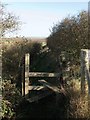
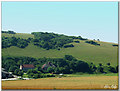
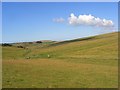
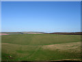
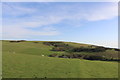
Nearby Images from Geograph Britain and Ireland:
©2013(licence)
©2005(licence)
©2008(licence)
©2013(licence)
©2020(licence)
The above images may not be of the site on this page, they are loaded from Geograph.
Please Submit an Image of this site or go out and take one for us!
Click here to see more info for this site
Nearby sites
Key: Red: member's photo, Blue: 3rd party photo, Yellow: other image, Green: no photo - please go there and take one, Grey: site destroyed
Download sites to:
KML (Google Earth)
GPX (GPS waypoints)
CSV (Garmin/Navman)
CSV (Excel)
To unlock full downloads you need to sign up as a Contributory Member. Otherwise downloads are limited to 50 sites.
Turn off the page maps and other distractions
Nearby sites listing. In the following links * = Image available
2.1km ENE 69° Friston Hill* Artificial Mound (TV545991)
2.5km NNE 20° Manure Barn Long Barrow (TQ53360065)
2.5km NNE 24° Charleston Bottom (Lower Ridge) Bowl Barrow* Artificial Mound (TQ5355600619)
2.5km NNE 24° Charleston Bottom (Lower ridge) Long/oval barrow* Long Barrow (TQ53550064)
2.5km SE 134° Baily's Hill Tumuli* Barrow Cemetery (TV545966)
2.6km NNE 25° Charleston Bottom (Upper Ridge) Field System Misc. Earthwork (TQ53630068)
3.0km NNE 24° Friston Forest* Round Barrow(s) (TQ53760107)
3.0km W 262° Seaford Head Hillfort (TV496978)
3.1km NNW 332° Litlington White Horse* Hill Figure or Geoglyph (TQ51070095)
3.2km W 265° Seaford Head Tumulus* Round Barrow(s) (TV494979)
3.3km NNW 334° Cradle Hill Tumulus* Round Barrow(s) (TQ5103101246)
3.6km NNE 29° Lullington/Clay Bottom* Misc. Earthwork (TQ5424201455)
3.7km NNE 19° Fore Down Tumulus * Round Barrow(s) (TQ53710178)
3.8km NE 40° Clay Bottom Tumulus* Artificial Mound (TQ5491401269)
3.8km NNE 20° Fore Down Cross Dyke* Misc. Earthwork (TQ5376701881)
4.2km SE 128° Belle Tout Tumuli Group* Artificial Mound (TV55949581)
4.2km SE 129° Belle Tout Enclosures* Misc. Earthwork (TV5596895728)
4.3km SE 129° Belle Tout Tumulus Round Barrow(s) (TV560957)
4.4km SE 128° Belle Tout Settlement* Ancient Village or Settlement (TV56109570)
4.4km ENE 67° Willingdon Hill Cross Dyke* Misc. Earthwork (TQ56600017)
4.4km NNE 16° Deap Dean* Barrow Cemetery (TQ537026)
4.5km NE 35° Holt Brow South Tumulus* Artificial Mound (TQ55090205)
4.6km ESE 114° Long Down Tumulus Round Barrow(s) (TV569965)
4.7km NNE 33° Holt Brow Tumulus* Round Barrow(s) (TQ5506802270)
4.7km NNE 17° Deep Dean Tenantry Ground Barrow* Round Barrow(s) (TQ53870282)
View more nearby sites and additional images


 We would like to know more about this location. Please feel free to add a brief description and any relevant information in your own language.
 Wir möchten mehr über diese Stätte erfahren. Bitte zögern Sie nicht, eine kurze Beschreibung und relevante Informationen in Deutsch hinzuzufügen.
 Nous aimerions en savoir encore un peu sur les lieux. S'il vous plaît n'hesitez pas à ajouter une courte description et tous les renseignements pertinents dans votre propre langue.
 Quisieramos informarnos un poco más de las lugares. No dude en añadir una breve descripción y otros datos relevantes en su propio idioma.