


<< Our Photo Pages >> Hermit's Well (East Sussex) - Holy Well or Sacred Spring in England in East Sussex
Submitted by holywell on Saturday, 16 February 2008 Page Views: 14645
Springs and Holy WellsSite Name: Hermit's Well (East Sussex) Alternative Name: Holy well/Wishing wellCountry: England
NOTE: This site is 0.845 km away from the location you searched for.
County: East Sussex Type: Holy Well or Sacred Spring
Nearest Village: High Hurstwood
Map Ref: TQ495250
Latitude: 51.004967N Longitude: 0.129445E
Condition:
| 5 | Perfect |
| 4 | Almost Perfect |
| 3 | Reasonable but with some damage |
| 2 | Ruined but still recognisable as an ancient site |
| 1 | Pretty much destroyed, possibly visible as crop marks |
| 0 | No data. |
| -1 | Completely destroyed |
| 5 | Superb |
| 4 | Good |
| 3 | Ordinary |
| 2 | Not Good |
| 1 | Awful |
| 0 | No data. |
| 5 | Can be driven to, probably with disabled access |
| 4 | Short walk on a footpath |
| 3 | Requiring a bit more of a walk |
| 2 | A long walk |
| 1 | In the middle of nowhere, a nightmare to find |
| 0 | No data. |
| 5 | co-ordinates taken by GPS or official recorded co-ordinates |
| 4 | co-ordinates scaled from a detailed map |
| 3 | co-ordinates scaled from a bad map |
| 2 | co-ordinates of the nearest village |
| 1 | co-ordinates of the nearest town |
| 0 | no data |
Internal Links:
External Links:
I have visited· I would like to visit
SolarMegalith would like to visit
 (PID:24106)")
The well itself is a little overgrown and boggy but the old stones can still be seen to the north of the Hermitage. The well is thought to have curative properties locally.
The site is a private residence, hence I have given only an approximate map reference.
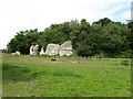
The well lies in the grounds of a series of caves. The age of these caves is not known but the house has been built into them. There is a fire place in one part suggesting that it may have been indeed a hermitage. The Hermit's well lies at the end of the more formal part of the grounds, a far distance from the cave. Very little appears to have been recorded about the well. Until I contacted the owner, she only knew the site as the 'Wishing Well', and that it was where the hermit baptised his converts. Its use as a baptismal site is not referred to by the only other source of information:
‘The well in the orchard in front (and north) of this cell. Half way down the orchard (also called the Vineyard) is the Wishing Well, ten feet in diameter...with steining of rough stone with a few blocks apparently worked, and a gap or opening on the east side, probably the former approach or "dipping place"’.(Hope 1893, p.167)
The site is now considerably overgrown and lies in a small copse. Small saplings have encroached upon the edge of the well. Worked stones can still be seen around the edge of the well, and she informed me that probing it revealed a stone bottom. Sadly, the contents are very murky and black.
The spring water formed a marshy stream which ran down into the paddock, forming four pools. There is a mesolithic site nearby suggesting an ancient origin for the site.
It must be stressed that The Hermitage and wishing well lie on private land, and uninvited guests are not welcomed. However, the owner is proud of the estate she has acquired and hopes to open the site for future Garden Open Days. More details can be read at the Living Spring Journal, from which I have taken the extracts with permission.
You may be viewing yesterday's version of this page. To see the most up to date information please register for a free account.
 (PID:36757)")
 (PID:24202)")
Do not use the above information on other web sites or publications without permission of the contributor.
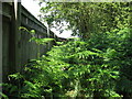
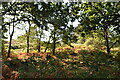
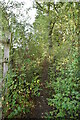
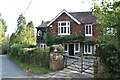
Nearby Images from Geograph Britain and Ireland:
©2010(licence)
©2021(licence)
©2021(licence)
©2021(licence)
©2009(licence)
The above images may not be of the site on this page, they are loaded from Geograph.
Please Submit an Image of this site or go out and take one for us!
Click here to see more info for this site
Nearby sites
Key: Red: member's photo, Blue: 3rd party photo, Yellow: other image, Green: no photo - please go there and take one, Grey: site destroyed
Download sites to:
KML (Google Earth)
GPX (GPS waypoints)
CSV (Garmin/Navman)
CSV (Excel)
To unlock full downloads you need to sign up as a Contributory Member. Otherwise downloads are limited to 50 sites.
Turn off the page maps and other distractions
Nearby sites listing. In the following links * = Image available
4.5km NW 317° Duddleswell Round Barrow(s) (TQ463282)
5.1km NNW 341° Kings Standing* Ancient Village or Settlement (TQ477298)
6.1km WSW 243° Piltdown* Natural Stone / Erratic / Other Natural Feature (TQ441221)
6.5km NW 311° Millbrook Barrow Round Barrow(s) (TQ444291)
6.6km NNW 343° Greenwood Gate Clump Enclosure Ancient Village or Settlement (TQ47373127)
6.8km NNW 338° Peat Lump Hill* Round Barrow(s) (TQ46773120)
7.6km NNW 341° A.A.Milne & E.H.Shephard Memorial* Modern Stone Circle etc (TQ468321)
8.0km NNW 347° Lone Oak Spring Holy Well or Sacred Spring (TQ475328)
8.1km NNW 326° Birch Wood Ironworks Ancient Mine, Quarry or other Industry (TQ448316)
8.6km NW 325° The Park Fort (Ashdown Forest) Hillfort (TQ44373195)
9.4km E 79° St Dunstan's Well Holy Well or Sacred Spring (TQ587271)
9.6km NW 321° Ashdown Forest Centre* Museum (TQ432323)
10.0km NW 308° The Danes Churchyard Ancient Village or Settlement (TQ41343089)
11.4km NE 48° Saxonbury Fort Hillfort (TQ578329)
11.7km NE 40° Eridge Old Park Caves and Spring Cave or Rock Shelter (TQ568342)
12.3km SSW 212° Bridge Farm Romano British settlement site* Ancient Village or Settlement (TQ433144)
13.8km WNW 303° St Mary's Rocks Cave or Rock Shelter (TQ37773226)
13.8km NNE 20° Harness Well Holy Well or Sacred Spring (TQ538381)
14.4km NW 326° Blunds Hole Cave or Rock Shelter (TQ41103670)
14.5km NNE 26° Adam's Well* Holy Well or Sacred Spring (TQ55623820)
14.7km NNE 27° High Rocks Settlement Ancient Village or Settlement (TQ559382)
14.8km NNE 28° High Rocks Hillfort* Hillfort (TQ561383)
14.9km NNE 28° High Rocks Rock Shelters* Cave or Rock Shelter (TQ56093842)
14.9km NW 312° Stone Rocks West Sussex Cave or Rock Shelter (TQ381347)
15.4km SSW 206° Malling Hill Long Barrow Long Barrow (TQ4311810996)
View more nearby sites and additional images


 We would like to know more about this location. Please feel free to add a brief description and any relevant information in your own language.
 Wir möchten mehr über diese Stätte erfahren. Bitte zögern Sie nicht, eine kurze Beschreibung und relevante Informationen in Deutsch hinzuzufügen.
 Nous aimerions en savoir encore un peu sur les lieux. S'il vous plaît n'hesitez pas à ajouter une courte description et tous les renseignements pertinents dans votre propre langue.
 Quisieramos informarnos un poco más de las lugares. No dude en añadir una breve descripción y otros datos relevantes en su propio idioma.