


<< Text Pages >> Chateau des Anglais - Hillfort in France in Normandie:Calvados (14)
Submitted by TheCaptain on Saturday, 16 April 2005 Page Views: 3371
Iron Age and Later PrehistorySite Name: Chateau des AnglaisCountry: France
NOTE: This site is 11.872 km away from the location you searched for.
Département: Normandie:Calvados (14) Type: Hillfort
Nearest Town: Lisieux Nearest Village: Cambremer
Latitude: 49.154000N Longitude: 0.007000E
Condition:
| 5 | Perfect |
| 4 | Almost Perfect |
| 3 | Reasonable but with some damage |
| 2 | Ruined but still recognisable as an ancient site |
| 1 | Pretty much destroyed, possibly visible as crop marks |
| 0 | No data. |
| -1 | Completely destroyed |
| 5 | Superb |
| 4 | Good |
| 3 | Ordinary |
| 2 | Not Good |
| 1 | Awful |
| 0 | No data. |
| 5 | Can be driven to, probably with disabled access |
| 4 | Short walk on a footpath |
| 3 | Requiring a bit more of a walk |
| 2 | A long walk |
| 1 | In the middle of nowhere, a nightmare to find |
| 0 | No data. |
| 5 | co-ordinates taken by GPS or official recorded co-ordinates |
| 4 | co-ordinates scaled from a detailed map |
| 3 | co-ordinates scaled from a bad map |
| 2 | co-ordinates of the nearest village |
| 1 | co-ordinates of the nearest town |
| 0 | no data |
Be the first person to rate this site - see the 'Contribute!' box in the right hand menu.
Internal Links:
External Links:
Hill Fort in Calvados
IMPORTANT NOTE: Positional co-ordinates scaled from a detailed map source
You may be viewing yesterday's version of this page. To see the most up to date information please register for a free account.
Do not use the above information on other web sites or publications without permission of the contributor.
Nearby Images from Flickr
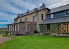
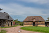
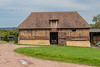
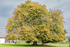
The above images may not be of the site on this page, but were taken nearby. They are loaded from Flickr so please click on them for image credits.
Click here to see more info for this site
Nearby sites
Click here to view sites on an interactive map of the areaKey: Red: member's photo, Blue: 3rd party photo, Yellow: other image, Green: no photo - please go there and take one, Grey: site destroyed
Download sites to:
KML (Google Earth)
GPX (GPS waypoints)
CSV (Garmin/Navman)
CSV (Excel)
To unlock full downloads you need to sign up as a Contributory Member. Otherwise downloads are limited to 50 sites.
Turn off the page maps and other distractions
Nearby sites listing. In the following links * = Image available
15.8km SW 219° La Pierre Cornue* Standing Stone (Menhir)
17.3km SW 215° La Butte du Hu* Chambered Cairn
17.3km SW 215° Tumuli de Condé-sur-Ifs* Chambered Cairn
18.4km E 98° les Pierres Tremblantes Burial Chamber or Dolmen
19.5km SE 142° Pierre Tournante (Livarot)* Standing Stone (Menhir)
24.0km SW 234° Bretteville-le-Rabet* Ancient Mine, Quarry or other Industry
24.2km WNW 290° Blainville-sur-Orne necropole Barrow Cemetery
24.4km SSW 213° Menhir d'Olendon* Standing Stone (Menhir)
25.3km WNW 293° Les Pierres Branlantes* Chambered Tomb
26.0km SW 217° Langrais menhirs* Standing Stones
26.1km NNE 19° Menhir Couché Lieu Gobin* Standing Stone (Menhir)
26.3km SW 219° Mont Joly* Ancient Village or Settlement
26.5km SW 219° Bons Tassilly polissoirs* Polissoir
26.8km NNE 19° Grosse Pierre de la Bergerie* Standing Stone (Menhir)
26.9km W 270° Fleury-sur-Orne necropolis* Barrow Cemetery
27.1km WSW 256° La Hoguette* Chambered Tomb
27.2km W 278° Musée de Normandie* Museum
27.7km WSW 257° La Hogue* Chambered Tomb
28.0km WSW 240° Pierre Tourneresse (Gouvix)* Standing Stone (Menhir)
28.9km SSW 213° Menhir de Soulangy* Standing Stone (Menhir)
29.1km WSW 248° Pierre Tournante (Fresnay-le-Puceux)* Standing Stone (Menhir)
29.5km WNW 292° Mathieu necropole Barrow Cemetery
29.6km SW 234° La Roche Piquée (St-Germain-le-Vasson)* Standing Stone (Menhir)
29.8km W 270° Menhir dit la Pierre Couchée (Louvigny)* Standing Stone (Menhir)
31.2km SW 223° Pierre du Pôt* Standing Stone (Menhir)
View more nearby sites and additional images


 We would like to know more about this location. Please feel free to add a brief description and any relevant information in your own language.
 Wir möchten mehr über diese Stätte erfahren. Bitte zögern Sie nicht, eine kurze Beschreibung und relevante Informationen in Deutsch hinzuzufügen.
 Nous aimerions en savoir encore un peu sur les lieux. S'il vous plaît n'hesitez pas à ajouter une courte description et tous les renseignements pertinents dans votre propre langue.
 Quisieramos informarnos un poco más de las lugares. No dude en añadir una breve descripción y otros datos relevantes en su propio idioma.