


<< Our Photo Pages >> Motte de Ste Christie d'Armagnac - Misc. Earthwork in France in Midi:Gers (32)
Submitted by Nick- on Monday, 10 March 2008 Page Views: 4407
Multi-periodSite Name: Motte de Ste Christie d'ArmagnacCountry: France
NOTE: This site is 18.028 km away from the location you searched for.
Département: Midi:Gers (32) Type: Misc. Earthwork
Nearest Town: Nogaro
Latitude: 43.783890N Longitude: 0.008890E
Condition:
| 5 | Perfect |
| 4 | Almost Perfect |
| 3 | Reasonable but with some damage |
| 2 | Ruined but still recognisable as an ancient site |
| 1 | Pretty much destroyed, possibly visible as crop marks |
| 0 | No data. |
| -1 | Completely destroyed |
| 5 | Superb |
| 4 | Good |
| 3 | Ordinary |
| 2 | Not Good |
| 1 | Awful |
| 0 | No data. |
| 5 | Can be driven to, probably with disabled access |
| 4 | Short walk on a footpath |
| 3 | Requiring a bit more of a walk |
| 2 | A long walk |
| 1 | In the middle of nowhere, a nightmare to find |
| 0 | No data. |
| 5 | co-ordinates taken by GPS or official recorded co-ordinates |
| 4 | co-ordinates scaled from a detailed map |
| 3 | co-ordinates scaled from a bad map |
| 2 | co-ordinates of the nearest village |
| 1 | co-ordinates of the nearest town |
| 0 | no data |
Internal Links:
External Links:
")
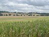
There is a large (aprox. 3 storeys high) mound, sited on a flat grass platform , with a further straight bank to the South (running from West to East). Like all these sort of hilltop sites round here, it was most probably occupied before the Early Middle Ages (English 'dark ages') and was possibly an oppidum /hillfort....
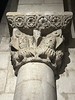
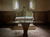
The church is nearby to the East, and the remmants of a medieval castle including a mud brick wall and 18th century(?) timbered (beamed) presbitary, the last two structures being both in rather a dire state....
Satellite photo and map here....
You may be viewing yesterday's version of this page. To see the most up to date information please register for a free account.
")
")
Do not use the above information on other web sites or publications without permission of the contributor.
Nearby Images from Flickr


The above images may not be of the site on this page, but were taken nearby. They are loaded from Flickr so please click on them for image credits.
Click here to see more info for this site
Nearby sites
Click here to view sites on an interactive map of the areaKey: Red: member's photo, Blue: 3rd party photo, Yellow: other image, Green: no photo - please go there and take one, Grey: site destroyed
Download sites to:
KML (Google Earth)
GPX (GPS waypoints)
CSV (Garmin/Navman)
CSV (Excel)
To unlock full downloads you need to sign up as a Contributory Member. Otherwise downloads are limited to 50 sites.
Turn off the page maps and other distractions
Nearby sites listing. In the following links * = Image available
11.1km S 171° St-Go Tumulus* Artificial Mound
11.1km S 190° La Motte castrale de Monterran* Hillfort
12.7km E 99° Dému Tumulus* Artificial Mound
14.3km SE 127° La Salle* Misc. Earthwork
22.6km NE 38° Seviac Villa gallo-romaine* Ancient Village or Settlement
32.1km WSW 257° Peyre Soulle Standing Stone (Menhir)
33.8km W 260° Menhir de Guillay* Standing Stone (Menhir)
33.9km S 180° Oppidum de Sombrum* Hillfort
34.7km W 260° Menhir de Larqué Standing Stone (Menhir)
35.1km W 268° IIème menhirs Standing Stones
35.2km SW 214° Péhau Tumulus* Round Barrow(s)
35.8km W 261° Peyre de Pithié* Passage Grave
37.3km NNE 17° Cromlech de las Naou-Peyros* Stone Circle
37.6km SSW 210° Madaune Tumulus Round Barrow(s)
37.8km NW 315° Treize Pouys Barrow Cemetery
38.1km ESE 104° La Pile d'Ordan-Larroque* Ancient Temple
38.2km SSW 208° Perez Tumulus* Round Barrow(s)
38.3km S 172° Butte temoin de Lafitole* Hillfort
39.2km NNE 15° Allée couverte de Peyre Soule* Passage Grave
39.3km E 100° La pile de Saint-Lary* Ancient Temple
45.6km S 178° Saint-Lezer Gallo-Roman Oppidium Stone Fort or Dun
46.8km E 99° Oppidum de la Sioutat Ancient Village or Settlement
46.8km NNE 29° Allée couverte du Passage de Serbat* Passage Grave
48.4km WSW 259° Peyrelounque* Standing Stone (Menhir)
48.9km NNE 22° Pompiey allée couverte* Passage Grave
View more nearby sites and additional images


 We would like to know more about this location. Please feel free to add a brief description and any relevant information in your own language.
 Wir möchten mehr über diese Stätte erfahren. Bitte zögern Sie nicht, eine kurze Beschreibung und relevante Informationen in Deutsch hinzuzufügen.
 Nous aimerions en savoir encore un peu sur les lieux. S'il vous plaît n'hesitez pas à ajouter une courte description et tous les renseignements pertinents dans votre propre langue.
 Quisieramos informarnos un poco más de las lugares. No dude en añadir una breve descripción y otros datos relevantes en su propio idioma.