 with our Megalithic Portal iPhone app")


<< Text Pages >> Holy well (Barking) - Holy Well or Sacred Spring in England in Greater London
Submitted by HOLYWELL on Monday, 24 January 2011 Page Views: 5198
Springs and Holy WellsSite Name: Holy well (Barking)Country: England
NOTE: This site is 1.512 km away from the location you searched for.
County: Greater London Type: Holy Well or Sacred Spring
Nearest Town: Barking Nearest Village: Loxford
Map Ref: TQ450853
Latitude: 51.547968N Longitude: 0.089799E
Condition:
| 5 | Perfect |
| 4 | Almost Perfect |
| 3 | Reasonable but with some damage |
| 2 | Ruined but still recognisable as an ancient site |
| 1 | Pretty much destroyed, possibly visible as crop marks |
| 0 | No data. |
| -1 | Completely destroyed |
| 5 | Superb |
| 4 | Good |
| 3 | Ordinary |
| 2 | Not Good |
| 1 | Awful |
| 0 | No data. |
| 5 | Can be driven to, probably with disabled access |
| 4 | Short walk on a footpath |
| 3 | Requiring a bit more of a walk |
| 2 | A long walk |
| 1 | In the middle of nowhere, a nightmare to find |
| 0 | No data. |
| 5 | co-ordinates taken by GPS or official recorded co-ordinates |
| 4 | co-ordinates scaled from a detailed map |
| 3 | co-ordinates scaled from a bad map |
| 2 | co-ordinates of the nearest village |
| 1 | co-ordinates of the nearest town |
| 0 | no data |
Internal Links:
External Links:
Holy Well or Sacred Spring in Greater London
In the heart of sub-urban East London is a record of a holy well noted as Halywellbrooke associated with the bridge which would cross Loxford water, south of Ilford Bridge. The rental of 1456 notes ‘pasture lying at the northern head of Luzias land… near Halywell and… at Loxfordbrigge’ and ‘land in Longlond at Halywellbrooke’.
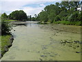
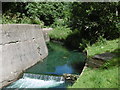
The site does not appear to have survived but there is a pond there which presumably is fed by a spring. There is no map evidence of the exact location however.
You may be viewing yesterday's version of this page. To see the most up to date information please register for a free account.
Do not use the above information on other web sites or publications without permission of the contributor.
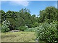
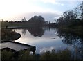
Nearby Images from Geograph Britain and Ireland:
©2016(licence)
©2012(licence)
©2016(licence)
©2016(licence)
©2007(licence)
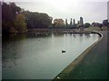
The above images may not be of the site on this page, they are loaded from Geograph.
Please Submit an Image of this site or go out and take one for us!
Click here to see more info for this site
Nearby sites
Key: Red: member's photo, Blue: 3rd party photo, Yellow: other image, Green: no photo - please go there and take one, Grey: site destroyed
Download sites to:
KML (Google Earth)
GPX (GPS waypoints)
CSV (Garmin/Navman)
CSV (Excel)
To unlock full downloads you need to sign up as a Contributory Member. Otherwise downloads are limited to 50 sites.
Turn off the page maps and other distractions
Nearby sites listing. In the following links * = Image available
3.3km ENE 69° Valence House* Museum (TQ4803386569)
4.7km NNE 27° St Chad's Well (Chadwell Heath)* Holy Well or Sacred Spring (TQ4706389580)
7.4km S 176° Winn's Common Tumulus* Round Barrow(s) (TQ457779)
8.0km NW 316° Gipsy Smith* Modern Stone Circle etc (TQ392909)
8.3km S 189° Shrewsbury Tumulus* Round Barrow(s) (TQ439771)
10.2km SW 219° Greenwich Park Barrows* Barrow Cemetery (TQ3883677128)
11.7km NNW 327° Pole Hill* Modern Stone Circle etc (TQ383949)
11.9km WNW 292° St. Eloy's Well* Holy Well or Sacred Spring (TQ338895)
12.4km WSW 250° St Olave's Well* Holy Well or Sacred Spring (TQ335807)
12.5km WSW 250° All Hallows by the Tower* Museum (TQ3337380695)
12.6km NNW 347° Loughton Camp* Hillfort (TQ418975)
12.6km SW 219° Hilly Fields Stone Circle* Modern Stone Circle etc (TQ374752)
13.0km WSW 252° London Stone* Standing Stone (Menhir) (TQ3267680903)
13.2km WSW 253° Mithras Temple (London)* Ancient Temple (TQ3252181031)
13.3km WNW 281° Finsbury Park earthworks* Artificial Mound (TQ3186087537)
13.3km NE 35° Unhenged* Modern Stone Circle etc (TQ5240696410)
13.4km WSW 254° Broken Cross (Westminster) Ancient Cross (TQ322812)
13.4km WSW 255° Museum of London* Museum (TQ321815)
13.5km SSE 159° Cavey's Springs Deneholes Ancient Mine, Quarry or other Industry (TQ502728)
13.6km WSW 257° Cow Cross (Finsbury) Ancient Cross (TQ31788181)
13.7km E 94° St. Cedd's Well (North Ockendon)* Holy Well or Sacred Spring (TQ587848)
13.8km NNW 345° High Beach* Artificial Mound (TQ410985)
13.9km WSW 258° Clerk's Well (Farringdon Lane) Holy Well or Sacred Spring (TQ3145282134)
14.0km E 93° Seven Springs (North Ockendon) Holy Well or Sacred Spring (TQ590850)
14.0km W 259° Skinner's Well (Finsbury) Holy Well or Sacred Spring (TQ313822)
View more nearby sites and additional images


 We would like to know more about this location. Please feel free to add a brief description and any relevant information in your own language.
 Wir möchten mehr über diese Stätte erfahren. Bitte zögern Sie nicht, eine kurze Beschreibung und relevante Informationen in Deutsch hinzuzufügen.
 Nous aimerions en savoir encore un peu sur les lieux. S'il vous plaît n'hesitez pas à ajouter une courte description et tous les renseignements pertinents dans votre propre langue.
 Quisieramos informarnos un poco más de las lugares. No dude en añadir una breve descripción y otros datos relevantes en su propio idioma.