


<< Other Photo Pages >> Cromlech de Gurrundué - Stone Circle in Spain in Aragón
Submitted by holger_rix on Wednesday, 09 December 2015 Page Views: 1736
Neolithic and Bronze AgeSite Name: Cromlech de GurrunduéCountry: Spain Region: Aragón Type: Stone Circle
Nearest Town: Bielsa Nearest Village: Escuain
Latitude: 42.627658N Longitude: 0.117007E
Condition:
| 5 | Perfect |
| 4 | Almost Perfect |
| 3 | Reasonable but with some damage |
| 2 | Ruined but still recognisable as an ancient site |
| 1 | Pretty much destroyed, possibly visible as crop marks |
| 0 | No data. |
| -1 | Completely destroyed |
| 5 | Superb |
| 4 | Good |
| 3 | Ordinary |
| 2 | Not Good |
| 1 | Awful |
| 0 | No data. |
| 5 | Can be driven to, probably with disabled access |
| 4 | Short walk on a footpath |
| 3 | Requiring a bit more of a walk |
| 2 | A long walk |
| 1 | In the middle of nowhere, a nightmare to find |
| 0 | No data. |
| 5 | co-ordinates taken by GPS or official recorded co-ordinates |
| 4 | co-ordinates scaled from a detailed map |
| 3 | co-ordinates scaled from a bad map |
| 2 | co-ordinates of the nearest village |
| 1 | co-ordinates of the nearest town |
| 0 | no data |
Internal Links:
External Links:
I have visited· I would like to visit
43559959 would like to visit
")
You may be viewing yesterday's version of this page. To see the most up to date information please register for a free account.
Do not use the above information on other web sites or publications without permission of the contributor.
Nearby Images from Flickr
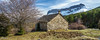
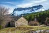
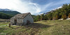
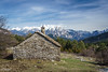
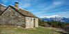
The above images may not be of the site on this page, but were taken nearby. They are loaded from Flickr so please click on them for image credits.
Click here to see more info for this site
Nearby sites
Click here to view sites on an interactive map of the areaKey: Red: member's photo, Blue: 3rd party photo, Yellow: other image, Green: no photo - please go there and take one, Grey: site destroyed
Download sites to:
KML (Google Earth)
GPX (GPS waypoints)
CSV (Garmin/Navman)
CSV (Excel)
To unlock full downloads you need to sign up as a Contributory Member. Otherwise downloads are limited to 50 sites.
Turn off the page maps and other distractions
Nearby sites listing. In the following links * = Image available
6.8km SE 134° Fandichuerre Dolmen* Burial Chamber or Dolmen
7.4km SE 136° Dolmen de Tella* Burial Chamber or Dolmen
14.9km NNE 24° Saux burial chamber* Burial Chamber or Dolmen
18.0km ESE 115° Collado Del Ibón Stone Circle
18.1km ESE 116° Collata De Labasar 7* Stone Circle
18.1km ESE 116° Collata De Labasar 1-6* Stone Circle
22.5km ESE 122° Armeña Túmulo Round Barrow(s)
24.1km ESE 105° Collado de Sahún* Stone Circle
24.6km ESE 105° La Bocona Chromlechs 1+2* Stone Circle
27.7km WNW 302° Los Batanes Túmulo Round Barrow(s)
28.0km WNW 303° Los Batanes Chromlech* Stone Circle
30.2km N 352° Dolmen dit la Cabane du Loup Burial Chamber or Dolmen
30.3km SE 126° Seira Dolmen* Burial Chamber or Dolmen
31.6km N 2° Toue cromlech* Stone Circle
31.9km WNW 284° Ibón De Sabocos Dolmen Burial Chamber or Dolmen
32.0km NE 49° Armenteule Menhir* Standing Stone (Menhir)
32.6km ESE 108° Espía Dolmen* Burial Chamber or Dolmen
33.3km NE 47° Aneran stone* Standing Stone (Menhir)
34.1km NW 310° Pe Det Malh* Stone Circle
35.0km NE 38° Menhir de Bordères-Louron Standing Stone (Menhir)
35.5km NNE 24° Peyre Hicade de Payolle* Standing Stone (Menhir)
35.8km W 276° Dolmen de Santa Elena* Burial Chamber or Dolmen
36.3km S 189° La Capilleta Dolmen* Burial Chamber or Dolmen
36.8km S 187° Pueyoril Dolmen* Burial Chamber or Dolmen
37.1km NNE 19° Le menhir de Campan Standing Stone (Menhir)
View more nearby sites and additional images


 We would like to know more about this location. Please feel free to add a brief description and any relevant information in your own language.
 Wir möchten mehr über diese Stätte erfahren. Bitte zögern Sie nicht, eine kurze Beschreibung und relevante Informationen in Deutsch hinzuzufügen.
 Nous aimerions en savoir encore un peu sur les lieux. S'il vous plaît n'hesitez pas à ajouter une courte description et tous les renseignements pertinents dans votre propre langue.
 Quisieramos informarnos un poco más de las lugares. No dude en añadir una breve descripción y otros datos relevantes en su propio idioma.