

<< Our Photo Pages >> Menhir du Pizou - Standing Stone (Menhir) in France in Aquitaine:Dordogne (24)
Submitted by LaDragonne on Monday, 24 April 2023 Page Views: 246
Neolithic and Bronze AgeSite Name: Menhir du Pizou Alternative Name: Dolmen du Pizou ; Pierre de soins du PizouCountry: France Département: Aquitaine:Dordogne (24) Type: Standing Stone (Menhir)
Nearest Town: Bergerac Nearest Village: Le Pizou
Latitude: 45.022940N Longitude: 0.052710E
Condition:
| 5 | Perfect |
| 4 | Almost Perfect |
| 3 | Reasonable but with some damage |
| 2 | Ruined but still recognisable as an ancient site |
| 1 | Pretty much destroyed, possibly visible as crop marks |
| 0 | No data. |
| -1 | Completely destroyed |
| 5 | Superb |
| 4 | Good |
| 3 | Ordinary |
| 2 | Not Good |
| 1 | Awful |
| 0 | No data. |
| 5 | Can be driven to, probably with disabled access |
| 4 | Short walk on a footpath |
| 3 | Requiring a bit more of a walk |
| 2 | A long walk |
| 1 | In the middle of nowhere, a nightmare to find |
| 0 | No data. |
| 5 | co-ordinates taken by GPS or official recorded co-ordinates |
| 4 | co-ordinates scaled from a detailed map |
| 3 | co-ordinates scaled from a bad map |
| 2 | co-ordinates of the nearest village |
| 1 | co-ordinates of the nearest town |
| 0 | no data |
Internal Links:
External Links:
")
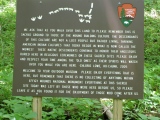
Il s'agit d'un authentique petit menhir de grès poli, une pierre de soins au sommet en cuvette avec une sorte de goulotte d'écoulement. Elle mesure 60cm hors sol sur environ 60 / 70cm de côté.
Ce n'est pas un reste de dolmen. Ce dernier a sans doute été victime des travaux multiples des carriers dans le vallon précité.
You may be viewing yesterday's version of this page. To see the most up to date information please register for a free account.
Do not use the above information on other web sites or publications without permission of the contributor.
Click here to see more info for this site
Nearby sites
Click here to view sites on an interactive map of the areaKey: Red: member's photo, Blue: 3rd party photo, Yellow: other image, Green: no photo - please go there and take one, Grey: site destroyed
Download sites to:
KML (Google Earth)
GPX (GPS waypoints)
CSV (Garmin/Navman)
CSV (Excel)
To unlock full downloads you need to sign up as a Contributory Member. Otherwise downloads are limited to 50 sites.
Turn off the page maps and other distractions
Nearby sites listing. In the following links * = Image available
12.3km SSW 203° Pierre Levée (Salles-de-Castillon)* Standing Stone (Menhir)
12.7km SSW 206° Peyre Lebade* Standing Stone (Menhir)
13.1km SSW 203° Menhir de Clotte Standing Stone (Menhir)
13.3km SSW 204° Dolmen de Puy Landry* Burial Chamber or Dolmen
15.1km SE 142° Dolmen Pierre Plantade* Burial Chamber or Dolmen
15.2km SW 235° Le Megalithe de Picampeau a Lussac* Rock Art
15.3km SSW 205° Pitray Allée couverte* Passage Grave
20.5km SSE 156° Dolmen de Bien Assis* Burial Chamber or Dolmen
20.9km SE 137° Dolmen de Barbeyrolle Burial Chamber or Dolmen
21.0km SE 138° Menhir de Barbeyrolle* Standing Stone (Menhir)
22.0km E 81° Dolmen de la Joncasse* Burial Chamber or Dolmen
22.3km SE 140° Tumulus de Malivert* Artificial Mound
22.7km S 175° Abri du Morin Cave or Rock Shelter
24.2km E 81° Menhir de la Croix Blanche* Standing Stone (Menhir)
24.3km E 90° Dolmen de Drouillas* Burial Chamber or Dolmen
25.1km SW 234° Peyrefitte* Standing Stone (Menhir)
25.6km NE 39° Les Pierres Noires* Stone Row / Alignment
25.9km E 86° Grotte de Las Agnelas* Cave or Rock Shelter
25.9km E 85° Source des Pierres* Holy Well or Sacred Spring
26.4km WSW 243° Menhir de Carré Standing Stone (Menhir)
26.4km E 98° Menhir de Les Leyches* Standing Stone (Menhir)
26.8km SSE 155° Menhir des Goulards* Standing Stone (Menhir)
26.9km SSE 155° Dolmen de Goulard* Burial Chamber or Dolmen
27.6km E 93° Dolmen de La Caze* Burial Chamber or Dolmen
29.1km NW 321° La Pierre Folle (Montguyon)* Passage Grave
View more nearby sites and additional images


 We would like to know more about this location. Please feel free to add a brief description and any relevant information in your own language.
 Wir möchten mehr über diese Stätte erfahren. Bitte zögern Sie nicht, eine kurze Beschreibung und relevante Informationen in Deutsch hinzuzufügen.
 Nous aimerions en savoir encore un peu sur les lieux. S'il vous plaît n'hesitez pas à ajouter une courte description et tous les renseignements pertinents dans votre propre langue.
 Quisieramos informarnos un poco más de las lugares. No dude en añadir una breve descripción y otros datos relevantes en su propio idioma.