

<< Other Photo Pages >> Atzompa - Ancient Village or Settlement in Mexico
Submitted by bat400 on Wednesday, 25 July 2012 Page Views: 13513
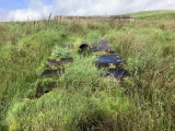
Multi-periodSite Name: AtzompaCountry: Mexico
NOTE: This site is 43.582 km away from the location you searched for.
Type: Ancient Village or Settlement
Nearest Town: Oaxaca, Mexico
Latitude: 17.079100N Longitude: 96.7828W
Condition:
| 5 | Perfect |
| 4 | Almost Perfect |
| 3 | Reasonable but with some damage |
| 2 | Ruined but still recognisable as an ancient site |
| 1 | Pretty much destroyed, possibly visible as crop marks |
| 0 | No data. |
| -1 | Completely destroyed |
| 5 | Superb |
| 4 | Good |
| 3 | Ordinary |
| 2 | Not Good |
| 1 | Awful |
| 0 | No data. |
| 5 | Can be driven to, probably with disabled access |
| 4 | Short walk on a footpath |
| 3 | Requiring a bit more of a walk |
| 2 | A long walk |
| 1 | In the middle of nowhere, a nightmare to find |
| 0 | No data. |
| 5 | co-ordinates taken by GPS or official recorded co-ordinates |
| 4 | co-ordinates scaled from a detailed map |
| 3 | co-ordinates scaled from a bad map |
| 2 | co-ordinates of the nearest village |
| 1 | co-ordinates of the nearest town |
| 0 | no data |
Internal Links:
External Links:
I have visited· I would like to visit
Andy B has visited here
")
The site is now open to the public.
Note: Mexican archaeologists unearth 1100-year-old burial chamber in extraordinary condition
You may be viewing yesterday's version of this page. To see the most up to date information please register for a free account.
")
")
")
")
")
")
")
")
Do not use the above information on other web sites or publications without permission of the contributor.
Click here to see more info for this site
Nearby sites
Click here to view sites on an interactive map of the areaKey: Red: member's photo, Blue: 3rd party photo, Yellow: other image, Green: no photo - please go there and take one, Grey: site destroyed
Download sites to:
KML (Google Earth)
GPX (GPS waypoints)
CSV (Garmin/Navman)
CSV (Excel)
To unlock full downloads you need to sign up as a Contributory Member. Otherwise downloads are limited to 50 sites.
Turn off the page maps and other distractions
Nearby sites listing. In the following links * = Image available
4.2km SSE 158° Monte Alban* Ancient Village or Settlement
24.2km SSE 158° El Palenque Ancient Village or Settlement
25.4km ESE 109° Dainzu* Ancient Village or Settlement
33.1km ESE 111° Lambityeco* Ancient Village or Settlement
37.9km ESE 111° Yagul* Ancient Village or Settlement
48.1km ESE 111° Mitla* Ancient Village or Settlement
88.9km WNW 290° Tayata Ancient Village or Settlement
163.2km SSE 151° Copalita Eco-Archaeological Park Museum
163.8km NNW 339° Ndachjian-Tehuacán* Ancient Village or Settlement
198.6km NNW 330° Teteles de Santo Nombre* Ancient Village or Settlement
211.1km NE 42° Tres Zapotes* Ancient Village or Settlement
219.8km NE 45° La Cobata* Sculptured Stone
224.5km ENE 72° El Azuzul* Pyramid / Mastaba
227.1km ENE 71° San Lorenzo Tenochtitlán Museum* Museum
242.5km ENE 65° Cascajal Artificial Mound
244.2km NNE 17° Isla de Sacrificios* Ancient Temple
249.5km NNE 13° Zempoala* Ancient Village or Settlement
251.8km W 279° Grottos of Juxtlahuaca Cave or Rock Shelter
272.5km NW 324° Cholula* Pyramid / Mastaba
275.3km N 357° Museo de Antropologia de Xalapa* Museum
275.4km NW 310° Chalcatzingo* Rock Art
290.7km N 8° Quiahuiztlan* Rock Cut Tomb
291.9km NW 326° Cacaxtla* Ancient Village or Settlement
292.2km NW 326° Xochitecatl* Pyramid / Mastaba
312.1km ENE 68° La Venta.* Ancient Village or Settlement
View more nearby sites and additional images


 We would like to know more about this location. Please feel free to add a brief description and any relevant information in your own language.
 Wir möchten mehr über diese Stätte erfahren. Bitte zögern Sie nicht, eine kurze Beschreibung und relevante Informationen in Deutsch hinzuzufügen.
 Nous aimerions en savoir encore un peu sur les lieux. S'il vous plaît n'hesitez pas à ajouter une courte description et tous les renseignements pertinents dans votre propre langue.
 Quisieramos informarnos un poco más de las lugares. No dude en añadir una breve descripción y otros datos relevantes en su propio idioma.