 with our Megalithic Portal iPhone app")

<< Other Photo Pages >> Itasca Bison Kill - Natural Stone / Erratic / Other Natural Feature in United States in The Plains
Submitted by bat400 on Tuesday, 14 September 2010 Page Views: 5308
Natural PlacesSite Name: Itasca Bison KillCountry: United States
NOTE: This site is 106.619 km away from the location you searched for.
Region: The Plains Type: Natural Stone / Erratic / Other Natural Feature
Nearest Town: Bemidji, MN
Latitude: 47.194000N Longitude: 95.231W
Condition:
| 5 | Perfect |
| 4 | Almost Perfect |
| 3 | Reasonable but with some damage |
| 2 | Ruined but still recognisable as an ancient site |
| 1 | Pretty much destroyed, possibly visible as crop marks |
| 0 | No data. |
| -1 | Completely destroyed |
| 5 | Superb |
| 4 | Good |
| 3 | Ordinary |
| 2 | Not Good |
| 1 | Awful |
| 0 | No data. |
| 5 | Can be driven to, probably with disabled access |
| 4 | Short walk on a footpath |
| 3 | Requiring a bit more of a walk |
| 2 | A long walk |
| 1 | In the middle of nowhere, a nightmare to find |
| 0 | No data. |
| 5 | co-ordinates taken by GPS or official recorded co-ordinates |
| 4 | co-ordinates scaled from a detailed map |
| 3 | co-ordinates scaled from a bad map |
| 2 | co-ordinates of the nearest village |
| 1 | co-ordinates of the nearest town |
| 0 | no data |
Internal Links:
External Links:
")
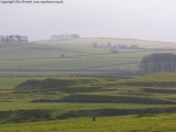
Exact location not known. Part of Itasca State Park.
You may be viewing yesterday's version of this page. To see the most up to date information please register for a free account.
Do not use the above information on other web sites or publications without permission of the contributor.
Nearby Images from Flickr
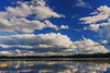
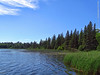
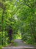
The above images may not be of the site on this page, but were taken nearby. They are loaded from Flickr so please click on them for image credits.
Click here to see more info for this site
Nearby sites
Click here to view sites on an interactive map of the areaKey: Red: member's photo, Blue: 3rd party photo, Yellow: other image, Green: no photo - please go there and take one, Grey: site destroyed
Download sites to:
KML (Google Earth)
GPX (GPS waypoints)
CSV (Garmin/Navman)
CSV (Excel)
To unlock full downloads you need to sign up as a Contributory Member. Otherwise downloads are limited to 50 sites.
Turn off the page maps and other distractions
Nearby sites listing. In the following links * = Image available
5.7km NNE 21° Itasca Burial Mounds* Barrow Cemetery
182.5km NNE 27° Manitou Mounds* Barrow Cemetery
185.8km NE 37° Grand Mound* Artificial Mound
192.6km NE 39° McKinstry Mounds* Artificial Mound
199.7km W 264° Standing Rock State Historic Site* Artificial Mound
222.7km SSE 147° Mahnomen Mounds Barrow Cemetery
241.1km ENE 57° Backcountry cache Ancient Mine, Quarry or other Industry
262.3km SE 129° Trade Lake Mound* Artificial Mound
266.2km S 185° Peterson Bison Kill Natural Stone / Erratic / Other Natural Feature
301.0km SE 145° Indian Mounds Regional Park* Artificial Mound
317.5km SE 143° Rattlesnake Mound Artificial Mound
325.8km N 355° Bannock Point Petroforms* Stone Row / Alignment
345.2km S 178° Jeffers Petroglyphs* Rock Art
356.3km SE 143° Bow and Arrow Rock Art
363.7km SSW 194° Pipestone National Monument Ancient Mine, Quarry or other Industry
396.6km SSW 191° Blue Mounds Equinox Stone Alignment Stone Row / Alignment
428.3km SSW 195° Blood Run Rock Art
430.3km W 268° Double Ditch State Historic Site* Ancient Village or Settlement
441.7km SSW 211° Mitchell Site* Ancient Village or Settlement
453.1km ENE 78° Triangle Island Mound, Isle Royale* Artificial Mound
494.8km S 183° Sanford Museum* Museum
499.2km SE 133° Fort McCoy Artificial Mound
500.9km S 183° Pilot Rock (Cherokee)* Natural Stone / Erratic / Other Natural Feature
517.7km SE 142° Fish Farm Mounds State Preserve Artificial Mound
523.9km SE 128° Cranberry Creek Mound Group Artificial Mound
View more nearby sites and additional images


 We would like to know more about this location. Please feel free to add a brief description and any relevant information in your own language.
 Wir möchten mehr über diese Stätte erfahren. Bitte zögern Sie nicht, eine kurze Beschreibung und relevante Informationen in Deutsch hinzuzufügen.
 Nous aimerions en savoir encore un peu sur les lieux. S'il vous plaît n'hesitez pas à ajouter une courte description et tous les renseignements pertinents dans votre propre langue.
 Quisieramos informarnos un poco más de las lugares. No dude en añadir una breve descripción y otros datos relevantes en su propio idioma.