


<< Other Photo Pages >> Trade Lake Mound - Artificial Mound in United States in Great Lakes Midwest
Submitted by AKFisher on Thursday, 27 July 2023 Page Views: 177
Pre-ColumbianSite Name: Trade Lake MoundCountry: United States
NOTE: This site is 25.062 km away from the location you searched for.
Region: Great Lakes Midwest Type: Artificial Mound
Nearest Town: Trade Lake, WI
Latitude: 45.678940N Longitude: 92.60697W
Condition:
| 5 | Perfect |
| 4 | Almost Perfect |
| 3 | Reasonable but with some damage |
| 2 | Ruined but still recognisable as an ancient site |
| 1 | Pretty much destroyed, possibly visible as crop marks |
| 0 | No data. |
| -1 | Completely destroyed |
| 5 | Superb |
| 4 | Good |
| 3 | Ordinary |
| 2 | Not Good |
| 1 | Awful |
| 0 | No data. |
| 5 | Can be driven to, probably with disabled access |
| 4 | Short walk on a footpath |
| 3 | Requiring a bit more of a walk |
| 2 | A long walk |
| 1 | In the middle of nowhere, a nightmare to find |
| 0 | No data. |
| 5 | co-ordinates taken by GPS or official recorded co-ordinates |
| 4 | co-ordinates scaled from a detailed map |
| 3 | co-ordinates scaled from a bad map |
| 2 | co-ordinates of the nearest village |
| 1 | co-ordinates of the nearest town |
| 0 | no data |
Internal Links:
External Links:
")
No other data available ~ please contribute!
More reading and information:
https://search.library.wisc.edu/digital/ABVKND6C74CJA29B
Directions: From Minneapolis ~ via I35 W and N, 88 mi near town of Trade Lake. Site is to the west of the lake.
You may be viewing yesterday's version of this page. To see the most up to date information please register for a free account.
Do not use the above information on other web sites or publications without permission of the contributor.
Nearby Images from Flickr
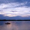
The above images may not be of the site on this page, but were taken nearby. They are loaded from Flickr so please click on them for image credits.
Click here to see more info for this site
Nearby sites
Click here to view sites on an interactive map of the areaKey: Red: member's photo, Blue: 3rd party photo, Yellow: other image, Green: no photo - please go there and take one, Grey: site destroyed
Download sites to:
KML (Google Earth)
GPX (GPS waypoints)
CSV (Garmin/Navman)
CSV (Excel)
To unlock full downloads you need to sign up as a Contributory Member. Otherwise downloads are limited to 50 sites.
Turn off the page maps and other distractions
Nearby sites listing. In the following links * = Image available
86.9km WSW 257° Mahnomen Mounds Barrow Cemetery
87.8km S 189° Rattlesnake Mound Artificial Mound
88.8km SSW 203° Indian Mounds Regional Park* Artificial Mound
119.5km S 176° Bow and Arrow Rock Art
238.4km SE 140° Fort McCoy Artificial Mound
249.1km WSW 248° Peterson Bison Kill Natural Stone / Erratic / Other Natural Feature
261.2km SW 228° Jeffers Petroglyphs* Rock Art
261.6km SE 129° Cranberry Creek Mound Group Artificial Mound
262.3km NW 311° Itasca Bison Kill* Natural Stone / Erratic / Other Natural Feature
264.1km NW 312° Itasca Burial Mounds* Barrow Cemetery
268.6km SSE 156° Fish Farm Mounds State Preserve Artificial Mound
295.0km SSE 149° Tainter Cave Cave or Rock Shelter
295.6km N 2° Backcountry cache Ancient Mine, Quarry or other Industry
306.6km SSE 155° Larsen Cave, Crawford Co* Rock Art
309.3km SSE 158° Effigy Mounds National Monument* Artificial Mound
322.9km SSE 158° Wyalusing Mounds* Artificial Mound
324.6km NNW 347° McKinstry Mounds* Artificial Mound
326.3km NNW 346° Grand Mound* Artificial Mound
336.6km SE 135° Man Mound Park* Artificial Mound
340.5km SE 137° Devil's Lake Mounds* Artificial Mound
346.6km WSW 239° Pipestone National Monument Ancient Mine, Quarry or other Industry
348.7km NNW 342° Manitou Mounds* Barrow Cemetery
351.2km NE 45° Triangle Island Mound, Isle Royale* Artificial Mound
359.5km SW 233° Blue Mounds Equinox Stone Alignment Stone Row / Alignment
361.4km SE 142° Brighid's Spring at Circle Sanctuary* Holy Well or Sacred Spring
View more nearby sites and additional images


 We would like to know more about this location. Please feel free to add a brief description and any relevant information in your own language.
 Wir möchten mehr über diese Stätte erfahren. Bitte zögern Sie nicht, eine kurze Beschreibung und relevante Informationen in Deutsch hinzuzufügen.
 Nous aimerions en savoir encore un peu sur les lieux. S'il vous plaît n'hesitez pas à ajouter une courte description et tous les renseignements pertinents dans votre propre langue.
 Quisieramos informarnos un poco más de las lugares. No dude en añadir una breve descripción y otros datos relevantes en su propio idioma.