<< Other Photo Pages >> Dunn Mounds - Artificial Mound in United States in The South
Submitted by stonetracker on Friday, 03 February 2023 Page Views: 1431
Pre-ColumbianSite Name: Dunn MoundsCountry: United States
NOTE: This site is 9.123 km away from the location you searched for.
Region: The South Type: Artificial Mound
Nearest Town: Clarksdale MS
Latitude: 34.216130N Longitude: 90.47574W
Condition:
| 5 | Perfect |
| 4 | Almost Perfect |
| 3 | Reasonable but with some damage |
| 2 | Ruined but still recognisable as an ancient site |
| 1 | Pretty much destroyed, possibly visible as crop marks |
| 0 | No data. |
| -1 | Completely destroyed |
| 5 | Superb |
| 4 | Good |
| 3 | Ordinary |
| 2 | Not Good |
| 1 | Awful |
| 0 | No data. |
| 5 | Can be driven to, probably with disabled access |
| 4 | Short walk on a footpath |
| 3 | Requiring a bit more of a walk |
| 2 | A long walk |
| 1 | In the middle of nowhere, a nightmare to find |
| 0 | No data. |
| 5 | co-ordinates taken by GPS or official recorded co-ordinates |
| 4 | co-ordinates scaled from a detailed map |
| 3 | co-ordinates scaled from a bad map |
| 2 | co-ordinates of the nearest village |
| 1 | co-ordinates of the nearest town |
| 0 | no data |
Internal Links:
External Links:
I have visited· I would like to visit
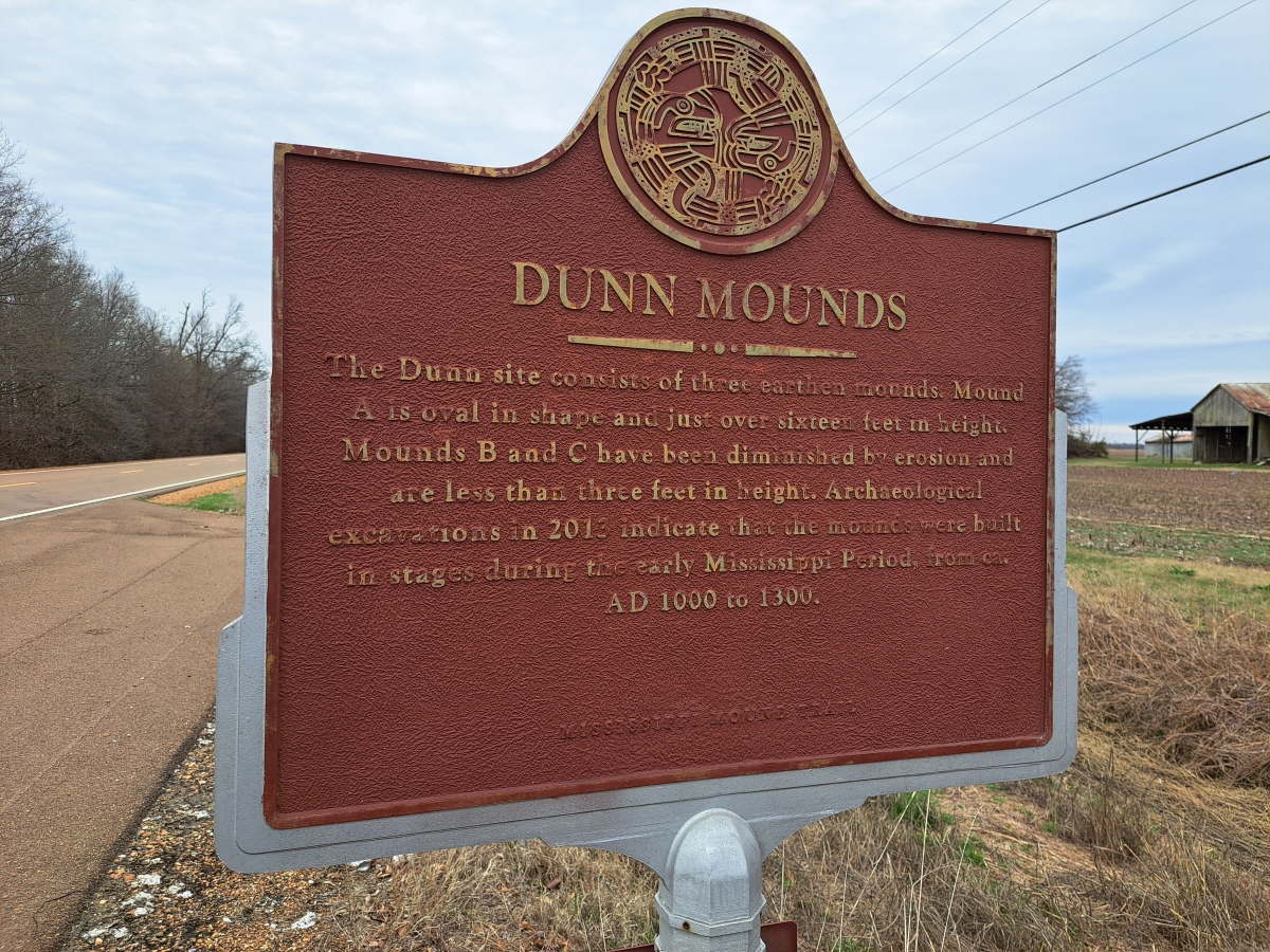
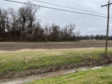
stonetracker saw from a distance on 1st Feb 2024 - their rating: Cond: 3 Amb: 3 All of the mounds are on private residential property and farm land, so viewing is only possible from a distance. There is a parking pulloff next to the interpretive sign about 200 yds north of Mound A and considerably farther away from the other mounds.
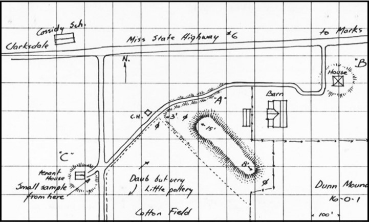
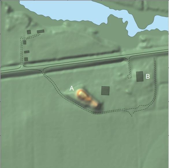
Mound A is easily visible although quite overgrown, even in winter. A house sits on a very low rise which is presumably Mound B. I was unable to locate Mound C in the farm field.

Visible from State Highway 6, the Dunn site consists of three earthen mounds. Mound A, the largest, has an unusual elongated oval shape and varies considerably in summit height. The northwestern portion of the mound is just over 16 feet tall, while the southeastern portion is a little over half that. Mounds B and C have been diminished by erosion and are currently less than three feet in height. In 2013, professional archaeologists excavated a portion of the northwestern slope of Mound A. They found that the mound was built in two stages - a broad flat apron topped by a long narrow second construction stage. Large amounts of structural debris were present in the upper levels of the mound slope, suggesting that a building located on the mound summit was pushed over the edge of the mound after its destruction. Pottery and other artifacts recovered from the site indicate that Native American people built the mounds during the Early Mississippi Period or perhaps a bit earlier, from ca. AD 1000-1300.
Location of coordinates is Mound A.
For more info, see trails.mdah.ms.gov/mmt/dunn/index.html#
You may be viewing yesterday's version of this page. To see the most up to date information please register for a free account.

Do not use the above information on other web sites or publications without permission of the contributor.
Click here to see more info for this site
Nearby sites
Click here to view sites on an interactive map of the areaKey: Red: member's photo, Blue: 3rd party photo, Yellow: other image, Green: no photo - please go there and take one, Grey: site destroyed
Download sites to:
KML (Google Earth)
GPX (GPS waypoints)
CSV (Garmin/Navman)
CSV (Excel)
To unlock full downloads you need to sign up as a Contributory Member. Otherwise downloads are limited to 50 sites.
Turn off the page maps and other distractions
Nearby sites listing. In the following links * = Image available
9.6km N 4° Alcorn Cemetery Mound* Artificial Mound
18.0km N 356° Salomon Mounds* Artificial Mound
20.9km WNW 295° Carson Mounds* Artificial Mound
23.7km N 3° Barbee Mound* Artificial Mound
27.8km WSW 240° Alligator Mounds (Clarksdale)* Artificial Mound
36.7km N 0° West Mounds* Artificial Mound
46.5km N 9° Beaverdam Mounds* Artificial Mound
47.6km N 9° Evansville Mounds* Artificial Mound
52.7km ENE 74° Batesville Mounds* Artificial Mound
59.2km N 10° Johnson Cemetery Mound* Artificial Mound
63.0km N 9° Hollywood Mounds* Artificial Mound
67.6km N 7° Commerce Mounds* Artificial Mound
68.0km SW 223° Christmas Mound* Artificial Mound
72.4km WSW 254° Menard-Hodges Site* Artificial Mound
76.3km SSW 205° Carter Mounds* Artificial Mound
87.9km NNE 18° Cheatham Mound* Artificial Mound
89.6km NNE 15° Edgefield Mounds* Artificial Mound
96.2km SSW 210° Metcalfe Mounds Artificial Mound
96.6km SSW 204° Leland Mounds* Artificial Mound
97.6km SSW 204° Stoneville Mounds Artificial Mound
97.6km SW 214° Winterville* Artificial Mound
99.3km NNE 18° Chucalissa Prehistoric Indian Village* Museum
107.3km NNE 20° Chickasaw Heritage Park* Artificial Mound
108.9km S 181° Jaketown* Artificial Mound
114.4km SSW 199° Arcola Mounds* Artificial Mound
View more nearby sites and additional images


 We would like to know more about this location. Please feel free to add a brief description and any relevant information in your own language.
 Wir möchten mehr über diese Stätte erfahren. Bitte zögern Sie nicht, eine kurze Beschreibung und relevante Informationen in Deutsch hinzuzufügen.
 Nous aimerions en savoir encore un peu sur les lieux. S'il vous plaît n'hesitez pas à ajouter une courte description et tous les renseignements pertinents dans votre propre langue.
 Quisieramos informarnos un poco más de las lugares. No dude en añadir una breve descripción y otros datos relevantes en su propio idioma.