


<< Our Photo Pages >> Berry Cemetery Mound - Artificial Mound in United States in The South
Submitted by stonetracker on Thursday, 14 March 2024 Page Views: 66
Multi-periodSite Name: Berry Cemetery MoundCountry: United States
NOTE: This site is 15.04 km away from the location you searched for.
Region: The South Type: Artificial Mound
Nearest Town: Earle AR
Latitude: 35.297190N Longitude: 90.46697W
Condition:
| 5 | Perfect |
| 4 | Almost Perfect |
| 3 | Reasonable but with some damage |
| 2 | Ruined but still recognisable as an ancient site |
| 1 | Pretty much destroyed, possibly visible as crop marks |
| 0 | No data. |
| -1 | Completely destroyed |
| 5 | Superb |
| 4 | Good |
| 3 | Ordinary |
| 2 | Not Good |
| 1 | Awful |
| 0 | No data. |
| 5 | Can be driven to, probably with disabled access |
| 4 | Short walk on a footpath |
| 3 | Requiring a bit more of a walk |
| 2 | A long walk |
| 1 | In the middle of nowhere, a nightmare to find |
| 0 | No data. |
| 5 | co-ordinates taken by GPS or official recorded co-ordinates |
| 4 | co-ordinates scaled from a detailed map |
| 3 | co-ordinates scaled from a bad map |
| 2 | co-ordinates of the nearest village |
| 1 | co-ordinates of the nearest town |
| 0 | no data |
Internal Links:
External Links:
I have visited· I would like to visit
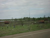
stonetracker visited on 1st Feb 2024 - their rating: Cond: 2 Amb: 3 There is no official parking for this site. On-street only. The mound is very visible about 100 yds from the road in a private farm field.
")
The Berry Cemetery Mound is listed as one of the smaller satellite village sites built during the Parkin phase of the Late Mississippian period (1400-1700 CE). Most of these village sites are located along either the St. Francis or Tyronza Rivers.
Note: The paramount mound site is located at Parkin Archaeological Park near the confluence of these two rivers.
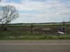
Most but not all of these smaller sites had at least one mound, a habitation area, and a surrounding palisade and moat. Although I do not have definitive proof, I believe the Berry Cemetery Mound matches the approximate location shown on maps and is the only "moundlike" feature that I know of in the immediate area.
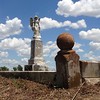
It is a low mound in a farm field with a historic cemetery on top.
For more on the villages and the Parkin Phase culture, see:
en.wikipedia.org/wiki/Parkin_Archeological_State_Park#Culture_of_the_Parkin_phase
You may be viewing yesterday's version of this page. To see the most up to date information please register for a free account.
")
Do not use the above information on other web sites or publications without permission of the contributor.
Nearby Images from Flickr
The above images may not be of the site on this page, but were taken nearby. They are loaded from Flickr so please click on them for image credits.
Click here to see more info for this site
Nearby sites
Click here to view sites on an interactive map of the areaKey: Red: member's photo, Blue: 3rd party photo, Yellow: other image, Green: no photo - please go there and take one, Grey: site destroyed
Download sites to:
KML (Google Earth)
GPX (GPS waypoints)
CSV (Garmin/Navman)
CSV (Excel)
To unlock full downloads you need to sign up as a Contributory Member. Otherwise downloads are limited to 50 sites.
Turn off the page maps and other distractions
Nearby sites listing. In the following links * = Image available
5.1km NNE 25° Richard's Bridge* Ancient Village or Settlement
8.5km WSW 255° Parkin* Ancient Village or Settlement
40.3km SE 130° Chucalissa Prehistoric Indian Village* Museum
40.7km ESE 118° Chickasaw Heritage Park* Artificial Mound
40.9km SE 146° Edgefield Mounds* Artificial Mound
45.2km SE 144° Cheatham Mound* Artificial Mound
49.2km NE 52° Hampson* Museum
53.7km S 172° Commerce Mounds* Artificial Mound
55.8km NE 52° Nodena Site* Ancient Village or Settlement
58.6km S 171° Hollywood Mounds* Artificial Mound
62.6km S 172° Johnson Cemetery Mound* Artificial Mound
73.5km S 175° Evansville Mounds* Artificial Mound
74.6km S 175° Beaverdam Mounds* Artificial Mound
83.5km S 180° West Mounds* Artificial Mound
85.7km NE 34° Chickasawba Mound* Artificial Mound
96.5km S 180° Barbee Mound* Artificial Mound
102.3km S 181° Salomon Mounds* Artificial Mound
110.7km S 180° Alcorn Cemetery Mound* Artificial Mound
113.2km S 190° Carson Mounds* Artificial Mound
116.7km SSE 155° Batesville Mounds* Artificial Mound
120.2km S 180° Dunn Mounds* Artificial Mound
136.5km S 191° Alligator Mounds (Clarksdale)* Artificial Mound
156.7km SSW 207° Menard-Hodges Site* Artificial Mound
162.2km E 82° Pinson Mounds - Twin Mounds* Artificial Mound
162.3km E 82° Pinson Mounds - Ozier Mound* Artificial Mound
View more nearby sites and additional images


 We would like to know more about this location. Please feel free to add a brief description and any relevant information in your own language.
 Wir möchten mehr über diese Stätte erfahren. Bitte zögern Sie nicht, eine kurze Beschreibung und relevante Informationen in Deutsch hinzuzufügen.
 Nous aimerions en savoir encore un peu sur les lieux. S'il vous plaît n'hesitez pas à ajouter une courte description et tous les renseignements pertinents dans votre propre langue.
 Quisieramos informarnos un poco más de las lugares. No dude en añadir una breve descripción y otros datos relevantes en su propio idioma.