 with our Megalithic Portal iPhone app")


<< Text Pages >> Dough - Stone Circle in Ireland (Republic of) in Co. Cork
Submitted by Anonymous on Monday, 14 October 2002 Page Views: 5673
Neolithic and Bronze AgeSite Name: DoughCountry: Ireland (Republic of) County: Co. Cork Type: Stone Circle
Map Ref: V784256
Discovery Map Number: D88
Latitude: 51.470623N Longitude: 9.750736W
Condition:
| 5 | Perfect |
| 4 | Almost Perfect |
| 3 | Reasonable but with some damage |
| 2 | Ruined but still recognisable as an ancient site |
| 1 | Pretty much destroyed, possibly visible as crop marks |
| 0 | No data. |
| -1 | Completely destroyed |
| 5 | Superb |
| 4 | Good |
| 3 | Ordinary |
| 2 | Not Good |
| 1 | Awful |
| 0 | No data. |
| 5 | Can be driven to, probably with disabled access |
| 4 | Short walk on a footpath |
| 3 | Requiring a bit more of a walk |
| 2 | A long walk |
| 1 | In the middle of nowhere, a nightmare to find |
| 0 | No data. |
| 5 | co-ordinates taken by GPS or official recorded co-ordinates |
| 4 | co-ordinates scaled from a detailed map |
| 3 | co-ordinates scaled from a bad map |
| 2 | co-ordinates of the nearest village |
| 1 | co-ordinates of the nearest town |
| 0 | no data |
Internal Links:
External Links:
Stone Circle in Co.Cork
Have you visited this site? Please contribute a description or any thoughts by adding a comment.
You may be viewing yesterday's version of this page. To see the most up to date information please register for a free account.
")
")
")
Do not use the above information on other web sites or publications without permission of the contributor.
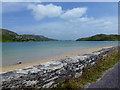
Nearby Images from Geograph Britain and Ireland:
©2013(licence)
©2015(licence)
©2011(licence)
©2015(licence)
©2015(licence)
The above images may not be of the site on this page, they are loaded from Geograph.
Please Submit an Image of this site or go out and take one for us!
Click here to see more info for this site
Nearby sites
Click here to view sites on an interactive map of the areaKey: Red: member's photo, Blue: 3rd party photo, Yellow: other image, Green: no photo - please go there and take one, Grey: site destroyed
Download sites to:
KML (Google Earth)
GPX (GPS waypoints)
CSV (Garmin/Navman)
CSV (Excel)
To unlock full downloads you need to sign up as a Contributory Member. Otherwise downloads are limited to 50 sites.
Turn off the page maps and other distractions
Nearby sites listing. In the following links * = Image available
408m E 90° Leenane wedge tomb* Wedge Tomb
696m NE 48° Arduslough wedge tomb* Wedge Tomb
761m NE 48° An Tuairín wedge tomb* Wedge Tomb
1.2km NNW 345° Ballyvoge Beg wedge tomb* Wedge Tomb
1.8km ENE 57° Castlemehigan cupmarked stone* Rock Art
3.9km N 354° Carrigacat and Milleen copper mine* Ancient Mine, Quarry or other Industry
8.8km NE 52° Toormore Wedge Tomb* Wedge Tomb (V855308)
8.8km ENE 57° Altar Wedge Tomb* Wedge Tomb (V8592530224)
9.5km N 350° Caherurlagh* Holed Stone (V770350)
10.1km ENE 56° Arderawinny* Portal Tomb (V870310)
12.3km NNE 16° Kilcrohane Standing Stones (V82163737)
13.4km N 7° Peakean* Passage Grave (V8044538831)
13.5km NNE 16° Farranamanagh* Stone Row / Alignment (V82543845)
13.8km NNE 23° Dromnea Stone Row / Alignment (V840382)
16.0km NNE 27° Gorteanish Stone Row / Alignment (V86143962)
16.0km NNE 27° Gorteanish* Stone Circle (V8609939666)
17.3km ENE 62° Rathcool Standing Stones (V93993325)
18.5km NNW 347° Bere Island wedge tomb* Wedge Tomb
18.6km ESE 101° Crathach Thiar standing stone* Standing Stone (Menhir)
19.1km E 99° Killickaforavane Passage Tomb* Passage Grave
19.4km NNW 337° Bere Island Standing Stone* Standing Stone (Menhir)
19.4km E 97° Comillane* Stone Row / Alignment (V977229)
19.7km NE 45° Dunbeacon* Stone Circle (V9270639202)
20.1km NE 46° Coolcoulaghta* Standing Stones (V9310639301)
22.3km NNW 335° Derrymihan W row Stone Row / Alignment (V696461)
View more nearby sites and additional images


 We would like to know more about this location. Please feel free to add a brief description and any relevant information in your own language.
 Wir möchten mehr über diese Stätte erfahren. Bitte zögern Sie nicht, eine kurze Beschreibung und relevante Informationen in Deutsch hinzuzufügen.
 Nous aimerions en savoir encore un peu sur les lieux. S'il vous plaît n'hesitez pas à ajouter une courte description et tous les renseignements pertinents dans votre propre langue.
 Quisieramos informarnos un poco más de las lugares. No dude en añadir una breve descripción y otros datos relevantes en su propio idioma.