<< Our Photo Pages >> Derrynablaha - Rock Art in Ireland (Republic of) in Co. Kerry
Submitted by Anthony_Weir on Sunday, 13 October 2002 Page Views: 10232
Rock ArtSite Name: DerrynablahaCountry: Ireland (Republic of)
NOTE: This site is 1.776 km away from the location you searched for.
County: Co. Kerry Type: Rock Art
Nearest Town: Kenmare Nearest Village: Sneem
Map Ref: V764778
Discovery Map Number: D78
Latitude: 51.939109N Longitude: 9.797998W
Condition:
| 5 | Perfect |
| 4 | Almost Perfect |
| 3 | Reasonable but with some damage |
| 2 | Ruined but still recognisable as an ancient site |
| 1 | Pretty much destroyed, possibly visible as crop marks |
| 0 | No data. |
| -1 | Completely destroyed |
| 5 | Superb |
| 4 | Good |
| 3 | Ordinary |
| 2 | Not Good |
| 1 | Awful |
| 0 | No data. |
| 5 | Can be driven to, probably with disabled access |
| 4 | Short walk on a footpath |
| 3 | Requiring a bit more of a walk |
| 2 | A long walk |
| 1 | In the middle of nowhere, a nightmare to find |
| 0 | No data. |
| 5 | co-ordinates taken by GPS or official recorded co-ordinates |
| 4 | co-ordinates scaled from a detailed map |
| 3 | co-ordinates scaled from a bad map |
| 2 | co-ordinates of the nearest village |
| 1 | co-ordinates of the nearest town |
| 0 | no data |
Internal Links:
External Links:
I have visited· I would like to visit
zabai would like to visit
X-Ice visited on 9th Aug 2982 - their rating: Cond: 4 Amb: 5 Access: 1
kith visited on 1st Feb 2013 - their rating: Cond: 1 Amb: 5 Access: 4 Many examples of rock art from very clear to almost erased/obscured. Large scattered site that is well worth a visit or preferably more than one if you want explore this area.
A superb setting easily accessed initially before requiring rock scrambling and hunting on both sides of the road.
frogcottage42 have visited here
Average ratings for this site from all visit loggers: Condition: 2.5 Ambience: 5 Access: 2.5
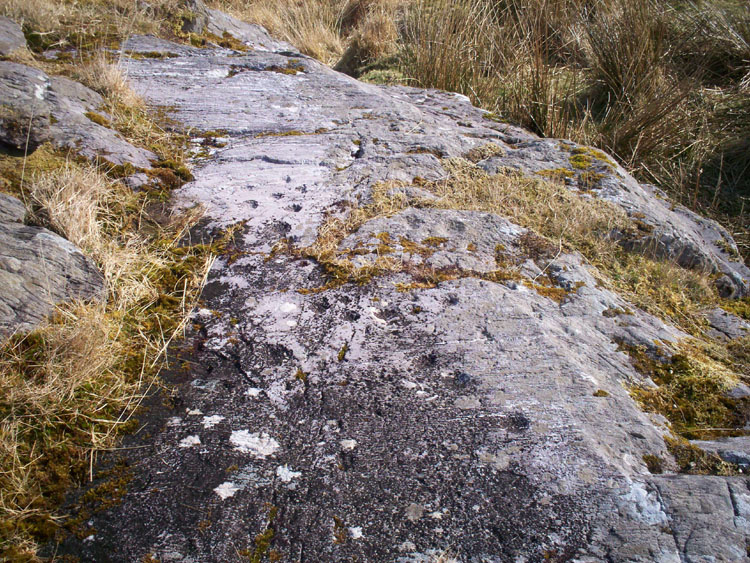
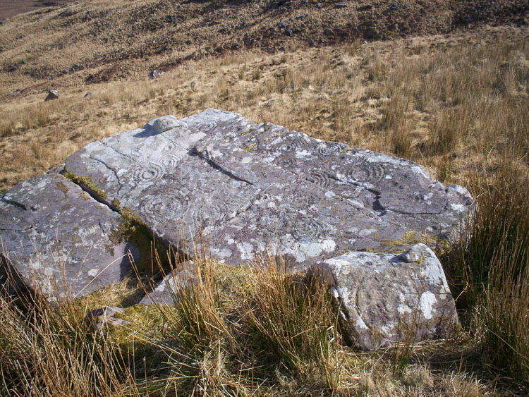
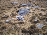
1.5 km E of Lough Brin, scattered over a wide area to the E and W of the road through the beautiful Ballaghabeama Gap, and surrounding the only inhabited house (in 1975) for miles, are over 20 decorated rocks.
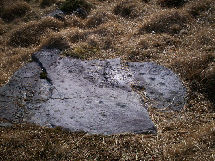
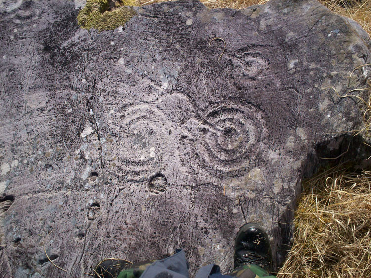
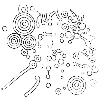
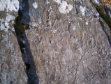
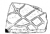
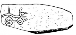
They are very difficult to find on the rock-strewn hillside, but perhaps the easiest to locate are those for which the grid reference above is given, found by following the S branch of a stream from the bridge about 300 metres S of the abovementioned farmhouse, then up the hillside for about 400 metres. A prominent taqble-like rock a short distanced S (left) of the stream – and visible from the road – is decorated with numerous cups and penannular rings and grooves. beside it is a small rock whose vertical (W) facee is decorated with the rare motif of cups and rings surrounded by a ring of small cups and a large indented ring, similar to those at Ormaig in the Kilmartin Valley of Argyll.
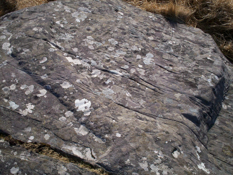
About 200 metres E of thyese, about halfway between them and the second bridge (200 metres SE of the first one) is a low altar-like rock with a curious design of cup-marks and irregular, roughly-circular grooves.
You may be viewing yesterday's version of this page. To see the most up to date information please register for a free account.



Do not use the above information on other web sites or publications without permission of the contributor.
Click here to see more info for this site
Nearby sites
Click here to view sites on an interactive map of the areaKey: Red: member's photo, Blue: 3rd party photo, Yellow: other image, Green: no photo - please go there and take one, Grey: site destroyed
Download sites to:
KML (Google Earth)
GPX (GPS waypoints)
CSV (Garmin/Navman)
CSV (Excel)
To unlock full downloads you need to sign up as a Contributory Member. Otherwise downloads are limited to 50 sites.
Turn off the page maps and other distractions
Nearby sites listing. In the following links * = Image available
382m SE 136° Derrynablaha Stone Row* Standing Stone (Menhir) (V7666077519)
3.0km N 353° Dromteewakeen Stone Row / Alignment (V761808)
3.1km SE 139° Derrylicka* Stone Row / Alignment (V784754)
4.0km S 186° Gortacloghane Stone Row / Alignment (V759738)
4.5km SSE 164° Gearha* Standing Stones (V7756473414)
5.5km NE 41° Curraghmore Stone Row / Alignment (V801819)
6.3km ENE 57° Bunbinnia hut site and standing stone* Ancient Village or Settlement
6.3km S 178° Dromlusk* Standing Stone (Menhir)
8.2km ESE 107° Boughill* Standing Stone (Menhir) (V8422075275)
9.5km ESE 116° Rossacoosane* Rock Art (V848734)
9.5km SSE 160° Derreenafoyle Standing Stones (V794688)
11.1km SE 141° Lomanagh Holy Well* Holy Well or Sacred Spring
13.0km SSE 151° Tuosist* Stone Circle (V824663)
13.1km SSE 164° Ormonds Island* Standing Stones (V79716512)
14.4km ESE 103° Carhoonmeengar East* Rock Art (V9040274338)
15.1km WNW 298° Coomasaharn Lake Rock Art (V632852)
15.2km SSE 163° Derrylough* Wedge Tomb (V80456315)
15.7km E 100° Inchimore* Cairn (V91827460)
15.8km SSE 152° Uragh North* Stone Circle (V83526368)
15.8km SSE 154° Uragh NE* Stone Circle (V8311763439)
15.9km ENE 77° Gertroe Stone Circle (V920810)
15.9km ESE 115° Kenmare* Stone Circle (V9067970713)
15.9km E 80° Esknamucky glen* Standing Stone (Menhir) (V922802)
16.0km SSE 156° Uragh SW* Stone Circle (V8251363033)
16.8km SE 135° Dromroe* Stone Circle (V8810565708)
View more nearby sites and additional images




 We would like to know more about this location. Please feel free to add a brief description and any relevant information in your own language.
 Wir möchten mehr über diese Stätte erfahren. Bitte zögern Sie nicht, eine kurze Beschreibung und relevante Informationen in Deutsch hinzuzufügen.
 Nous aimerions en savoir encore un peu sur les lieux. S'il vous plaît n'hesitez pas à ajouter une courte description et tous les renseignements pertinents dans votre propre langue.
 Quisieramos informarnos un poco más de las lugares. No dude en añadir una breve descripción y otros datos relevantes en su propio idioma.