

<< Our Photo Pages >> Curraduff Stone Row - Stone Row / Alignment in Ireland (Republic of) in Co. Kerry
Submitted by frogcottage42 on Tuesday, 01 October 2002 Page Views: 4635
Neolithic and Bronze AgeSite Name: Curraduff Stone RowCountry: Ireland (Republic of)
NOTE: This site is 10.421 km away from the location you searched for.
County: Co. Kerry Type: Stone Row / Alignment
Map Ref: Q703088
Discovery Map Number: D71
Latitude: 52.216164N Longitude: 9.898424W
Condition:
| 5 | Perfect |
| 4 | Almost Perfect |
| 3 | Reasonable but with some damage |
| 2 | Ruined but still recognisable as an ancient site |
| 1 | Pretty much destroyed, possibly visible as crop marks |
| 0 | No data. |
| -1 | Completely destroyed |
| 5 | Superb |
| 4 | Good |
| 3 | Ordinary |
| 2 | Not Good |
| 1 | Awful |
| 0 | No data. |
| 5 | Can be driven to, probably with disabled access |
| 4 | Short walk on a footpath |
| 3 | Requiring a bit more of a walk |
| 2 | A long walk |
| 1 | In the middle of nowhere, a nightmare to find |
| 0 | No data. |
| 5 | co-ordinates taken by GPS or official recorded co-ordinates |
| 4 | co-ordinates scaled from a detailed map |
| 3 | co-ordinates scaled from a bad map |
| 2 | co-ordinates of the nearest village |
| 1 | co-ordinates of the nearest town |
| 0 | no data |
Internal Links:
External Links:
")
Have you visited this site? Please contribute a description or any thoughts by adding a comment.
You may be viewing yesterday's version of this page. To see the most up to date information please register for a free account.
Do not use the above information on other web sites or publications without permission of the contributor.
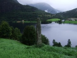
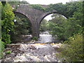
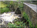
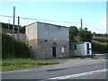
Nearby Images from Geograph Britain and Ireland:
©2006(licence)
©2006(licence)
©2006(licence)
©2006(licence)
©2018(licence)
The above images may not be of the site on this page, they are loaded from Geograph.
Please Submit an Image of this site or go out and take one for us!
Click here to see more info for this site
Nearby sites
Click here to view sites on an interactive map of the areaKey: Red: member's photo, Blue: 3rd party photo, Yellow: other image, Green: no photo - please go there and take one, Grey: site destroyed
Download sites to:
KML (Google Earth)
GPX (GPS waypoints)
CSV (Garmin/Navman)
CSV (Excel)
To unlock full downloads you need to sign up as a Contributory Member. Otherwise downloads are limited to 50 sites.
Turn off the page maps and other distractions
Nearby sites listing. In the following links * = Image available
2.2km NW 304° Ballygarret Stone Row / Alignment (Q685101)
6.7km S 191° Caherpiece Standing Stone (Menhir)
11.3km WSW 246° Derrygorman Standing Stones (Q599044)
11.4km WSW 250° Dromvally SE* Standing Stones (Q59440514)
12.9km WSW 248° Coumduff Standing Stones (Q58200418)
14.8km NW 325° Illauntannig Island Ancient Cross (Q621211)
15.9km NW 318° Illaunimnal Stone Circle (Q600210)
17.2km W 277° Drom E Standing Stones (Q53181124)
17.5km W 266° Ballyhoneen Wedge Tomb* Wedge Tomb
17.8km SSW 191° Kilnabreck Lower* Standing Stones (V66339144)
18.5km WSW 247° Gownlaneard Standing Stones (Q53050203)
19.0km WSW 242° An Gráig standing stone* Standing Stone (Menhir)
19.3km WSW 238° Minard W Standing Stones (V536991)
19.5km W 280° Cloonsherragh Stone Row / Alignment (Q511128)
20.0km WSW 241° Dún na Manach wedge tomb* Wedge Tomb
20.2km WSW 243° Ardamore* Stone Row / Alignment (Q521000)
21.1km WSW 243° Áth an Charbaill rock art* Rock Art
21.4km SSW 198° Coolnaharragill Rock Art (V633886)
22.2km WSW 253° Ballyrishteen Standing Stones (Q489027)
22.7km WSW 244° Kinard East* Carving (V496994)
23.5km WNW 287° Meenanare Stone Circle (Q479162)
24.6km SSW 195° Coomasaharn Lake Rock Art (V632852)
25.0km SE 134° Coomagort ogham stones* Standing Stones
25.5km WSW 248° Ballintaggart Nine Stones* Early Christian Sculptured Stone (V464997)
25.8km W 272° Brandon Mountain Modern Stone Circle etc (Q445103)
View more nearby sites and additional images


 We would like to know more about this location. Please feel free to add a brief description and any relevant information in your own language.
 Wir möchten mehr über diese Stätte erfahren. Bitte zögern Sie nicht, eine kurze Beschreibung und relevante Informationen in Deutsch hinzuzufügen.
 Nous aimerions en savoir encore un peu sur les lieux. S'il vous plaît n'hesitez pas à ajouter une courte description et tous les renseignements pertinents dans votre propre langue.
 Quisieramos informarnos un poco más de las lugares. No dude en añadir una breve descripción y otros datos relevantes en su propio idioma.