


<< Text Pages >> Glenbaun Dun II - Stone Fort or Dun in Ireland (Republic of) in Co. Mayo
Submitted by KaiHofmann on Thursday, 25 April 2013 Page Views: 1898
Multi-periodSite Name: Glenbaun Dun IICountry: Ireland (Republic of)
NOTE: This site is 4.436 km away from the location you searched for.
County: Co. Mayo Type: Stone Fort or Dun
Nearest Village: Glenbaun
Latitude: 53.736714N Longitude: 9.706466W
Condition:
| 5 | Perfect |
| 4 | Almost Perfect |
| 3 | Reasonable but with some damage |
| 2 | Ruined but still recognisable as an ancient site |
| 1 | Pretty much destroyed, possibly visible as crop marks |
| 0 | No data. |
| -1 | Completely destroyed |
| 5 | Superb |
| 4 | Good |
| 3 | Ordinary |
| 2 | Not Good |
| 1 | Awful |
| 0 | No data. |
| 5 | Can be driven to, probably with disabled access |
| 4 | Short walk on a footpath |
| 3 | Requiring a bit more of a walk |
| 2 | A long walk |
| 1 | In the middle of nowhere, a nightmare to find |
| 0 | No data. |
| 5 | co-ordinates taken by GPS or official recorded co-ordinates |
| 4 | co-ordinates scaled from a detailed map |
| 3 | co-ordinates scaled from a bad map |
| 2 | co-ordinates of the nearest village |
| 1 | co-ordinates of the nearest town |
| 0 | no data |
Be the first person to rate this site - see the 'Contribute!' box in the right hand menu.
Internal Links:
External Links:
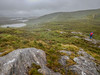
Ringfort or dun in Co. Mayo
Ringfort near Glenbaun. In this area are some more ringforts to find.
You may be viewing yesterday's version of this page. To see the most up to date information please register for a free account.
Do not use the above information on other web sites or publications without permission of the contributor.
Nearby Images from Flickr
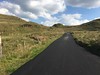
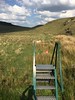
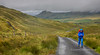
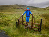

The above images may not be of the site on this page, but were taken nearby. They are loaded from Flickr so please click on them for image credits.
Click here to see more info for this site
Nearby sites
Click here to view sites on an interactive map of the areaKey: Red: member's photo, Blue: 3rd party photo, Yellow: other image, Green: no photo - please go there and take one, Grey: site destroyed
Download sites to:
KML (Google Earth)
GPX (GPS waypoints)
CSV (Garmin/Navman)
CSV (Excel)
To unlock full downloads you need to sign up as a Contributory Member. Otherwise downloads are limited to 50 sites.
Turn off the page maps and other distractions
Nearby sites listing. In the following links * = Image available
1.1km WNW 294° Glenbaun Dun I Stone Fort or Dun
7.5km SW 232° Derryheeagh* Standing Stone (Menhir) (L8138073151)
7.7km WSW 258° Knockeen Stone* Standing Stone (Menhir) (L7986876200)
8.0km W 265° Knockeen Tomb Burial Chamber or Dolmen
8.4km NE 53° Killadangan* Stone Row / Alignment
8.5km WSW 246° Srahwee* Wedge Tomb (L7953074462)
8.9km W 270° Formoyle Tomb Burial Chamber or Dolmen
10.1km E 83° Boheh* Rock Art (L97517866)
11.9km WSW 255° Cloonty Dun Stone Fort or Dun
11.9km WSW 250° Aillemore* Court Tomb (L7613973809)
12.8km WSW 249° Roonkeel Cairn Cairn
12.8km WSW 255° Killadoon (2)* Standing Stone (Menhir)
12.9km WSW 253° Killadoon (1)* Standing Stone (Menhir)
13.1km W 260° Cloonlaur* Standing Stones (L744758)
13.3km WSW 248° Roonkeel Tomb Burial Chamber or Dolmen
13.6km WSW 257° Cross Lough Crannog Crannog
13.6km ENE 62° Sandy Hill Mound* Misc. Earthwork
13.8km SW 230° Dadreen Cross Inscribed Pillar* Ancient Cross
13.8km SW 233° Cloonaghmanagh Ringfort Stone Fort or Dun
14.0km SW 234° Claggan Ringfort Stone Fort or Dun
14.1km SW 236° Corragaun I Stone Fort or Dun
14.4km WSW 240° Corragaun II Stone Fort or Dun
14.9km WSW 248° Roonkeel Fort Promontory Fort / Cliff Castle
17.3km S 181° Leenaun Tomb Burial Chamber or Dolmen
18.0km S 188° Glencraff Tomb Burial Chamber or Dolmen
View more nearby sites and additional images


 We would like to know more about this location. Please feel free to add a brief description and any relevant information in your own language.
 Wir möchten mehr über diese Stätte erfahren. Bitte zögern Sie nicht, eine kurze Beschreibung und relevante Informationen in Deutsch hinzuzufügen.
 Nous aimerions en savoir encore un peu sur les lieux. S'il vous plaît n'hesitez pas à ajouter une courte description et tous les renseignements pertinents dans votre propre langue.
 Quisieramos informarnos un poco más de las lugares. No dude en añadir una breve descripción y otros datos relevantes en su propio idioma.